- Wallan, Victoria
Infobox Australian Place | type = town
name = Wallan
state = vic
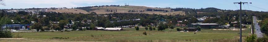
caption = Wallan from the top of Green Hill
lga = Shire of Mitchell
postcode = 3756
pop = 6641 (2006 Census)
est =
elevation= 308
stategov = Seymour
fedgov = McEwen
dist1 = 46
location1=Melbourne
near-nw = Willowmavin
near-n = Kilmore
near-ne = Wandong
near-w = Romsey
near-e = Upper Plenty
near-sw = Romsey
near-s = Beveridge
near-se = Upper PlentyWallan or Wallan Wallan is a town in Victoria, 50 km from
Melbourne on theNorthern Highway inAustralia .The town sits at the southern end of the large and diverseShire of Mitchell which extends from the northern fringes ofMelbourne into the farming country of north-central Victoria and the lowerGoulburn Valley . The township flanks the Northern Highway and is set against the backdrop of theGreat Dividing Range . At the 2006 census, Wallan had a population of 6,641.Census 2006 AUS
id=UCL255000
name=Wallan (Urban Centre/Locality)
accessdate=2007-08-15
quick=on]History
A Wallan Wallan Post Office opened on 1 April 1858. A Wallan Wallan Railway Station Post Office opened on 1 October 1873, later renamed as Wallan Wallan East and closing in 1992.Citation
last = Premier Postal History | title = Post Office List | url = https://www.premierpostal.com/cgi-bin/wsProd.sh/Viewpocdwrapper.p?SortBy=VIC&country= | accessdate = 2008-04-11 ]Overview
In the past, Wallan was a small village with only a few houses and a shop, but today it is known for the Hidden Valley Housing Development 1 km to the north. Until 1997 this was a private farm, however it has now been developed as an all-embracing residential estate with a
golf course running through the middle.The fastest growing town in the shire, Wallan is a convenient link between the city and the rural charms of such towns as Kilmore, Broadford and Seymour.
15 kilometres to the north is a turnoff to Strath Creek which leads to the stunningly scenic drive through the Valley of a Thousand Hills.
One of the shire’s more interesting enterprises is the development of the so-called multi-purpose trail project which links several Goulburn River locations with a Lions Park in Seymour. The trail follows some of the most picturesque Goulburn River stretches for about five kilometres.
The Wellington Square Shopping Centre, opened in 2004, includes many corporate franchise businesses (mainly Victoria's biggest supermarket chain Safeway), creating competition for the already existing
Coles Supermarket across the road.Mitchel Shire Library Servive opened its Wallan branch only days after the Shopping Centre's opening.
Shortly after opening the centre, a section of the carpark was closed off for construction of a KFC, despite the community's protests.
In 2008, 2 more KFC outlets were given approval for construction along the
Northern Highway ; one on each side of the road.In 2007, Wallan received an upgrade to its Police Station, but community members were outraged when they discovered that the station would be relocated on top of Hadfield Park - the towns central parkland, and home to the monthly Wallan Market.
References
External links
Wikimedia Foundation. 2010.