- Emu Flat, Victoria
Infobox Australian Place | type = town
name = Emu Flat
state = vic
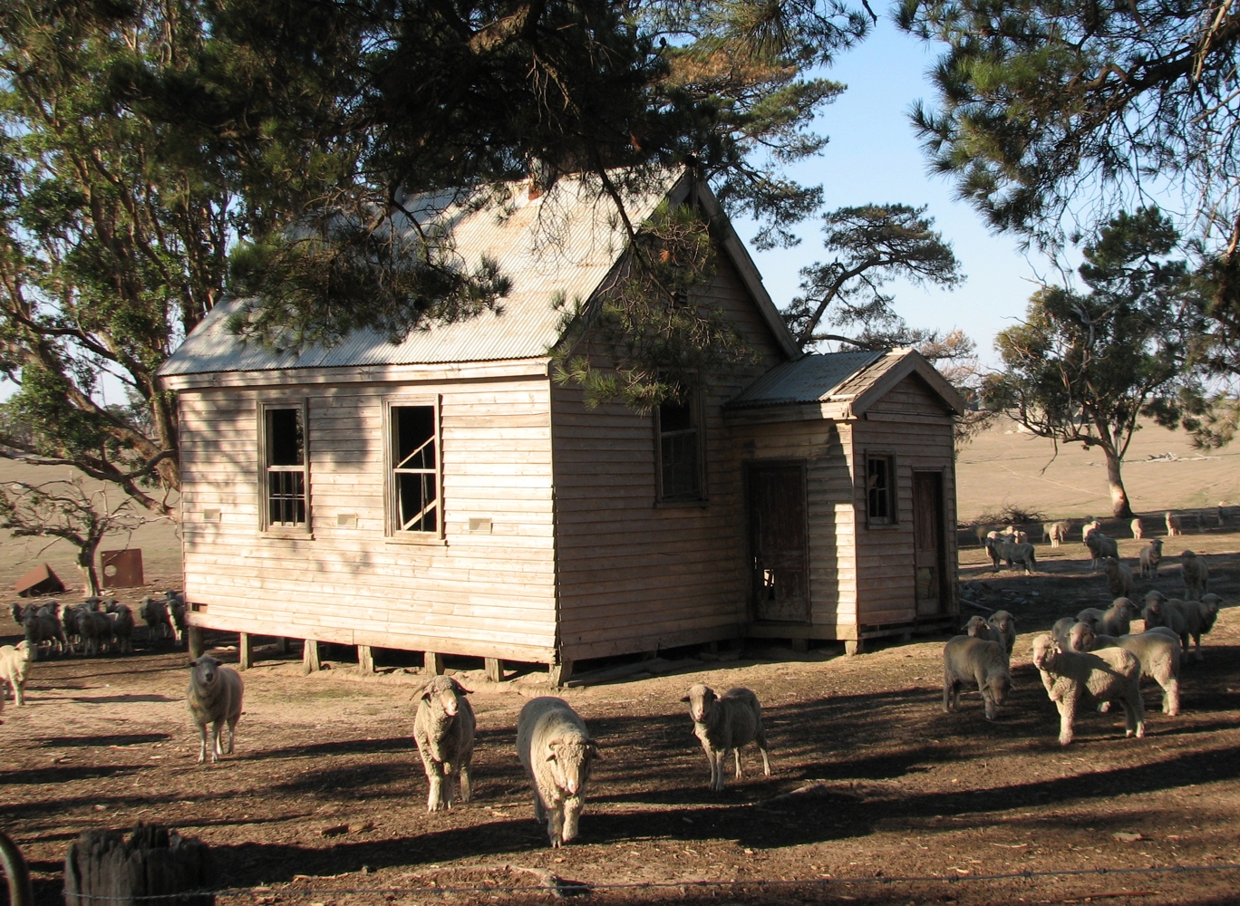
caption = Former Emu Flat State School
lga = Shire of Mitchell
postcode = 3522. [cite web|title=Locaton:Emu Flat, Vic|url=http://www1.auspost.com.au/postcodes/index.asp?Locality=emu+flat&sub=1&State=VIC&Postcode=&submit1=Search|work =Postcode Search|publisher=Australia Post|accessdate=2008-04-21]
est =
pop =
elevation=
maxtemp =
mintemp =
rainfall =
stategov =
fedgov =
dist1 = 92
dir1 = NW
location1=Melbourne
dist2 = 23
dir2 = N
location2= Lancefield
dist3 = 20
dir3 = S
location3= Tooborac
near-n =
near-ne =
near-e =
near-se =
near-s =
near-sw =
near-w =
near-nw =Emu Flat is a locality in the
Shire of Mitchell local government area, in Victoria,Australia . It is situated between Lancefield and Tooborac , 92 kilometres to the north-west ofMelbourne by road. [cite web|title=travelmate.com.au|url=http://www.travelmate.com.au/MapMaker/mapmaker.asp|accessdate=2008-04-21(Emu Flat-Baynton Rd, Nulla Vale )] [cite web|title=Emu Flat|url=http://www.ga.gov.au/bin/gazd01?rec=242349|work = Place Names Search|publisher=Geoscience Australia |accessdate=2008-04-21]Emu Flat has two "heritage places" listed in the Shire of Mitchell Planning Scheme. These are the
Uniting Church (formerly Presbyterian Church) , and the formerState School . [cite web|title=Schedule to the Heritage Overlay |url=http://www.psdocs.dpcd.vic.gov.au/public/Mitchell/43_01s_mith.doc|work=Mitchell Planning Scheme|accessdate=2008-04-21]Emu Flat Post Office opened on 17 September 1877 and closed in 1945. Citation
last = Premier Postal History | title = Post Office List | url = https://www.premierpostal.com/cgi-bin/wsProd.sh/Viewpocdwrapper.p?SortBy=VIC&country= | accessdate = 2008-04-11 ]References
Wikimedia Foundation. 2010.