- Cobaw, Victoria
-
Cobaw
Victoria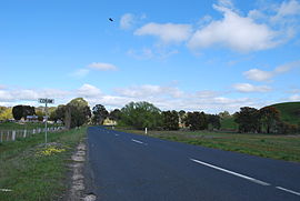
Entering Cobaw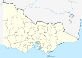
 Cobaw
CobawPostcode: 3442 Elevation: 490 m (1,608 ft) LGA: Shire of Macedon Ranges State District: Macedon Federal Division: McEwen Localities around Cobaw: Carlsruhe Cobaw Range / State Forest. Benloch Carlsruhe Cobaw Lancefield Newham Newham Rochford Cobaw is a locality in the Macedon Ranges Shire, in Victoria, situated on Dry Creek.
The Cobaw area formerly had its own Post Office and State school[1], now closed.
Cobaw Post Office opened on 1 December 1887 and closed in 1952. [2]The Cobaw Range is a section of the Great Dividing Range north of the settlement, running roughly east-west. The ranges are mainly granitic and reach a maximum height of 760m. Most of the western parts of this range are within the boundaries of the Cobaw State Forest.
References
- ^ Victorian Municipal Directory. Brunswick: Arnall & Jackson. 1956. p. 751.
- ^ Premier Postal History. "Post Office List". https://www.premierpostal.com/cgi-bin/wsProd.sh/Viewpocdwrapper.p?SortBy=VIC&country=. Retrieved 2008-04-11.
Towns and localities in the Shire of Macedon Ranges
(major towns in bold)Ashbourne · Baynton · Bolinda · Bullengarook · Carlsruhe · Cherokee · Clarkefield · Cobaw · Darraweit Guim · Gisborne · Gisborne South · Hesket · Kerrie · Kyneton · Lancefield · Lauriston · Macedon · Malmsbury · Monegeetta · Monegeetta North · Mount Macedon · New Gisborne · Newham · Riddells Creek · Rochford · Romsey · Springfield · Tylden · Woodend · Woodend North
Categories:- Towns in Victoria (Australia)
- Macedon Ranges
- Victoria (Australia) geography stubs


Wikimedia Foundation. 2010.