- Melway
-
Melway 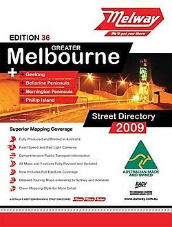
The front cover of the Melway 36th (2009) edition.Author(s) Melway Publishing Pty. Ltd. Country Australia Language English Genre(s) Road atlas Publisher Melway Publishing Pty. Ltd. Publication date May 1966 (1st (1966) edition) Media type Paperback Pages 1202 (35th (2008) edition) ISBN 978-0-909439-49-1 (36th (2010) edition) Melway (often incorrectly referred to as Melways or The Melways[citation needed]) is an almost ubiquitous street directory for Melbourne, Australia[1] and its immediate surrounds, including the city of Geelong. It is currently in its 39th edition—the 2012 edition—which was released in July 2011.
Contents
History
Melway was conceived by Merv Godfrey and Iven Mackay in the 1950s. The first edition of Melway was released in May 1966, after five years of work and research. All of the 106 original maps were hand-drawn in ink. Many detractors claimed it would be unpopular due to its high price at the time – $2.50, twice that of its most expensive competitor.[2] First editions can sell for more than $800 on the second hand market.[citation needed]
By the early 1980s Melway was the most popular street directory in Melbourne, holding in excess of 80 per cent of the market; indeed "Melway" had begun to be used as a generic term for any street directory.[3][4] The current RRP for a 2010 Melway is $54.95,[5] but many retailers sell Melway for around $40.[6]
In 1982, after the fourteenth edition of Melway had been released, it was awarded the International Cartographic Excellence Award, as well as the inaugural award for Cartographic Excellence from the Australian Institute of Cartographers.[2] Ausway won the Australian award again in 1994 for its first edition of Sydway.
Almost every motorist in Melbourne has a copy of Melway,[7] as do many taxi drivers, bus drivers and some hire cars. It is officially used by the Victoria Police, fire brigade, ambulance service, Victorian State Emergency Service, St. John Ambulance Victoria and for the State government car fleet. Its main competitor is the UBD, which has a strong footing in Sydney and Brisbane, but is not as common in Melbourne.[1][8]
The Melbourne Museum has an exhibit dedicated to the directory.[citation needed]
Features
While primarily a street directory, Melway editions also contain details on public transport (train, tram, and bus routes, tickets and prices), bicycle paths, suburb and postcode details, public parks and reserves, landmarks (such as commercial buildings, telephone boxes, pubs and restaurants), attractions, and also boat mooring details in recognised docks.
In addition to the "blue" bordered and "red" bordered street maps, there are "yellow" bordered maps of university campuses and crematoria, and "green" bordered maps showing routes through the country to Adelaide and Sydney. Many versions of the street directory are obtainable, usually in standard or large-print editions, wall-charts, or an online directory.
Grid references
In Melbourne it is common for a Melway reference (in the format Map – Grid reference, e.g. 59 K5) to be given along with directions on, for example, an event notice or real estate advertisement.[9] It is generally assumed that everyone has, or has access to, a copy of the directory in Melbourne. By comparison, the UBD reference for a particular "Melways reference" (as it is colloquially known) can be significantly different, but is rarely (if ever) provided.[10] It is generally assumed that all such references, regardless of whether it is explicitly stated or not, are from the Melway directory and not from the UBD.[citation needed]
Some organisations provide a Melway year of publication in addition to their map reference (e.g.: (2006) 70 F6), to avoid confusion if map references change in newer versions of the directory. However Melway have kept the need for this to an absolute minimum over the years and have held off several cartographic features, including a more logical overall tiling of pages across the entire metropolitan area (which do appear in the Sydway and Brisway) in order to protect the integrity and continuity of the original 1966 grid references.[citation needed]
Cartography
One of the distinguishing differences of a Melway-style map from other Australian street directories is in the rendering of roads. Rather than the traditional drawing of two lines with the road name printed in-between, (known as 'double casing') Melway maps show a single line with the name above or below the road, in many colours reflecting the identity or usage of the road. This allows for much more detail to fit into the same size map, as well as showing dual carriageways, slip lanes, service roads, speed bumps, roundabouts, and other useful information.
This difference has been copied by UBD in their Melbourne directory,[11] in a bid to capitalise on familiarity of Melway. UBD have only attempted this in the Melbourne directory, retaining their usual format for their other directories. The map design was first fully completed by computer in 2000.[2]
Editions
There have been 38 editions of the Melway released since the mid-1960s. A new edition is typically released late one year and advertised for the following year. Example: Edition 35 was released in August 2007 and advertised as the 2008 Melway. This is not entirely misleading as many roads and features under construction or proposed are included fully detailed (such as Eastlink in the 35th edition), thus even editions up to 5 or even 10 years old are still useful.
List of Editions
Below is a list of Melway editions, the years they were released, their price at the time of release and other information and introduced features:
- 1 1966 ($2.50)
- 2 1968 (central city map introduced)
- 3 1969 (postcode boundaries, house numbers and 10 new maps)
- 4 1970 (11 new maps)
- 5 1971 (over dimensional route maps)
- 6 1973 (university enlarged maps)
- 7 1974 (45 new maps including Mornington Peninsula, 4000 new streets)
- 8 1975 ($4.95, 750 new streets)
- 9 1976 (traffic lights, 20 new maps)
- 10 1977 (36 new maps including Baccus Marsh & Geelong, kindergartens, RSL clubs)
- 11 1978 (4m clearance bridges, taxi & car hire)
- 12 1979 (rescaling to metric)
- 13 1980 (public transport section, bus routes)
- 14 1982 (inner city maps, bicycle paths, Bellarine Peninsula maps)
- 15 1984 (inner Geelong maps, Victorian Arts Centre enlarged map)
- 16 1986 (9 new maps including Warburton)
- 17 1987
- 18 1988 (large print edition first published)
- 19 1989 (28 new maps, Yarra Glen and Phillip Island)
- 20 1990 (central Melbourne mobility map)
- 21 1991 (bus routes reintroduced, 30 new maps including 18 touring maps, Australia map)
- 22 1993 (36 new maps, Dandenong, Frankston and Melbourne Airport enlarged maps)
- 23 1994 (24 new maps including Sunbury, Craigieburn and Healesville, cross referencing, new council boundaries)
- 24 1995 (enlarged CBD maps, 9 new maps, fire, water and electricity authority boundaries, CityLink)
- 25 1997 (enlarged Southbank maps, enlarged Kensington and Footscray maps)
- 26 1998 (24 new maps including Greater Geelong, Doreen and Mernda, docklands boundaries)
- 27 1999 (for 2000, enlarged maps of St Kilda, new suburb boundaries)
- 28 2000 (for 2001, every map computer generated, hook turns, official suburb names, boundaries and postcodes)
- 29 2001 (for 2002, 29 new maps, expanded coverage of Werribee, dog prohibited areas)
- 30 2002 (for 2003, 17 new maps including Lorne, Nar Nar Goon and Tynong, Queenscliff enlargement, bicycle facilities)
- 31 2003 (for 2004, GPS compatible, enlarged maps of Box Hill and Moonee ponds, marine parks, shared bicycle road routes)
- 32 2004 (for 2005, 12 new maps including Wollert and Eynesbury, Eastern Ring Road, Avalon Airport facilities)
- 33 2005 (for 2006, new hierarchy of roads, Craigieburn Bypass)
- 34 2006 (for 2007, Flemington Racecourse enlargement)
- 35 2007 (for 2008, eWay electronic street directory released)
- 36 2008 (for 2009, petrol stations, speed and red light cameras, EastLink fully detailed) includes Melway Ballarat Edition 1
- 37 2009 (for 2010, new maps for Beveridge, proposed Peninsula Link alignment)
- 38 2010 (for 2011, Peninsula Link alignment under construction, proposed Outer Ring Road and Rail)
- 39 2011 (for 2012, new maps for Macedon, Mount Macedon, Riddells Creek and Bannockburn)
Expansion into other Australian markets
Melway has spawned an umbrella company known as Ausway, which started producing directories for other cities and towns from the early 1990s onwards. These other directories include:
- Sydway – Sydney, introduced 1994
- Sydway: Central Coast – Central Coast region, introduced 1999
- Brisway – Brisbane, introduced 2005
- Melway Perth – Perth, introduced 2010
References
- ^ a b Melway Publishing Pty Ltd – vs – Robert Hicks Pty Ltd (15 MARCH 2001) Despite some aggressive marketing and promotion of their products by its competitors, UBD and Gregorys, the appellant's Melbourne directory continued to maintain its dominant share of the wholesale and retail market for street directories in Melbourne
- ^ a b c History of Melway (Ausway site)
- ^ Melway Publishing Pty Ltd – vs – Robert Hicks Pty Ltd (15 MARCH 2001)
- ^ Google Books: Paul Smitz (2005) Lonely Planet Australia
- ^ Ausway Online Store
- ^ Maps Downunder
- ^ Melway Publishing Pty Ltd – vs – Robert Hicks Pty Ltd (15 MARCH 2001) So popular was the directory that 60 per cent of the national sales of street directories by the large retail chain K-Mart comprised sales of the appellant's Melbourne directory.
- ^ The development of section 46 in Australia: Melway and its likely impact on business – November 2000 Given the national scope of Universal Press's dominance in most city markets (except Melbourne) it is not improbable or even unlikely that it could, if it was worth its while, engage in an extensive advertising or marketing campaign to attempt to make more of an impact in this one market where it holds insignificant market share.
- ^ Australian House Hunters Real Estate Blog
- ^ Compare a Google search for UBD reference Melbourne (38,900 results) to Melway reference melbourne (161,000 results)
- ^ Universal Press (2003) UBD 2003 Melbourne & Surrounds Street Directory 38th Edition
External links
Categories:- Transport in Melbourne
- Atlases
Wikimedia Foundation. 2010.