- Morwell, Victoria
-
Morwell
Victoria
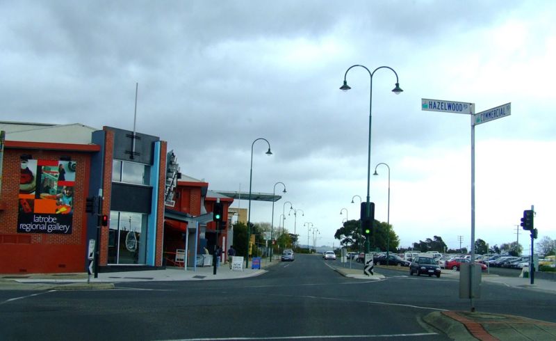
Corner of Hazelwood and Commercial Roads, Morwell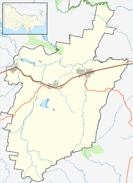
 Morwell
Population: 13,399[1] Established: 1870s Postcode: 3840 Elevation: 80 m (262 ft) Location: 149 km (93 mi) from Melbourne LGA: City of Latrobe State District: Morwell Federal Division: Gippsland Localities around Morwell: Yallourn North Yallourn North Traralgon Boolarra Morwell Hazelwood North Yinnar Churchill Hazelwood North Morwell is a city in central Gippsland, a region in the east of Victoria. Morwell is the heart of Victoria's energy centre, the Latrobe Valley. It is also the administrative centre for the City of Latrobe. The name Morwell is believed to have been derived from the Aboriginal term More willie, meaning 'woolly possum'.
Contents
History
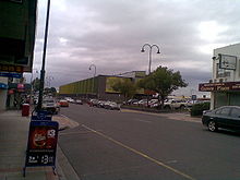 Commercial Road, Morwell's main street, looking towards the Latrobe City Corporate Headquarters
The earliest inhabitants of the Morwell district were the Gunai Indigenous Australians ( Sometimes spelled Kurnai). Their first contact with Europeans would have been with pastoralists who came south from the Monaro region of New South Wales in the 1840s in search of pasture for their stock.
In 1841, McMillan and Strzelecki made journeys of exploration through the region which would later be named Gippsland and during the 1840s the squatting runs of Maryvale, Merton Rush and Hazelwood were taken up in the area which is now Morwell.
The 1870s were a time of railway building in Victoria. In 1873 the government approved the construction of a railway line from Melbourne to Sale and it was this decision which gave rise to the development of the township of Morwell.
The first public sale of land in the town took place in January 1879 but there were at least ten traders operating in the town by that time, a Post Office in the township having been open since 1875 (an earlier PO having served the rural area from 1870 to 1873). On January 1, 1880 Morwell PO was renamed Morwell Bridge and Morwell Railway Station PO (open since 1877) became the main Morwell PO.[2]
A brickworks and a pottery were established in the 1880s, a butter factory was built in 1890 and a cordial factory.
Even in the 1880s, coal was seen to be of importance to Morwell. In 1888 two coal mining companies were established—The Great Morwell Coal Mining Company and the Maryvale Proprietary Coal Mining Company. Both these companies produced steam coal and were part of the industrial growth of the town which included timber getting, food processing (butter and cordial factories), brick and pottery manufacture and the transport of goods along the main railway line. Fires in the commercial area in 1890 and 1912 caused major damage to shops. This led to the formation of the Morwell Waterworks Trust and in December 1913 a town water supply from Billy's Creek was connected.
The development of the Yallourn open cut coal mine and power station in the 1920s contributed to Morwell's development, providing employment and trade.
Work on the Morwell power station and briquette works commenced in 1949 by the State Electricity Commission of Victoria (SECV), when field works on the Morwell open cut mine commenced, and briquette production equipment was ordered from Germany. It was originally known as the Morwell Power Station and is now known as Energy Brix. Production at the plant started in 1956, with the briquettes produced used for domestic and industrial use. As well as this a town gas production for Melbourne at an adjacent gasworks by the Gas and Fuel Corporation of Victoria was built.
The 1980s and 1990s were a growth period for the township of Morwell. Schools were built to educate the children of families settling in the area.
A major Research and Development project into the conversion of brown coal into oil, (Brown Coal Liquefaction Victoria or BCLV) was established in Morwell in 1983/84. Funded by the Japanese Government at a cost of over one billion dollars this project established a 50 tonne per day pilot plant which ran until 1991. The project saw several hundred Japanese families move to the area and led to the establishment of a unique educational experiment in the form of a Japanese/Australian combined curriculum at the Commercial Road Primary School.
Thriving on the success of the power industry, Morwell developed into a city offering substantial housing and financial opportunities for its many residents. With the general growth of the Latrobe Valley, Morwell's success appeared destined to continue. However, the approval by the City of Morwell to build the Mid Valley Shopping Centre complex away from the CBD led to the decline of the CBD, with many empty shopfronts the result. Further, restructuring and privatisation of the State Electricity Commission in the 1990s led to massive job losses in the region, which accelerated the decline of Morwell's central business district. Many shops are now empty and in a state of disrepair.
Amalgamation of the local councils under a commission saw the major civic centre move to Traralgon. With the re-establishment of an elected council, the civic centre was moved back to Morwell and the new council building constructed in 2005 in the hope of leading to a revitalisation of the city centre. Unfortunately, that revitalisation failed to eventuate. The new justice precinct was completed in 2006 and has somewhat increased CBD activity as alleged criminals come to the Morwell justice precinct for processing through the Justice System.
Figures released by the Australian Bureau of Statistics in March 2011 show the average wage of Morwell residents to be the lowest of the three major Latrobe Valley towns.[3]
Morwell is the headquarters of the Central Gippsland Institute of Technical and Further Education. It contains a major regional art gallery with an excellent local collection and is noted for its extensive rose gardens. Nearby at Churchill is the Gippsland Campus of Monash University. A commemorative bust of Lt Gen Sir Stanley Savige was erected in 2006. Born in Morwell, Savige founded Legacy Australia following World War 1 to assist widows and families of servicemen.
Geography
Climate
Morwell experiences an oceanic climate (Köppen climate classification Cfb).
Climate data for Morwell Month Jan Feb Mar Apr May Jun Jul Aug Sep Oct Nov Dec Year Average high °C (°F) 26.2
(79.2)26.5
(79.7)24.4
(75.9)20.5
(68.9)16.9
(62.4)14.2
(57.6)13.6
(56.5)14.9
(58.8)16.9
(62.4)19.3
(66.7)21.6
(70.9)24.0
(75.2)19.9 Average low °C (°F) 12.5
(54.5)12.7
(54.9)11.1
(52.0)8.5
(47.3)6.6
(43.9)4.4
(39.9)3.7
(38.7)4.3
(39.7)5.8
(42.4)7.4
(45.3)9.4
(48.9)11.1
(52.0)8.1 Precipitation mm (inches) 50.1
(1.972)39.2
(1.543)43.9
(1.728)57.1
(2.248)51.6
(2.031)58.4
(2.299)66.4
(2.614)62.9
(2.476)78.4
(3.087)72.8
(2.866)75.0
(2.953)68.6
(2.701)724.4
(28.52)Source: [4] Transport
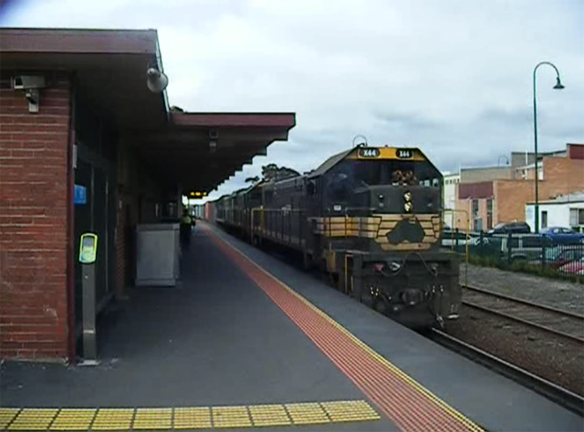
 Morwell Railway Station
The main form of transport in Morwell is the automobile. The Princes Freeway (A1) now bypasses the town to the south while the old Princes Highway which once passed through east-west through its centre is now Princes Drive and Commercial Road. The highway connects Morwell with other Latrobe Valley cities including Moe to the west and Traralgon to the east. Other main roads include the Strzelecki Highway (B460) running south toward Leongatha.
Morwell railway station is serviced by the Bairnsdale V/Line rail service with hourly weekday VLocity services to Melbourne and other towns and cities along the Latrobe Valley and East Gippsland.
Morwell is home to Latrobe Valley Airport, providing general aviation to the urban area.
Sport
The city has an Australian rules football team The Morwell Football Club,[5] with their home ground being the Morwell Recreation Reserve, competing in the West Gippsland Latrobe Football League, and a Morwell East competing in the Mid Gippsland Football League.
The Morwell Cougars Baseball Club usually forms teams in three senior grades and all junior grades of the Latrobe Valley League. Their diamonds in Toners Lane are the only dedicated diamonds in the League.
Morwell has two cricket clubs, Morwell and Latrobe, the latter of which Peter Siddle played for in his younger days.
There are 3 soccer clubs in the town; Pegasus, Fortuna and Falcons.
There is also a 25-metre indoor swimming pool, used by the local swimming club for competitive swimming.
Golfers play at the course of the Morwell Golf Club on Fairway Drive.[6]
Morwell is home to two scout groups - 1st Morwell and Morwell East, offering weekly programs to youth aged 6 to 26
Media
Warragul Radio stations Star FM and 3GG service this region.
Notable people
- John Hutchinson, footballer
- Bryan Quirk, footballer
- Peter Siddle, cricketer
- Vin Waite, footballer
See also
- Commercial Road Primary School, Morwell
- HM Prison Morwell River
- Latrobe Valley Airport
- Morwell railway station
- Electoral district of Morwell
References
- ^ Australian Bureau of Statistics (25 October 2007). "Morwell (Urban Centre/Locality)". 2006 Census QuickStats. http://www.censusdata.abs.gov.au/ABSNavigation/prenav/LocationSearch?collection=Census&period=2006&areacode=UCL235200&producttype=QuickStats&breadcrumb=PL&action=401. Retrieved 22 December 2009.
- ^ Premier Postal History, Post Office List, https://www.premierpostal.com/cgi-bin/wsProd.sh/Viewpocdwrapper.p?SortBy=VIC&country=, retrieved 2008-04-11
- ^ http://issuu.com/lvvoice/docs/march30_edition_lvvoice
- ^ "Climate statistics for Morwell (Latrobe Valley Airport)". Australian Bureau of Meteorology. http://www.bom.gov.au/climate/averages/tables/cw_085280.shtml.
- ^ http://www.facebook.com/group.php?gid=18917801868&ref=ts
- ^ Golf Select, Morwell, http://www.golfselect.com.au/armchair/courseView.aspx?course_id=301, retrieved 2009-05-11
External links
Cities of Victoria, Australia Regional VictoriaArarat · Bairnsdale · Ballarat · Benalla · Bendigo · Castlemaine · Colac · Echuca · Geelong · Hamilton · Horsham · Maryborough · Mildura · Moe · Morwell · Portland · Sale · Shepparton · Swan Hill · Traralgon · Wangaratta · Warrnambool · WodongaList of Melbourne suburbs · List of localities in Victoria Places in Latrobe City Council Boolarra · Callignee · Churchill · Glengarry · Hazelwood · Hazelwood North · Jeeralang · Loy Yang · Moe · Morwell · Newborough · Toongabbie · Traralgon · Tyers · Yallourn · Yallourn North · Yinnar · Yinnar South
Towns in the Latrobe Valley Boolarra · Churchill · Erica · Glengarry · Hazelwood North · Moe · Morwell · Newborough · Rawson · Thorpdale · Traralgon · Tyers · Walhalla · Yallourn North · Yinnar · Yinnar South
Categories:- Mining towns in Victoria (Australia)
- Cities in Victoria (Australia)
- Australian Aboriginal placenames
- Gippsland


Wikimedia Foundation. 2010.