- City of Lake Macquarie
-
This article is about the City of Lake Macquarie. For the lake, see Lake Macquarie (New South Wales).
City of Lake Macquarie
New South Wales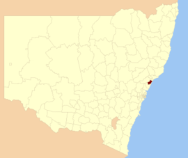
Location in New South WalesPopulation: 199,277(2009)[1] Area: 644 km² (248.6 sq mi) Mayor: Greg Piper Council Seat: Speers Point Region: Hunter Valley State District: Lake Macquarie, Swansea, Charlestown, Wyong Federal Division: Shortland, Charlton 
LGAs around City of Lake Macquarie: Maitland Newcastle Newcastle Cessnock City of Lake Macquarie Tasman Sea Cessnock Wyong Tasman Sea The City of Lake Macquarie is a Local Government Area in New South Wales, Australia, approximately 150 km (93 mi) north of Sydney. It is immediately adjacent to the city of Newcastle and was proclaimed as a city from 7 September 1984.
Contents
The City of Lake Macquarie
The City of Lake Macquarie has an estimated population of 199,277 (Australian Bureau of Statistics 2009 estimate) and is the fourth largest Local Government Area in NSW by population (the two largest, Blacktown and Sutherland, are within metropolitan Sydney while the third largest is Wollongong). Its population is much larger than that of the City of Newcastle (pop. 152,659 ABS 2009) and similar to that of the City of Wollongong. One of its major tourist attractions is its lake, also named Lake Macquarie.
Lake Macquarie is classified as a "city", but there is no significant distinction between the terms "city", "shire", and "municipality" as applied to Local Government Areas in New South Wales. The area is demographically a set of closely contiguous towns that surround a coastal saltwater lake, and merge with the suburbs of Newcastle to the north. Some suburbs, such as Adamstown Heights are partly in the City of Newcastle and partly within the City of Lake Macquarie. There are 92 identified settlements ranging from small rural style communities through to larger and higher density areas such as Toronto, Warners Bay, Belmont, Charlestown and Morisset.
History
The Shire of Lake Macquarie was proclaimed on 6 March 1906. It became a Municipality on 1 March 1977, and a city on 7 September 1984.[2][3][4]
Demographics
According to the Australian Bureau Statistics,[5] there:
- were 189,596 people as at 30 June 2006, the 4th largest Local Government Area in New South Wales. It was equal to 2.8% of the New South Wales population of 6,827,694
- was, in percentage terms, an increase of 0.2% in the number of people over the year to 30 June 2006, the 126th fastest growth in population of a Local Government Area in New South Wales.
- was an increase in population over the 10 years to 30 June 2006 of 12,846 people or 7.3% (0.7% in annual average terms).
Main towns and villages
Lake Macquarie is home to several prominent coastal suburbs such as Catherine Hill Bay, Caves Beach, Blacksmiths Beach and Redhead. The area is known for its world-famous surfing conditions. Retail centres include Belmont, Cardiff, Charlestown, Glendale, Swansea, Toronto, and Morisset with its large area and rapidly increasing developments. (see below).
Significant population centres include:
- Belmont
- Boolaroo
- Booragul
- Cardiff
- Charlestown
- Eleebana
- Glendale
- Morisset
- Speers Point
- Swansea
- Toronto
- Valentine
- Warners Bay
The various towns and suburbs are classified as being part of the Newcastle Statistical District, so their population is included when Newcastle is commonly listed as Australia's sixth largest city. However, the City of Lake Macquarie has its own independent local government (Lake Macquarie City Council), which is planning to develop a new Central Business District.[citation needed] The largest commercial centre in the region is Charlestown which has a turnover greater than that of Newcastle's central business district.[citation needed]
Shopping
- Charlestown Square
- Stockland Glendale
- Lake Macquarie Fair
- Morisset Mega Market
- Morisset Square
- Morisset Industrial Estate
- Morisset Marketplace -under construction
Freedom of the City
The following persons have been granted Freedom to the City of Lake Macquarie.[citation needed]
Persons granted Freedom of the City Notes Cyril Renwick AO Albert G. Burgin Reginald Lenaghan OAM Former Mayor Ronald E. Robinson OAM HMAS Tobruk Right of Freedom of Entry (1991)[6] Paul W. Harragon OAM Footballer Ellen Kilpatrick Former mayoress Donald Caldwall Economics
Lake Macquarie has a significant coal mining industry and smaller agriculture and manufacturing industries. Eraring power station, a 1980s-era coal-fired power station, supplies 25% of New South Wales' power.[7] Lake Macquarie has a number of Constructed Wetlands with the council placing an empasis on the environment.
Council
Lake Macquarie City Council is composed of twelve councillors elected proportionally. The area is divided into three wards, each electing four councillors. The mayor is directly elected.[8] The current makeup of the council is as follows:[8]
Party Councillors Independents 6 Australian Labor Party 3 Liberal Party of Australia 2 The Greens 2 Total 13 The current council, elected in 2008, is:[8]
Ward Councillor Party Notes Mayor Greg Piper Independent ILA East Ward Laurie Coghlan Independent ILA Kay Fraser Labor Garry Edwards Liberal Deputy Mayor Phillipa Parsons Greens North Ward Jodie Harrison Labor Paul Scarfe Independent ILA Barry Johnston Independent Hannah Gissane Greens West Ward Wendy Harrison Independent ILA Daniel Wallace Labor Arnold Tammekand Independent ILA- Elected on Wendy Harrison's ticket Anthony Birt Liberal - ILA: Independent Lake Alliance
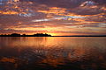
Gallery
-

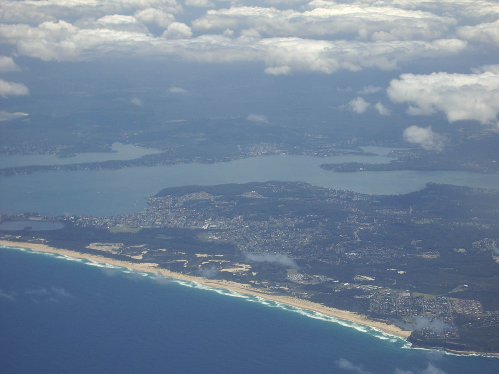
View from Woods Point showing Vales Point
-
View from Cane Point showing Marks Point across Village Bay
-
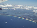
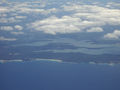
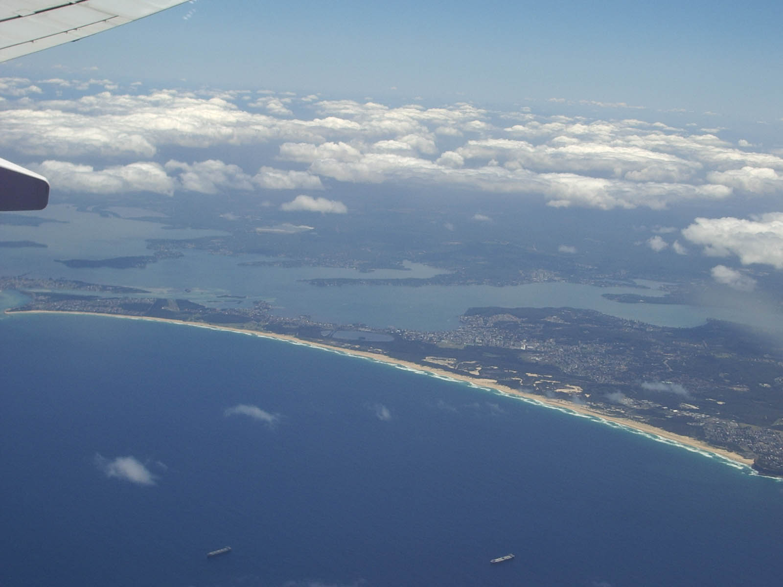
Wide view of Lake Macquarie from east of Nine Mile beach.
-
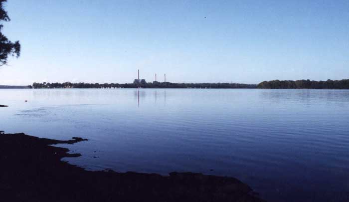
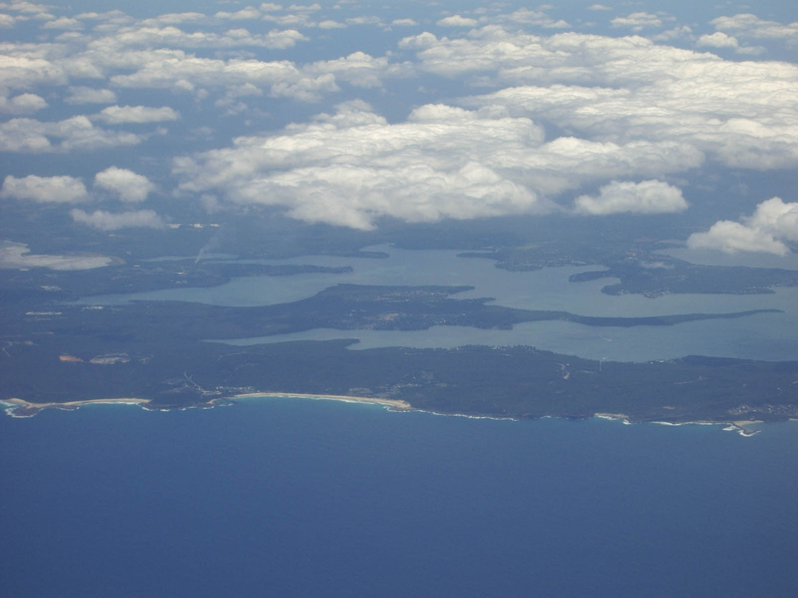
Looking west at the southern end of Lake Macquarie.
-
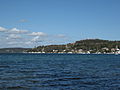
Lake Macquarie Shoreline at Wangi Wangi.
Sister cities
City Prefecture Country Hakodate  Hokkaidō
 Japan
JapanRotorua  Bay of Plenty New Zealand
Tanagura  Fukushima Japan
See also
- List of mayors of the City of Lake Macquarie
- List of cities in Australia
- Eraring Power Station
- Vales Point Power Station
References
- ^ Australian Bureau of Statistics (30 March 2010). "Regional Population Growth, Australia, 2008–09". http://www.abs.gov.au/ausstats/abs@.nsf/Latestproducts/3218.0Main%20Features42008-09?opendocument&tabname=Summary&prodno=3218.0&issue=2008-09&num=&view=. Retrieved 3 June 2010.
- ^ "Council History: Lake Macquarie City Council". City of Lake Macquarie. 2 March 2007. http://www.lakemac.com.au/page.aspx?pid=489&vid=10. Retrieved 1 June 2008.
- ^ "Hunter History Highlights". Hunter Valley Research Foundation. Archived from the original on 25 December 2007. http://web.archive.org/web/20071225012441/http://www.hvrf.com.au/pages/hrf/hunter_history_highlights.php. Retrieved 1 June 2008.
- ^ "Contact information - Company: Lake Macquarie City Council". careerone.com.au. http://jobs.careerone.com.au/texis/company?compid=470617ef42a40. Retrieved 1 June 2008.
- ^ "Regional Population Growth, Australia, 2005-06 (catalogue no.: 3218.0)". Australian Bureau of Statistics. http://abs.gov.au. Retrieved 12 March 2007.
- ^ Piper, Greg (April 2010). "Legend of ANZAC" (PDF). p. 6. http://www.gregpiper1.com/download/get-document/mediarelease/20. Retrieved 15 June 2011.
- ^ "Eraring Power Station". Hunter New England Area Health Service. 2005. http://www1.hnehealth.nsw.gov.au/hneph/EHM/Eraring.htm. Retrieved 1 June 2008.[dead link]
- ^ a b c "Lake Macquarie City Council". 2008 Election results. Electoral Commission NSW. http://www.lg.elections.nsw.gov.au/LGE2008/result.Lake_Macquarie.html. Retrieved 3 August 2009.[dead link]
External links
- Lake Macquarie City Council
- Lake Macquarie Business Directory
- Lake Macquarie City
- Clickable map of New South Wales LGAs (NSW Dept. of Local Government)
- Rathmines Community Website and Forum
- Shires of Australia at statoids.com
Cities of Australia Australian Capital Territory New South Wales Northern Territory Queensland Brisbane · Bundaberg · Cairns · Caloundra · Gladstone · Gold Coast · Gympie · Hervey Bay · Mackay · Maryborough · Mount Isa · Rockhampton · Sunshine Coast · Toowoomba · TownsvilleSouth Australia Adelaide · Mount Gambier · Murray Bridge · Port Augusta · Port Lincoln · Port Pirie · Victor Harbor · WhyallaTasmania Victoria Western Australia Local Government Areas of New South Wales Metropolitan Sydney Inner SydneyAshfield · Botany Bay · Burwood · Canada Bay · Canterbury · Hurstville · Kogarah · Lane Cove · Leichhardt · Manly · Marrickville · Mosman · North Sydney · Randwick · Rockdale · Strathfield · Sydney · Waverley · Willoughby · WoollahraOuter SydneyAuburn · Bankstown · Blacktown · Camden · Campbelltown · Fairfield · The Hills · Holroyd · Hornsby · Hunter's Hill · Ku-ring-gai · Liverpool · Parramatta · Penrith · Pittwater · Ryde · Sutherland · WarringahSydney SurroundsMid North Coast Bellingen · Clarence Valley · Coffs Harbour · Greater Taree · Kempsey · Nambucca · Port Macquarie-Hastings · Lord Howe IslandMurray Murrumbidgee Carrathool · Coolamon · Cootamundra · Griffith · Gundagai · Hay · Junee · Leeton · Lockhart · Murrumbidgee · Narrandera · Temora · Wagga WaggaHunter Cessnock · Dungog · Gloucester · Great Lakes · Lake Macquarie · Maitland · Muswellbrook · Newcastle · Port Stephens · Singleton · Upper HunterIllawarra Richmond Tweed Southeastern Bega · Bombala · Boorowa · Cooma-Monaro · Eurobodalla · Goulburn Mulwaree · Harden · Palerang · Queanbeyan · Snowy River · Tumut · Upper Lachlan · Yass Valley · YoungNorthern Armadale Dumaresq · Glen Innes-Severn · Gunnedah · Guyra · Gwydir · Inverell · Liverpool Plains · Moree Plains · Narrabri · Tamworth · Tenterfield · Uralla · WalchaCentral West North Western Far West Categories:- Lake Macquarie
- Cities in New South Wales


Wikimedia Foundation. 2010.