- City of Willoughby
-
City of Willoughby
New South Wales
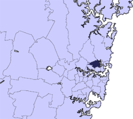
Population: 69,269(2009)[1] • Density: 2800/km² (7,252.0/sq mi) Area: 22.6 km² (8.7 sq mi) Mayor: Patrick Reilly JP Council Seat: Chatswood Region: Metropolitan Sydney State District: Willoughby, Lane Cove Federal Division: Bradfield, North Sydney, Warringah LGAs around City of Willoughby: Ku-ring-gai Council Warringah Council City of Ryde City of Willoughby Manly Council Municipality of Lane Cove North Sydney Council Municipality of Mosman The City of Willoughby is a Local Government Area on the North Shore of Sydney, in the state of New South Wales, Australia. It is located 6 km north of the Sydney central business district.
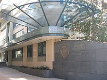
The main commercial centre of the LGA is Chatswood, home to one of Sydney's suburban skyscraper clusters. Other commercial centres are the suburbs of Willoughby, St Leonards and Artarmon. Willoughby is situated on an elevated plateau, and all of Sydney's television stations broadcast from towers in the area. The Royal North Shore Hospital (RNS), situated in St Leonards (within the LGA), is one of Sydney's major hospitals.
Contents
Suburbs in the local government area
Suburbs in the City of Willoughby are:
- Artarmon
- Castle Cove
- Castlecrag
- Chatswood
- Chatswood West
- Middle Cove
- Naremburn
- North Willoughby
- Northbridge
- Roseville
- Willoughby
- Willoughby East
Council
Willoughby City Council is composed of twelve councillors elected proportionally. The area is divided into four wards, each electing three councillors. The mayor is directly elected.[2] The current makeup of the council, including the mayor, is as follows:[2]
Party Councillors Independents 12 The Greens 1 Total 13 The current council, elected in 2008, is:[2]
Ward Councillor Party Notes Mayor Pat Reilly Independent Middle Harbour Wendy Norton Independent Elected on Pat Reilly's ticket Judith Rutherford Independent Robert Wilson Independent Elected on Pat Reilly's ticket Naremburn Stuart Coppock Independent Barry Thompson Independent Kate Lamb Independent Sailors Bay Gail Giles-Gidney Independent Adrian Cox Independent John Hooper Independent West Lynne Saville Greens Terry Fogarty Independent Mandy Stevens Independent Economy
Carter Holt Harvey's head Australia office is located in Level 6 of Tower A of The Zenith Tower at 821 Pacific Highway in the Chatswood area of the City of Willoughby.[3]
References
- ^ Australian Bureau of Statistics (30 March 2010). "Regional Population Growth, Australia, 2008–09". http://www.abs.gov.au/ausstats/abs@.nsf/Latestproducts/3218.0Main%20Features42008-09?opendocument&tabname=Summary&prodno=3218.0&issue=2008-09&num=&view=. Retrieved 3 June 2010.
- ^ a b c "Willoughby City Council". 2008 Election results. Electoral Commission NSW. http://www.lg.elections.nsw.gov.au/LGE2008/result.Willoughby.html. Retrieved 2009-08-02.[dead link]
- ^ "Contact." Carter Holt Harvey. Retrieved on January 28, 2009.
External links
- City of Willoughby is at coordinates 33°48′10″S 151°11′52″E / 33.80291°S 151.19778°ECoordinates: 33°48′10″S 151°11′52″E / 33.80291°S 151.19778°E
- 2001 Census Information
Regions of Sydney Local Government Areas of Sydney Ashfield · Auburn · Bankstown · Blacktown · Botany Bay · Burwood · Camden · Campbelltown · Canada Bay · Canterbury · Fairfield · The Hills · Holroyd · Hornsby · Hunter's Hill · Hurstville · Kogarah · Ku-ring-gai · Lane Cove · Leichhardt · Liverpool · Manly · Marrickville · Mosman · North Sydney · Parramatta · Penrith · Pittwater · Randwick · Rockdale · Ryde · Strathfield · Sutherland · City of Sydney · Warringah · Waverley · Willoughby · WoollahraList of Sydney suburbs Suburbs of City of Willoughby · North Shore · Sydney Artarmon · Castlecrag · Castle Cove · Chatswood · Gore Hill · Middle Cove · Naremburn · Northbridge · Roseville · St Leonards · WilloughbyList of Sydney suburbs Local Government Areas of New South Wales Metropolitan Sydney Inner SydneyAshfield · Botany Bay · Burwood · Canada Bay · Canterbury · Hurstville · Kogarah · Lane Cove · Leichhardt · Manly · Marrickville · Mosman · North Sydney · Randwick · Rockdale · Strathfield · Sydney · Waverley · Willoughby · WoollahraOuter SydneyAuburn · Bankstown · Blacktown · Camden · Campbelltown · Fairfield · The Hills · Holroyd · Hornsby · Hunter's Hill · Ku-ring-gai · Liverpool · Parramatta · Penrith · Pittwater · Ryde · Sutherland · WarringahSydney SurroundsMid North Coast Bellingen · Clarence Valley · Coffs Harbour · Greater Taree · Kempsey · Nambucca · Port Macquarie-Hastings · Lord Howe IslandMurray Murrumbidgee Carrathool · Coolamon · Cootamundra · Griffith · Gundagai · Hay · Junee · Leeton · Lockhart · Murrumbidgee · Narrandera · Temora · Wagga WaggaHunter Cessnock · Dungog · Gloucester · Great Lakes · Lake Macquarie · Maitland · Muswellbrook · Newcastle · Port Stephens · Singleton · Upper HunterIllawarra Richmond Tweed Southeastern Bega · Bombala · Boorowa · Cooma-Monaro · Eurobodalla · Goulburn Mulwaree · Harden · Palerang · Queanbeyan · Snowy River · Tumut · Upper Lachlan · Yass Valley · YoungNorthern Armadale Dumaresq · Glen Innes-Severn · Gunnedah · Guyra · Gwydir · Inverell · Liverpool Plains · Moree Plains · Narrabri · Tamworth · Tenterfield · Uralla · WalchaCentral West North Western Far West Categories:- Local Government Areas in Sydney
Wikimedia Foundation. 2010.


