- Yass Valley Council
Infobox Australian Place | type = lga
name = Yass Valley
state = nsw
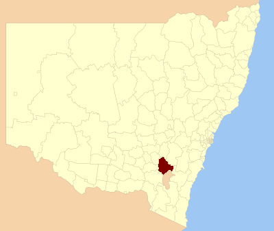
caption = Location in NSW
pop = 9,675 [ cite web
publisher =Australian Bureau of Statistics
title=Regional Population Growth, Australia, 2004-05
url = http://abs.gov.au/Ausstats/abs@.nsf/Latestproducts/3218.0Main%20Features22004-05?opendocument&tabname=Summary&prodno=3218.0&issue=2004-05&num=&view=
accessdate = 2006-12-03 ]
area = 3999
est = 1980
seat = Yass (209 Comur Street)cite web
title=Yass Valley Council
publisher = Department of Local Government
url = http://www.dlg.nsw.gov.au/dlg/dlghome/dlg_CouncilContactDetails.asp?slacode=8710
accessdate = 2006-11-12 ]
mayor = Nic Carmody
region =Southern Tablelands
url = http://www.yass.nsw.gov.au
fedgov = Hume
stategov = Burrinjuck
near-nw= Harden
near-w= Gundagai
near-sw= Cootamundra
near-s= ACT
near-se= Palerang
near-e= Goulburn
near-ne= Upper Lachlan
near-n= BoorowaYass Valley Shire is a local government area in the
Australia n State ofNew South Wales . It is located in theSouthern Tablelands region of New South Wales on the Hume andBarton Highway s and the Main Southern railway line.The Shire includes Yass, Binalong, Bookham, Bowning, Gundaroo, Murrumbateman, Sutton and Wee Jasper.
Yass Shire Council was proclaimed on 1 January 1980 following the amalgamation of Goodradigbee Shire Council and the Yass Municipal Council. Yass Shire Council in turn was proclaimed the Yass Valley Council on 11 February 2004, following a further amalgamation of Yass Shire Council and parts of Gunning and Yarrowlumla Shire Councils.
Demographics
Indigenous Origin: There were 190 people (2.0%) who identified as being of Indigenous origin in the 2001 Census. The median age of people in the 2001 Census was 38 years.
Country Of Birth: The number of people born overseas in the 2001 Census was 902 (9.3%). Of those born overseas, the three main countries of birth in the 2001 Census were:
United Kingdom : 348 (3.6%)New Zealand : 107 (1.1%) andGermany : 53 (0.5%).Ancestry: In the 2001 Census, the three most common ancestries identified with were:
Australia n: 4905 people (50.7%)
English: 3722 people (38.5%) and
Irish: 1307 people (13.5%).Language: English was stated as the only language spoken at home by 9,220 people (95.3%) in the 2001 Census. The three most common languages spoken at home other than English in the 2001 Census were:
German: 30 (0.3%)
Croatian: 27 (0.3%) and
Italian: 22 (0.2%).Computer Usage: In the week preceding the 2001 Census, 4381 people (45.3%) had used a personal computer at home. The total number of persons who had used the Internet in the week preceding the 2001 Census was 3632. There were 621 people (6.4%) who had used the Internet at work only, 1762 people (18.2%) who had used the internet at home only and 319 people (3.3%) who had used the internet elsewhere only.
Marital Status: In the 2001 Census, there were 4335 married people (57.9%), 242 separated people (3.2%), 528 divorced people (7.1%), 505 widowed people (6.7%) and 1874 people who had never been married (25.0%).
Education: In the 2001 Census, 285 (3.8%) people (152 males and 133 females) held a postgraduate degree, graduate diploma or graduate certificate; 760 (10.2%) people (343 males and 417 females) held a bachelor degree; 1741 (23.3%) people (1097 males and 644 females) with an advanced diploma, diploma or certificate; and 4697 (62.8%) people (2096 males and 2601 females) did not have a qualification.
Unemployment: In the 2001 Census, 215 people were unemployed, representing 4.3% of the labour force. The labour force participation rate was 80.1%.
Industry Of Employment: In the 2001 Census, 207 (4.3%) people were employed in the Manufacturing industry; 364 (7.6%) people employed in the Construction industry; 659 (13.7%) people employed in the Retail Trade industry; 453 (9.4%) people were employed in the Property and Business Services industry; 323 (6.7%) people employed in the Education industry; and 395 (8.2%) people employed in the Health and Community Services industry.
Income: The median weekly individual income for people aged 15 years and over in the 2001 Census was $400-$499.
Journey To Work: On Census day,
7 August 2001 , 3 (0.1%) people travelled to work by train only, 63 (1.3%) people took the bus only and 0 (0.0%) people took both the train and bus. There were 3018 (62.4%) people who travelled to work by car, either as the driver or as a passenger and 283 (5.9%) people either rode a bike or walked to work.Families: In the 2001 Census, there were 1280 couple families with children (which comprised 47.0% of all families in occupied private dwellings), 1110 couple families without children (40.7%), 313 one parent families (11.5%) and 22 other families (0.8%).
Dwellings: In the 2001 Census, there were 3346 separate houses (92.3%), 120 semi detached, row or terrace houses and townhouses (3.3%), 93 flats, units or apartments (2.6%) and 62 other dwellings (1.7%). Of all occupied private dwellings in the 2001 Census, 2670 were either fully owned or being purchased, which represents (73.6%) of all occupied private dwellings, while 707 (19.5%) were being rented.
Transport facilities
Yass Valley is serviced by the following transport facilities:
*
Hume Highway (National Highway 31)
*Barton Highway (National Highway 25)
* Lachlan Valley Way (State Route 81)
* Main Southern Railway (Countrylink )
*Transborder Express (A local bus & coach firm)References
Wikimedia Foundation. 2010.