- Gundagai Shire Council
Infobox Australian Place | type = lga
name = Gundagai Shire
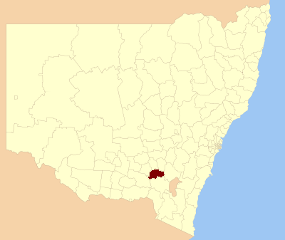
caption = Location in NSW
state=New South Wales
region=Riverina
area=2458
seat=Gundagai (255 Sheridan Street) cite web
title=Gundagai Shire Council
publisher = Department of Local Government
url = http://www.dlg.nsw.gov.au/dlg/dlghome/dlg_CouncilContactDetails.asp?slacode=3500
accessdate = 2006-11-09 ]
est =
pop = formatnum:3693
pop_footnotes = Census 2006 AUS|id=LGA13500|name=Gundagai (A) (Local Government Area)|accessdate=2008-03-23|quick=on]
url=http://gundagai.local-e.nsw.gov.au/
mayor=Len Tozer
fedgov =Riverina
stategov =Burrinjuck
near-nw= Junee
near-w= Wagga Wagga
near-sw= Wagga Wagga
near-s= Tumut
near-se= Tumut
near-e= Yass Valley
near-ne= Harden
near-n= CootamundraGundagai Shire is a local government area in the
Riverina region ofNew South Wales ,Australia , on theHume Highway . Gundagai was declared a Municipality in 1889, and Adjungbilly Shire Council created in 1906 to administer the district. These two were amalgamated in 1923 to form the Gundagai Shire Council, which still administers local government today. [ cite web | year = 2005 | url = http://gundagai.local-e.nsw.gov.au/about/1000/1001.html | title = Potted History of Gundagai | publisher = Gundagai Shire Council | accessdate = 2006-07-12]Gundagai is a primarily rural shire with a small population. 80% of the shire's population live in the town of Gundagai. There are four villages in the Shire: Coolac, Tumblong, Muttama and Nangus, with populations ranging from 40 to 90 people.
References
Wikimedia Foundation. 2010.