- Marrickville Council
-
Marrickville Council
New South Wales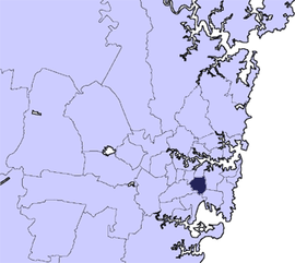
Population: 78,271(2009)[1] • Density: 4570.2/km² (11,836.8/sq mi) [2] Area: 17 km² (6.6 sq mi) Mayor: Morris Hanna Council Seat: Petersham Region: Metropolitan Sydney State District: Marrickville, Canterbury, Heffron Federal Division: Grayndler 
LGAs around Marrickville Council: Municipality of Ashfield Municipality of Leichhardt City of Sydney City of Canterbury Marrickville Council City of Sydney City of Canterbury City of Rockdale City of Botany Bay Marrickville Council is a Local Government Area (LGA) situated in the Inner West region of Sydney, Australia.
The area is bounded by Leichhardt to the north, the City of Sydney to the east and north-east, the City of Botany Bay to the south-east, Rockdale to the south, Canterbury to the west, and Ashfield to the north-west.
While the area's background has traditionally been working-class, several waves of immigration and a continuing trend of gentrification have substantially influenced the demographics and character of the area.[3][4] Marrickville also has a substantial student population, being situated relatively close to the University of Sydney and the University of Technology, Sydney.
According to Marrickville Council's website, "the area contains one of the highest percentages of artists, cultural workers and arts industries of any local government area in Australia."[5]
Contents
History
Based on artefacts found near the Cooks River and Alexandra Canal, it is believed that the area has been occupied for at least 7,000 years. The area was originally occupied by the Cadigal clan of the Darug people who spoke the Eora language.[6] Their name for most of the present day LGA was Bullanaming.[7]
European settlement of the area began very soon after the arrival of the First Fleet in 1788. The first land grant was made in 1789, and by 1809 all the land had been granted. In the 1830s, the district consisted of five large estates, including Thomas Chalder's estate named Marrick after his home town in North Yorkshire. At this point, the area was still quite rural in nature.
Following the subdivision of these estates, municipalities were formed in Marrickville (1861), Camperdown (1861), Newtown (1862), St Peters (1871) and Petersham (1872). The area lost its rural character as Sydney grew, and by the 1820s had become an urbanised industrial area.
The population of these municipalities increased greatly in that time, peaking at roughly 113,000 in 1948. It was in this year that the State Government introduced the Local Government (Areas) Act, and Marrickville Municipal Council was enlarged by merging with St Peters and Petersham on 1 January 1949. The Camperdown and Newtown municipalities had already been merged with the City of Sydney, however in 1968 a boundary readjustment added parts of these areas to Marrickville, resulting in the present boundaries.[6]
While migration has always been an important part of Marrickville, this was especially true from the 1950s to the 1970s, as large groups of immigrants arrived from Southern Europe, the Middle East and then Asia. The area is today one of the most culturally diverse in the country.[8]
Israel boycott
On 14 December 2010 Greens councillor Cathy Peters moved a motion to support the international Boycott, Divestment and Sanctions against Israel.[9] This motion was supported by Greens, Labor and one independent councillor, including Mayor Fiona Byrne. The motion was widely condemned by politicians from both sides of politics including Foreign Minister Kevin Rudd, then Premier Kristina Keneally and federal Greens leader, Bob Brown.[10] The move received support from Nobel Peace Prize Laureates Archbishop Desmond Tutu [11] and Mairead Maguire.[12] After 3 hours in which members of the community were invited to express their opinions, the motion was rescinded at a council meeting on 19 April 2011.[13]. On 14 April 2011 it was revealed that the boycott would cost Marrickville ratepayers A$3.4 million if implemented. The boycott also meant the council would have to replace goods from companies such as Hewlett Packard, Holden, Volvo and Motorola amongst others.[14]
After New South Wales Liberal Premier Barry O'Farrell threatened to sack the council, they reversed the boycott on 19 April at a council meeting.[citation needed] Byrne did not seek re-election, and in September 2011, Morris Hanna became the new mayor after the ALP supported his candidacy and his name was pulled out of the hat in the tie breaker. He is an independent who fought against the BDS campaign.[15]
Geography
The Marrickville LGA is situated in Sydney's Inner West, between 4 and 10 kilometres south-west of the city centre.[16] It covers an area of approximately 17 square kilometres.
The area is roughly bounded by Parramatta Road to the north, King Street and the Princes Highway to the east, the Cooks River and Alexandra Canal to the south, and New and Old Canterbury Roads to the west.
Suburbs in the local government area
The suburbs and localities completely within in the Marrickville Council area are:
Suburbs located partially in Marrickville and partially in the City of Sydney are:
Housing
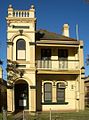
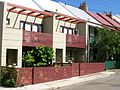
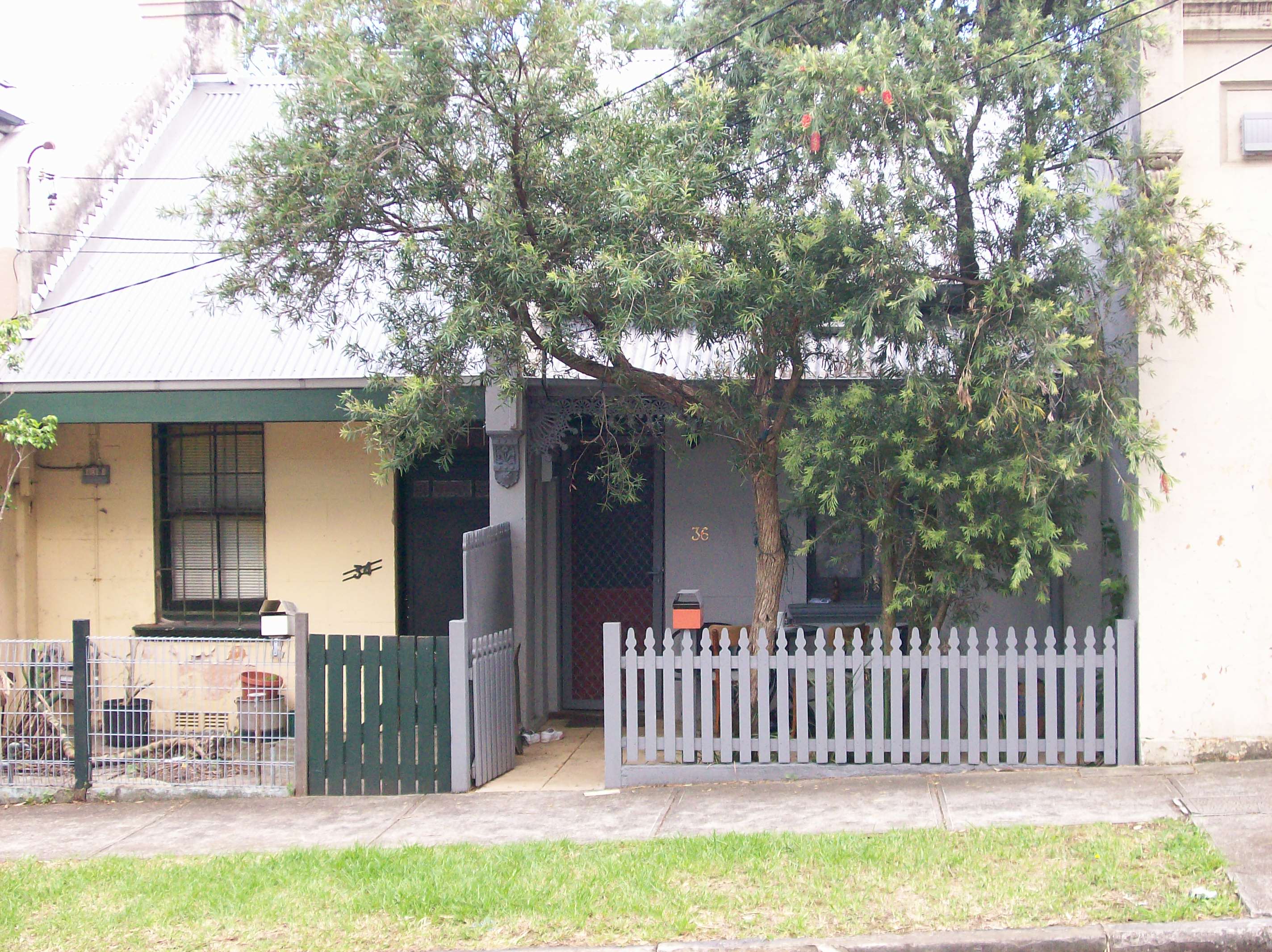
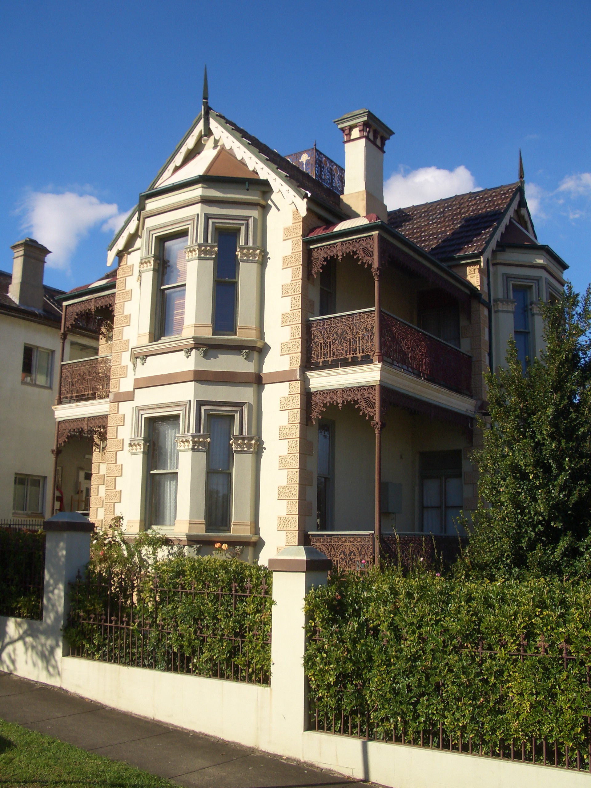
The suburbs within the Marrickville area are generally characterised by Victorian-era terraces, semi-detached houses and other varieties of urban federation housing. These houses gained popularity among renovators as the suburbs became gentrified in the late 20th century.[17] Detached housing, wider streets and larger blocks of land are more common in the suburbs further from the city, such as Dulwich Hill and parts of Marrickville.
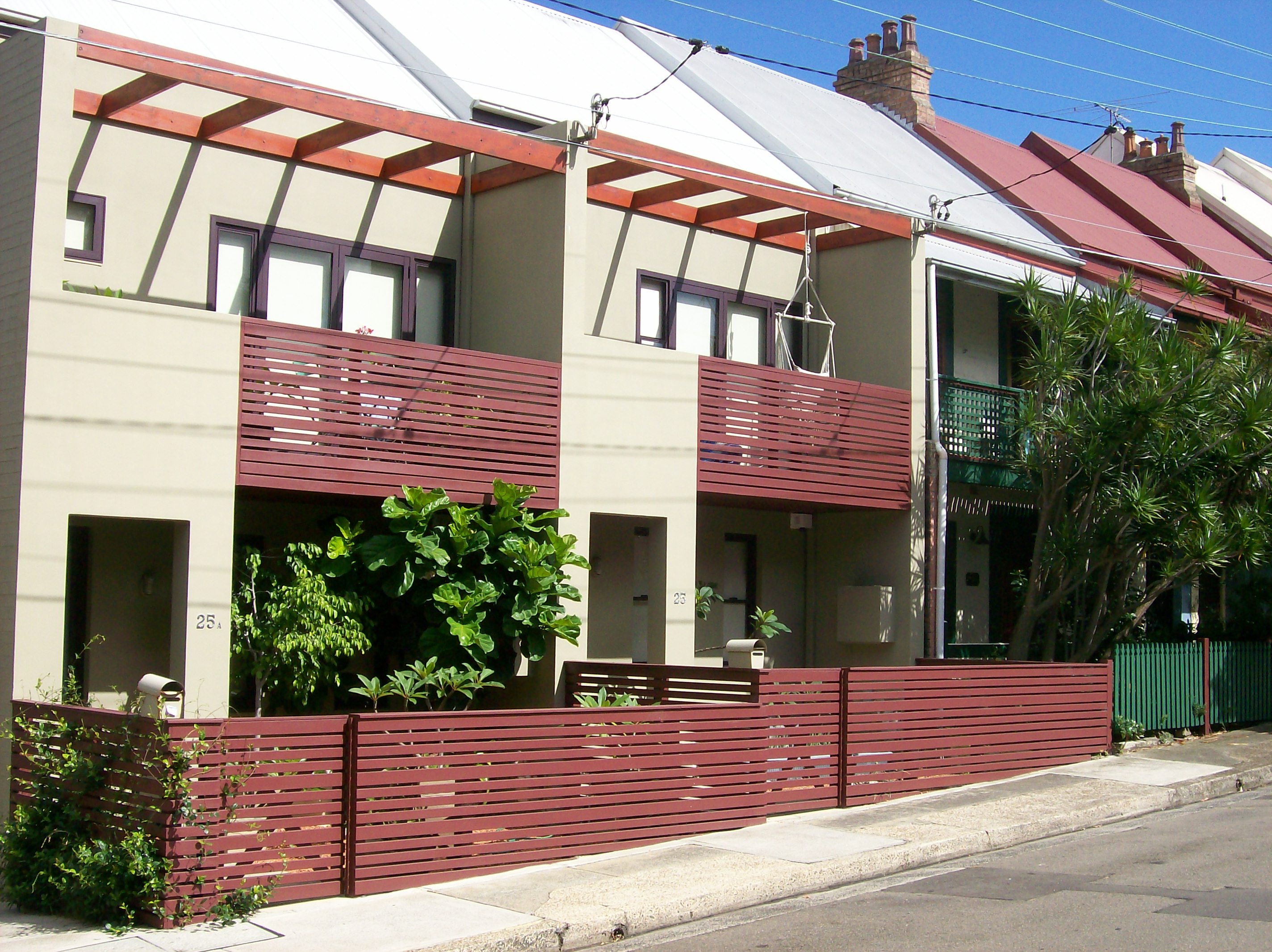
Several medium density apartment blocks were constructed in the area in the 1960s and 1970s. Since the 1980s, modern infill development has tended to be sympathetic with traditional streetscapes.[17]
-

Modest single-storey terraces in Camperdown
-
House in the suburb of Marrickville
-
Sympathetic infill development in Camperdown
-

Restored house in Petersham
Population
The population of the Marrickville area was measured at 75,525 people by the most recent Census.[2]
The Marrickville area is culturally and linguistically diverse. 38.3% of the population were born overseas, and 35.9% speak a language other than English at home. The main non-English languages spoken at home are Greek, Vietnamese, Arabic, Portuguese, Cantonese, Italian and Mandarin.[18] Indigenous Australians form 1.7% of the total population of Marrickville.[2]
The average income for a working adult in Marrickville in mid-2006 was $769 per week, $60 per week higher than the $709 average for Sydney as a whole.[19]
Recreation and Culture
Parks
The Marrickville area has 88 parks and reserves of various sizes within its boundaries. Major sporting grounds include Henson Park, home of the Newtown Jets rugby league club, and Petersham Park, where Sir Donald Bradman scored his first century in grade cricket.[20]
Tempe Lands, 10 hectares of parkland at the south-western corner of LGA, was redeveloped by Marrickville Council in 2003 on the site of a former rubbish tip at a cost of A$17.5 million. The parklands feature sporting fields, a golf driving range, and a constructed saltmarsh and ephemeral wetlands area for wildlife.[21]
Other major parks in the area include Enmore Park, Camperdown Park, Marrickville Park, Steel Park and Camperdown Memorial Rest Park. There are also substantial parklands surrounding the Cooks River.[22]
Events
A number of entertainment and cultural events are held in Marrickville throughout the year. The Marrickville Road Festival is the area's largest annual event, drawing a crowd of around 50,000 people each year.[23] Other major events in the area include the Newtown Festival, Australia Day celebrations at Enmore Park, the Bairro Português Food & Wine Fair in Petersham, and the Dulwich Hill Street Fair.
Transport
Roads
Parramatta Road runs along the northern boundary of the Marrickville local government area. Historically the main east–west arterial road in Sydney, this section of Parramatta Road is still a busy route carrying an average of over 65,000 vehicles per day.[24]
Other main arterial routes running through the area include State Route 54 (composed of New Canterbury Road, Stanmore and Enmore Road) linking Sydney to Liverpool, and the King Street–Princes Highway corridor.
Rail
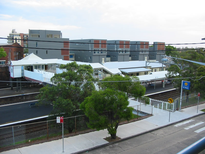
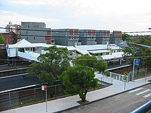 St Peters railway station
CityRail provides passenger rail services to suburbs in the area. The northern part of the LGA is served by the Inner West Line, and the southern and eastern parts are served by the Bankstown line. Trains on the Eastern Suburbs & Illawarra Line serve Sydenham and Tempe railway stations, and some East Hills Line trains also stop at Sydenham during the weekday peak.[25]
Buses
Sydney Buses operates bus services through all suburbs in the Marrickville area.
Airport
 Sydenham Green, formerly the site of noise-affected homes
Australia's busiest airport, Kingsford Smith International Airport, is situated directly south-east of the Marrickville LGA. As a result, many parts of Marrickville suffer from high levels of aircraft noise.[26] Aircraft taking off and landing from Kingsford-Smith Airport also fly at low altitude over the Leichhardt, Ashfield, Canterbury, Rockdale, Botany Bay LGA, Randwick, Canada Bay LGA and Burwood council areas.
After the completion of the airport's third runway in the mid-1990s, the Commonwealth Government controversially purchased and demolished 152 residential properties in the worst-affected parts of Sydenham. The newly vacant land, which is located not under the approach path of the third runway but under the approach/departure path for runway 16R/34L, became Sydenham Green, a public park covering 4.5 hectares. A series of oversized 'living room' sculptures (lamp, chairs and fireplace) decorate the park, paying homage to the homes that formerly occupied the site.[27]
Council
Morris Hanna became the new mayor in September 2011, succeeding Fiona Byrne. Hanna is an independent who fought against the anti-Israel BDS campaign (see above).[28]
Marrickville Council is composed of twelve councillors elected proportionally. The area is divided into four wards, each electing three councillors. The mayor is not directly elected.[29] The current makeup of the council is as follows:[29]
Party Councillors The Greens 5 Australian Labor Party 4 Independents 3 Total 12 The council, elected in 2008, is:[29]
Ward Councillor Party Notes Central Ward Max Phillips Greens Sam Iskandar Labor Deputy Mayor Victor Macri Independent North Ward Fiona Byrne Greens Laura Wright Labor Cathy Peters Greens South Ward Peter Olive Greens Mary O'Sullivan Labor Morris Hanna Independent Mayor West Ward Marika Kontellis Greens Emanuel Tsardoulias Labor Dimitrios Thanos Independent Sister cities
Marrickville Council has sister city relations with the following cities[30]:
 Bethlehem, West Bank, since 2007
 Funchal, Madeira Islands, Portugal, since 1996
 Keelung, Taiwan, since 1989
 Kos, Greece, since 1990
 Larnaca, Cyprus, since 2005
 Safita, Syria, since 2005
 Zonnebeke, Belgium, since 2007
The following cities have also signed agreements to formalise relationships with Marrickville:
References
- ^ Australian Bureau of Statistics (30 March 2010). "Regional Population Growth, Australia, 2008–09". http://www.abs.gov.au/ausstats/abs@.nsf/Latestproducts/3218.0Main%20Features42008-09?opendocument&tabname=Summary&prodno=3218.0&issue=2008-09&num=&view=. Retrieved 3 June 2010.
- ^ a b c Australian Bureau of Statistics, Census 2006, National Regional Profile: Marrickville
- ^ Local Government and Shires Associations of NSW, Marrickville Public Art Strategy, section 2.2.2 Cultural Identity
- ^ http://studentwork.hss.uts.edu.au/oj2/oj2_s2000/2042/index.html
- ^ Marrickville Council, Artist Opportunities
- ^ a b Marrickville Council, Our Local History
- ^ Marrickville Council, History of Suburbs
- ^ Marrickville Council, http://www.marrickville.nsw.gov.au/council.htm Your Council
- ^ http://www.smh.com.au/nsw/suburb-joins-israeli-boycott-20101220-1935z.html?skin=text-only
- ^ http://www.theaustralian.com.au/national-affairs/victorian-greens-distance-themselves-from-nsw-branchs-israel-boycott/story-fn59niix-1226031927385
- ^ http://www.smh.com.au/nsw/social-justice-at-local-scale-takes-courage-tutu-tells-marrickville-mayor-20110606-1fpdl.html
- ^ http://www.smh.com.au/nsw/top-names-back-marrickville-councils-israel-boycott-20110419-1dmo5.html
- ^ http://www.smh.com.au/nsw/marrickville-councils-move-to-boycott-israel-sinks-in-stormy-sea-of-debate-20110419-1dnkk.html
- ^ http://www.theaustralian.com.au/national-affairs/marrickville-ratepayers-37m-bill-for-israel-boycott/story-fn59niix-1226038771230
- ^ New Mayor for Marrickville
- ^ Department of Local Government, Review Report, Marrickville Council
- ^ a b Bruce and Hassan, A walking tour of O'Connell Town and parts of Bligh's Terrace (Newtown)
- ^ Marrickville Council, Your Council
- ^ Marrickville Council, Marrickville Community Portrait
- ^ Bradman Foundation, Bradman Centenary Widely Recognised
- ^ Sydney Morning Herald, From Waste to Wonder, 9 August 2005
- ^ Marrickville Council Parks and Facilities
- ^ Marrickville Council, Community Events
- ^ RTA, Daily traffic volumes, Parramatta Rd nr Cardigan St Camperdown (combined east and westbound averages)
- ^ Marrickville Council, Welcome to Marrickville: Transport
- ^ ABC Online, Airport noise pollution will double, residents warned, 20 March 2008
- ^ Chrys Meader, Dictionary of Sydney: Sydenham
- ^ New Mayor for Marrickville
- ^ a b c "Marrickville Council". 2008 Election results. Electoral Commission NSW. http://www.lg.elections.nsw.gov.au/LGE2008/result.Marrickville.html. Retrieved 2 August 2009.[dead link]
- ^ Marrickville Council, Sister Cities
External links
- Marrickville Council
- Cadigal-Wangal website
- Reverse Garbage Centre
- Youth Resource Centre
- Interactive Map of Marrickville Local Government Area
- 2001 Census Information
Regions of Sydney Local Government Areas of SydneyAshfield · Auburn · Bankstown · Blacktown · Botany Bay · Burwood · Camden · Campbelltown · Canada Bay · Canterbury · Fairfield · The Hills · Holroyd · Hornsby · Hunter's Hill · Hurstville · Kogarah · Ku-ring-gai · Lane Cove · Leichhardt · Liverpool · Manly · Marrickville · Mosman · North Sydney · Parramatta · Penrith · Pittwater · Randwick · Rockdale · Ryde · Strathfield · Sutherland · City of Sydney · Warringah · Waverley · Willoughby · WoollahraLocal Government Areas of New South Wales Metropolitan Sydney Inner SydneyAshfield · Botany Bay · Burwood · Canada Bay · Canterbury · Hurstville · Kogarah · Lane Cove · Leichhardt · Manly · Marrickville · Mosman · North Sydney · Randwick · Rockdale · Strathfield · Sydney · Waverley · Willoughby · WoollahraOuter SydneyAuburn · Bankstown · Blacktown · Camden · Campbelltown · Fairfield · The Hills · Holroyd · Hornsby · Hunter's Hill · Ku-ring-gai · Liverpool · Parramatta · Penrith · Pittwater · Ryde · Sutherland · WarringahSydney SurroundsMid North Coast Bellingen · Clarence Valley · Coffs Harbour · Greater Taree · Kempsey · Nambucca · Port Macquarie-Hastings · Lord Howe IslandMurray Murrumbidgee Carrathool · Coolamon · Cootamundra · Griffith · Gundagai · Hay · Junee · Leeton · Lockhart · Murrumbidgee · Narrandera · Temora · Wagga WaggaHunter Cessnock · Dungog · Gloucester · Great Lakes · Lake Macquarie · Maitland · Muswellbrook · Newcastle · Port Stephens · Singleton · Upper HunterIllawarra Richmond Tweed Southeastern Bega · Bombala · Boorowa · Cooma-Monaro · Eurobodalla · Goulburn Mulwaree · Harden · Palerang · Queanbeyan · Snowy River · Tumut · Upper Lachlan · Yass Valley · YoungNorthern Armadale Dumaresq · Glen Innes-Severn · Gunnedah · Guyra · Gwydir · Inverell · Liverpool Plains · Moree Plains · Narrabri · Tamworth · Tenterfield · Uralla · WalchaCentral West North Western Far West Categories:- Local Government Areas in Sydney
-


Wikimedia Foundation. 2010.