- City of Botany Bay
-
City of Botany Bay
New South Wales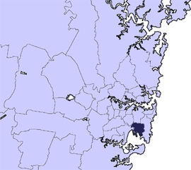
Population: 39,664(2009)[1] • Density: 1700/km² (4,403.0/sq mi) Area: 22 km² (8.5 sq mi) Mayor: Ron Hoenig Council Seat: Mascot Region: Metropolitan Sydney State District: Heffron, Maroubra Federal Division: Kingsford Smith LGAs around City of Botany Bay: Marrickville Sydney Randwick Marrickville City of Botany Bay Randwick Rockdale Botany Bay Randwick  City of Botany Bay Admin Building, Mascot
The City of Botany Bay is a Local Government Area in south eastern Sydney, in the state of New South Wales, Australia. It encompasses the suburbs to the north of Botany Bay, such as Botany. The administrative centre is located at Mascot, which is 7 km south of the Sydney central business district. Before 1996, the city was known as the Municipality of Botany.
Contents
Demographics
According to the Australian Bureau Statistics,[2] there:
- were 37,415 people as at 30 June 2006, the 61st largest Local Government Area in New South Wales. It was equal to 0.5% of the New South Wales population of 6,827,694
- was an increase of 153 people over the year to 30 June 2006, the 73rd largest population growth in a Local Government Area in New South Wales. It was equal to 0.3% of the 58,753 increase in the population of New South Wales
- was, in percentage terms, an increase of 0.4% in the number of people over the year to 30 June 2006, the 106th fastest growth in population of a Local Government Area in New South Wales. In New South Wales the population grew by 0.9%
- was an increase in population over the 10 years to 30 June 2006 of 1,477 people or 4.1% (0.4% in annual average terms), the 75th highest rate of a Local Government Area in New South Wales. In New South Wales the population grew by 622,966 or 10% (1.0% in annual average terms) over the same period.
State Emergency Service
The State Emergency Service unit attached to the Botany Bay City Council area was disbanded in August 2006 when all members of the unit walked out after an ongoing dispute over funding with the local council came to a head.[citation needed] In the event of a storm or flood emergency, the Botany Bay Council area is now serviced by volunteers from Randwick.
Suburbs in the local government area
Suburbs in the City of Botany Bay are:
Council
Botany Bay City Council is composed of six councillors elected proportionally, together with the mayor, directly elected. The city is divided into three wards, each electing two councillors.[3] The current makeup of the council, including the mayor, is as follows:[3]
Party Councillors Australian Labor Party 7 Total 7 The current council, elected in 2008, is:[3]
Ward Councillor Party Notes Mayor Ron Hoenig Labor Mayor A Ward Anne Slattery Labor Stan Kondilios Labor B Ward Greg Mitchell Labor Mark Castle Labor C Ward George Glinatsis Labor Deputy Mayor Brian Troy Labor Economy
Qantas's head office, the Qantas Centre, is at 203 Coward Street in the Mascot suburb of Botany Bay.[4] The regional airline Eastern Australia Airlines has its head office on the grounds of Sydney Airport in Mascot.[5] The airline Impulse Airlines, when it existed, had its head office in the airport property.[6]
Education
Government schools
Residents are zoned to schools in the New South Wales Department of Education.
The following primary schools are in Botany Bay:
- Banksmeadow Public School
- Botany Public School
- Daceyville Public School
- Eastlakes Public School
- Mascot Public School]
- Pagewood Public School
J J Cahill Memorial High School is in the Mascot section of Botany Bay.
The John Brotchie Nursery School is also located in Botany Bay.
Private schools
St Therese's Catholic School is across from Cahill. St Bernard's Catholic School, Ramsgate St Botany
Other statistics
According to the 2001 census, Botany Bay has a population of 35,897 (17,735 males and 18,162 females).
There were 558 people (1.6%, 274 males and 284 females) who identified as being of Indigenous origin. Eastern/South East Asian and people from Indian subcontinent make 19.24% of the population, followed by Middle Eastern and Northern African people at 7.17% and Pacific Islanders at 2.72%. The three most common languages spoken at home other than English in the 2001 Census were Greek 7.4%, Chinese languages 5.05% and Spanish 4.5%.
The median weekly individual income for people aged 15 years and over in the 2001 Census was $300–$399. 49.8% of households have children and 3.5% of the people were in group households.
References
- ^ Australian Bureau of Statistics (30 March 2010). "Regional Population Growth, Australia, 2008–09". http://www.abs.gov.au/ausstats/abs@.nsf/Latestproducts/3218.0Main%20Features42008-09?opendocument&tabname=Summary&prodno=3218.0&issue=2008-09&num=&view=. Retrieved 3 June 2010.
- ^ "Regional Population Growth, Australia, 2005-06 (catalogue no.: 3218.0)". Australian Bureau of Statistics. http://abs.gov.au. Retrieved 2007-03-12.
- ^ a b c "Botany Bay City Council". 2008 Election results. Electoral Commission NSW. http://www.lg.elections.nsw.gov.au/LGE2008/result.Botany_Bay.html. Retrieved 2009-06-16.[dead link]
- ^ "Other Qantas Contacts." Qantas. Retrieved on 10 February 2009.
- ^ "World Airline Directory." Flight International. 23–29 March 2004. 66.
- ^ "World Airline Directory." Flight International. 4–10 April 2000. 85.
External links
Suburbs and localities within the City of Botany Bay · South-eastern Sydney · Sydney Banksmeadow · Botany · Daceyville · Eastgardens · Eastlakes · Hillsdale · Mascot · Pagewood
List of Sydney suburbs Regions of Sydney Local Government Areas of Sydney Ashfield · Auburn · Bankstown · Blacktown · Botany Bay · Burwood · Camden · Campbelltown · Canada Bay · Canterbury · Fairfield · The Hills · Holroyd · Hornsby · Hunter's Hill · Hurstville · Kogarah · Ku-ring-gai · Lane Cove · Leichhardt · Liverpool · Manly · Marrickville · Mosman · North Sydney · Parramatta · Penrith · Pittwater · Randwick · Rockdale · Ryde · Strathfield · Sutherland · City of Sydney · Warringah · Waverley · Willoughby · WoollahraList of Sydney suburbs Local Government Areas of New South Wales Metropolitan Sydney Inner SydneyAshfield · Botany Bay · Burwood · Canada Bay · Canterbury · Hurstville · Kogarah · Lane Cove · Leichhardt · Manly · Marrickville · Mosman · North Sydney · Randwick · Rockdale · Strathfield · Sydney · Waverley · Willoughby · WoollahraOuter SydneyAuburn · Bankstown · Blacktown · Camden · Campbelltown · Fairfield · The Hills · Holroyd · Hornsby · Hunter's Hill · Ku-ring-gai · Liverpool · Parramatta · Penrith · Pittwater · Ryde · Sutherland · WarringahSydney SurroundsMid North Coast Bellingen · Clarence Valley · Coffs Harbour · Greater Taree · Kempsey · Nambucca · Port Macquarie-Hastings · Lord Howe IslandMurray Murrumbidgee Carrathool · Coolamon · Cootamundra · Griffith · Gundagai · Hay · Junee · Leeton · Lockhart · Murrumbidgee · Narrandera · Temora · Wagga WaggaHunter Cessnock · Dungog · Gloucester · Great Lakes · Lake Macquarie · Maitland · Muswellbrook · Newcastle · Port Stephens · Singleton · Upper HunterIllawarra Richmond Tweed Southeastern Bega · Bombala · Boorowa · Cooma-Monaro · Eurobodalla · Goulburn Mulwaree · Harden · Palerang · Queanbeyan · Snowy River · Tumut · Upper Lachlan · Yass Valley · YoungNorthern Armadale Dumaresq · Glen Innes-Severn · Gunnedah · Guyra · Gwydir · Inverell · Liverpool Plains · Moree Plains · Narrabri · Tamworth · Tenterfield · Uralla · WalchaCentral West North Western Far West Categories:- Local Government Areas in Sydney
- Botany Bay


Wikimedia Foundation. 2010.