- City of Shellharbour
-
City of Shellharbour
New South Wales
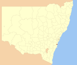
Location in NSWPopulation: 70,000(2011)[1] Established: 1859 Area: 147 km² (56.8 sq mi) Mayor: Kelie Marsh Council Seat: Shellharbour City Centre (Lamerton House, Lamerton Crescent)[2] Region: Illawarra State District: Shellharbour, Kiama Federal Division: Throsby, Gilmore LGAs around City of Shellharbour: Wingecarribee Wollongong Pacific Ocean Wingecarribee City of Shellharbour Pacific Ocean Wingecarribee Kiama Pacific Ocean City of Shellharbour is a Local Government Area located in the Illawarra region, on the east coast of Australia, about 100 km south of Sydney. It covers southern suburbs of the Wollongong urban area centred around Shellharbour, and has an estimated population of 66,905[1].
The area is bordered by the City of Wollongong to the north, with the boundary being the Lake Illawarra entrance (and the suburb of Lake Illawarra) and Macquarie Rivulet (Albion Park Rail). To the south lies the Municipality of Kiama.
Contents
History
Indigenous occupation of the area, particularly of Bass Point, can be traced back to 17,000 BP. The area was discovered by Bass and Flinders in 1796. Free settlers began arriving between 1817 and 1831 and the township was founded in 1851.
The Shellharbour (Municipal) Council was constituted on 4 June 1859, and was gazetted as a City in 1996. In May 2009, Shellharbour City Council celebrated its 150th birthday.[3]
Public inquiry
A public inquiry into Shellharbour City Council was instigated by the Department of Local Government on the 31st of March 2008. The inquiry concluded on 11 June 2008 with the Commissioner of the Inquiry due to report in early July to the Department of Local Government.
On 9 July 2008, the Commissioner, Richard Colley, recommended to the Department of Local Government that all civic offices at the council should be declared vacant. The Hon. Paul Lynch, the Minister for Local Government, announced the dismissal of Shellharbour City Council later the same day.[4]
Attractions
Shellharbour City has many attractions for family entertainment and recreation. In Albion Park Rail there is a Light Rail Museum and steam trains, Historical Aircraft Restoration Society (HARS) Museum, and Albion Oval; a local sports ground. Shellharbour Village, the beach and playground are also popular attractions. A cycleway goes from Oak Flats to Barrack Point.
References
- ^ a b Australian Bureau of Statistics (30 March 2010). "Regional Population Growth, Australia, 2008–09". http://www.abs.gov.au/ausstats/abs@.nsf/Latestproducts/3218.0Main%20Features42008-09?opendocument&tabname=Summary&prodno=3218.0&issue=2008-09&num=&view=. Retrieved 3 June 2010.
- ^ "Shoalhaven City Council". Department of Local Government. http://www.dlg.nsw.gov.au/dlg/dlghome/dlg_CouncilContactDetails.asp?slacode=6900. Retrieved 2006-11-26.
- ^ "Our History". Shellharbour City Council. http://www.shellharbour.nsw.gov.au/default.aspx?WebPage=115. Retrieved 2008-03-16.
- ^ Announcement from the Minister for Local Government
External links
Suburbs of the City of Shellharbour Local Government Area, New South Wales Albion Park Rail · Albion Park · Balarang · Barrack Heights · Barrack Point · Blackbutt · Calderwood · Croom · Dunmore · Flinders · Lake Illawarra · Mount Warrigal · Oak Flats · Shellharbour · Tongarra · Tullimbar · Warilla · Yellow Rock · North Macquarie · Macquarie Pass · Shell Cove · Shellharbour City Centre
Local Government Areas of New South Wales Metropolitan Sydney Inner SydneyAshfield · Botany Bay · Burwood · Canada Bay · Canterbury · Hurstville · Kogarah · Lane Cove · Leichhardt · Manly · Marrickville · Mosman · North Sydney · Randwick · Rockdale · Strathfield · Sydney · Waverley · Willoughby · WoollahraOuter SydneyAuburn · Bankstown · Blacktown · Camden · Campbelltown · Fairfield · The Hills · Holroyd · Hornsby · Hunter's Hill · Ku-ring-gai · Liverpool · Parramatta · Penrith · Pittwater · Ryde · Sutherland · WarringahSydney SurroundsMid North Coast Bellingen · Clarence Valley · Coffs Harbour · Greater Taree · Kempsey · Nambucca · Port Macquarie-Hastings · Lord Howe IslandMurray Murrumbidgee Carrathool · Coolamon · Cootamundra · Griffith · Gundagai · Hay · Junee · Leeton · Lockhart · Murrumbidgee · Narrandera · Temora · Wagga WaggaHunter Cessnock · Dungog · Gloucester · Great Lakes · Lake Macquarie · Maitland · Muswellbrook · Newcastle · Port Stephens · Singleton · Upper HunterIllawarra Richmond Tweed Southeastern Bega · Bombala · Boorowa · Cooma-Monaro · Eurobodalla · Goulburn Mulwaree · Harden · Palerang · Queanbeyan · Snowy River · Tumut · Upper Lachlan · Yass Valley · YoungNorthern Armadale Dumaresq · Glen Innes-Severn · Gunnedah · Guyra · Gwydir · Inverell · Liverpool Plains · Moree Plains · Narrabri · Tamworth · Tenterfield · Uralla · WalchaCentral West North Western Far West Categories:- Populated places established in 1859
- 1859 establishments in Australia
- Local Government Areas of New South Wales
- Shellharbour, New South Wales
Wikimedia Foundation. 2010.
