- Cobar Shire
-
Cobar Shire
New South Wales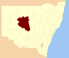
Location in New South WalesPopulation: 5,166(2009)[1] • Density: 0.11/km² (0.3/sq mi) Area: 44065 km² (17,013.6 sq mi) Mayor: Lilliane Brady Council Seat: Cobar (36 Linsley Street) Region: Orana State District: Barwon Federal Division: Parkes LGAs around Cobar Shire: Central Darling Bourke Brewarrina Central Darling Cobar Shire Bogan Central Darling Carrathool Lachlan Cobar Shire is a local government area in the Orana region of New South Wales, Australia. It is an outback shire based on the mining town of Cobar. It is traversed by the Barrier Highway and the Kidman Way. With a total area of 44,065 square kilometres, it is larger than Denmark and 99 other countries and self-governing territories.
Contents
Incomes
According to the Australian Bureau Statistics [2] during 2003-04, there:
- were 1,898 wage and salary earners (ranked 116th in New South Wales and 376th in Australia, less than 0.1% of both New South Wales's 2,558,415 and Australia's 7,831,856)
- was a total income of $78,550,082 (around $79 million) (ranked 108th in New South Wales and 359th in Australia, less than 0.1% of both New South Wales's $107,179,688,262 (around $107 billion) and Australia's $304,034,755,876 (around $304 billion))
- was an estimated average income per wage and salary earner of $41,386 (ranked 27th in New South Wales and 85th in Australia, 100% of New South Wales's $41,407 and 107% of Australia's $38,820)
- was an estimated median income per wage and salary earner of $36,856 (ranked 27th in New South Wales and 81st in Australia, 104% of New South Wales's $35,479 and 108% of Australia's $34,149).
Other villages
The shire also includes four very small outback towns; the twin villages of Euabalong and Euabalong West in the far south east of the shire, Mount Hope, and Nymagee.[3]
Council
Cobar Shire Council is composed of twelve councillors elected proportionally. The mayor is not directly elected.[4] The current makeup of the council is as follows:[4]
Party Councillors Independents and Unaffiliated 12 Total 12 The current council, elected in 2008, is:[4]
Councillor Party Notes Lilliane Brady Unaffiliated Mayor George Yench Independent Tracey Kings Independent Greg Martin Unaffiliated Deputy Mayor Harley Toomey Independent Angela Webb Unaffiliated Marsha Isbester Unaffiliated Gerard Francisco Independent Michael St John Cox Independent Bob Sinclair Independent Ray Wilson Unaffiliated Jarrod Marsden Unaffiliated References
- ^ Australian Bureau of Statistics (30 March 2010). "Regional Population Growth, Australia, 2008–09". http://www.abs.gov.au/ausstats/abs@.nsf/Latestproducts/3218.0Main%20Features42008-09?opendocument&tabname=Summary&prodno=3218.0&issue=2008-09&num=&view=. Retrieved 3 June 2010.
- ^ "Regional Wage and Salary Earner Statistics, Australia (catalogue no.: 5673.055.003)". Australian Bureau of Statistics. http://abs.gov.au. Retrieved 2007-03-11.
- ^ Cobar Shire villages page retrieved 2008-02-05.
- ^ a b c "Cobar Shire Council". 2008 Election results. Electoral Commission NSW. http://www.lg.elections.nsw.gov.au/LGE2008/result.Cobar.html. Retrieved 2009-06-16.[dead link]
Coordinates: 31°29′S 145°48′E / 31.483°S 145.8°E
Local Government Areas of New South Wales Metropolitan Sydney Inner SydneyAshfield · Botany Bay · Burwood · Canada Bay · Canterbury · Hurstville · Kogarah · Lane Cove · Leichhardt · Manly · Marrickville · Mosman · North Sydney · Randwick · Rockdale · Strathfield · Sydney · Waverley · Willoughby · WoollahraOuter SydneyAuburn · Bankstown · Blacktown · Camden · Campbelltown · Fairfield · The Hills · Holroyd · Hornsby · Hunter's Hill · Ku-ring-gai · Liverpool · Parramatta · Penrith · Pittwater · Ryde · Sutherland · WarringahSydney SurroundsMid North Coast Bellingen · Clarence Valley · Coffs Harbour · Greater Taree · Kempsey · Nambucca · Port Macquarie-Hastings · Lord Howe IslandMurray Murrumbidgee Carrathool · Coolamon · Cootamundra · Griffith · Gundagai · Hay · Junee · Leeton · Lockhart · Murrumbidgee · Narrandera · Temora · Wagga WaggaHunter Cessnock · Dungog · Gloucester · Great Lakes · Lake Macquarie · Maitland · Muswellbrook · Newcastle · Port Stephens · Singleton · Upper HunterIllawarra Richmond Tweed Southeastern Bega · Bombala · Boorowa · Cooma-Monaro · Eurobodalla · Goulburn Mulwaree · Harden · Palerang · Queanbeyan · Snowy River · Tumut · Upper Lachlan · Yass Valley · YoungNorthern Armadale Dumaresq · Glen Innes-Severn · Gunnedah · Guyra · Gwydir · Inverell · Liverpool Plains · Moree Plains · Narrabri · Tamworth · Tenterfield · Uralla · WalchaCentral West North Western Bogan · Bourke · Brewarrina · Cobar · Coonamble · Dubbo · Gilgandra · Narromine · Walgett · Warren · Warrumbungle · WellingtonFar West Categories:- Local Government Areas of New South Wales
- New South Wales geography stubs

Wikimedia Foundation. 2010.