- Narromine Shire
-
Narromine
New South Wales
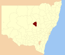
Location in New South WalesPopulation: 6,818(2009)[1] Area: 5264 km² (2,032.4 sq mi) Mayor: Bill McAnally[2] Council Seat: Narromine (124 Dandaloo Street} Region: Orana State District: Dubbo, Barwon Federal Division: Parkes LGAs around Narromine: Warren Warren Gilgandra Lachlan Narromine Dubbo Lachlan Parkes Cabonne Narromine Shire is a Local Government Area located west of Dubbo in the Orana region of New South Wales, Australia. It is on the Mitchell Highway and the Main Western railway line.
Narromine Shire also includes Trangie and Tomingley.
References
- ^ Australian Bureau of Statistics (30 March 2010). "Regional Population Growth, Australia, 2008–09". http://www.abs.gov.au/ausstats/abs@.nsf/Latestproducts/3218.0Main%20Features42008-09?opendocument&tabname=Summary&prodno=3218.0&issue=2008-09&num=&view=. Retrieved 3 June 2010.
- ^ "Narromine Shire Council". Department of Local Government. http://www.dlg.nsw.gov.au/dlg/dlghome/dlg_CouncilContactDetails.asp?slacode=5850. Retrieved 2006-11-24.
Coordinates: 32°14′S 148°14′E / 32.233°S 148.233°E
Local Government Areas of New South Wales Metropolitan Sydney Inner SydneyAshfield · Botany Bay · Burwood · Canada Bay · Canterbury · Hurstville · Kogarah · Lane Cove · Leichhardt · Manly · Marrickville · Mosman · North Sydney · Randwick · Rockdale · Strathfield · Sydney · Waverley · Willoughby · WoollahraOuter SydneyAuburn · Bankstown · Blacktown · Camden · Campbelltown · Fairfield · The Hills · Holroyd · Hornsby · Hunter's Hill · Ku-ring-gai · Liverpool · Parramatta · Penrith · Pittwater · Ryde · Sutherland · WarringahSydney SurroundsMid North Coast Bellingen · Clarence Valley · Coffs Harbour · Greater Taree · Kempsey · Nambucca · Port Macquarie-Hastings · Lord Howe IslandMurray Murrumbidgee Carrathool · Coolamon · Cootamundra · Griffith · Gundagai · Hay · Junee · Leeton · Lockhart · Murrumbidgee · Narrandera · Temora · Wagga WaggaHunter Cessnock · Dungog · Gloucester · Great Lakes · Lake Macquarie · Maitland · Muswellbrook · Newcastle · Port Stephens · Singleton · Upper HunterIllawarra Richmond Tweed Southeastern Bega · Bombala · Boorowa · Cooma-Monaro · Eurobodalla · Goulburn Mulwaree · Harden · Palerang · Queanbeyan · Snowy River · Tumut · Upper Lachlan · Yass Valley · YoungNorthern Armadale Dumaresq · Glen Innes-Severn · Gunnedah · Guyra · Gwydir · Inverell · Liverpool Plains · Moree Plains · Narrabri · Tamworth · Tenterfield · Uralla · WalchaCentral West North Western Bogan · Bourke · Brewarrina · Cobar · Coonamble · Dubbo · Gilgandra · Narromine · Walgett · Warren · Warrumbungle · WellingtonFar West Categories:- Local Government Areas of New South Wales
- New South Wales geography stubs
Wikimedia Foundation. 2010.
