- Cooks River
-
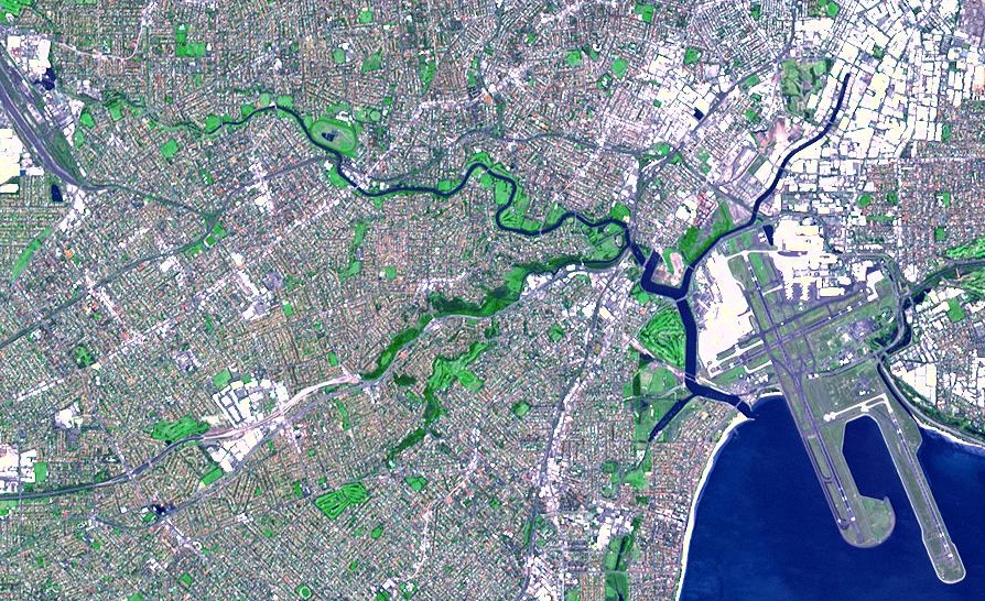
Cooks River 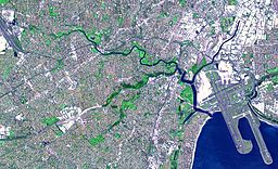 NASA satellite image of the Cooks River
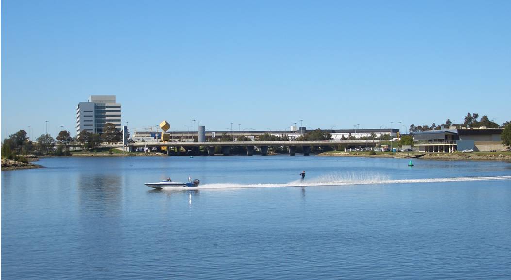
Country Australia State New South Wales Municipality Sydney Source Graf Park - location Yagoona Mouth Botany Bay - location Kyeemagh Length 23 km (14 mi) Basin 100 km2 (39 sq mi)  Cooks River, near Sydney Airport
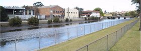
 Cooks River, railway bridge between Tempe and Wolli Creek
The Cooks River is a 23 kilometre long urban waterway of south-western Sydney, New South Wales, Australia emptying into Botany Bay. The course of the river has been altered to accommodate various developments along its shore. It serves as part of a stormwater system for the 100 square kilometres of its watershed, and many of the original streams running into it have been turned into concrete lined channels. The tidal sections support significant areas of mangroves, bird, and fish life, and are used for recreational activities.
Contents
Course
The river commences at Graf Park, Yagoona, then flows approximately north-west direction through to Chullora. It reaches its northern-most point at Strathfield, where it leads into a concrete open canal, no more than one meter wide and thirty centimetres deep, and heads towards the south-east. Part of the river, where it runs through Strathfield Golf Course, has had the concrete lining removed and the plants have returned and create an environment where the water is filtered and runs clean, and wildlife has returned. One section here is called the Chain of Ponds.
At Belfield it joins with the Cox Creek Channel and flows in an easterly direction. The canal widens and deepens as it picks up stormwater from surrounding suburbs, such as Campsie and becomes influenced by tidal action.
At Canterbury, it is joined by Cup and Saucer Creek. Industrial areas line the Cooks River at Canterbury. In the past, factories discharged their waste directly into the water.
The valley becomes more pronounced as the river reaches Tempe, where it is joined by Wolli Creek and the Alexandra Canal. The Princes Highway crosses the Cooks River and links Tempe to Wolli Creek.
The course of the final south-flowing section of river is entirely artificial, altered to accommodate the expanding Sydney Airport. Cooks River connects with Botany Bay at Kyeemagh.
The corridor of land beside the river is a conduit for many services along large parts of its length including electricity, high voltage lines, a high pressure oil pipe owned by Shell, and high volume sewage pipes. Many of the lower lying areas have been filled and are parks and sports grounds. In spite of this the river and adjacent lands are being recognised for their beauty, history, amenity, environmental value, if not also for potential for improvements. The walkway and cycleway beside much of the "river" is part of the path connecting Sydney Olympic Park with Bay.
Management
Care and control of the river is shared between many local councils and the New South Wales Government through agencies such as the Sydney Metropolitan Catchment Management Authority, the Environment Protection Authority and the Sydney Water corporation.
Environmental Issues
 Cooks River joined by Cup and Saucer Creek
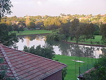 Cooks River at Hurlstone Park
The Cooks River has a catchment area of 100 square kilometres, within the metropolitan areas of Sydney enclosed by urban environments and extensive recreational areas. The human population of this area is over 400,000 people. There are over 100,000 commercial and industrial premises. The river has typical water catchment management problems characteristic of heavily urbanised areas, including:
- Removal of native vegetation and habitat destruction
- Modified hydrology including increased peak run-off rates due to covering of land with hard surfaces, concrete storm water canals" and re-routing of water courses
- Pollution from motor vehicles, litter, sewage, illegal dumping, industrial, commercial and domestic activities
- Nutrient enrichment from surrounding environment, especially due to water runoffs from recreational parks, resulting in increased algal levels
Water quality testing conducted by the Water Research Centre found quantities of pharmaceutical and industrial chemicals at levels similar to untreated sewage.[1] A very old and broken sewerage system has been blamed for the contaminants which included soaps, insecticides, caffeine and anticonvulsants.[1]
A group of local Councils fund the project named Riverlife, which trains tour guides and organises interpretive walking and cycling tours of the "river" most weekends.
History
Prior to European Settlement, the river was part of the area owned by the Cadigal people. The Indigenous Australian population used the river by fishing and gathering shellfish. This had little effect on the river's natural ecology. In 1770, Captain Cook sailed into Botany Bay and made the first written description of the river as follows: "I found a very fine stream of fresh water on the north side in the first sandy cove within the island before which a ship might lay land-locked and wood for fuel may be got everywhere." The existence of the river appeared to make settlement a possibility, however when the First Fleet arrived the river and valley was regarded as unsuitable. Captain John Hunter and Lieutenant Bradley both mentioned the shallowness of the water and large swamp areas.
The first land grants along the river tended to be fairly large and used mostly for grazing and timber with some fishing and lime burning at Botany Bay. Governor Macquarie makes reference to a slender bridge in his 1810 diary, adding that "the soil is bad and neither good for tillage or pasturage". Nevertheless, some farmers did find they could till the land and settlement along the river spread, and roads and crossings were made in several places.
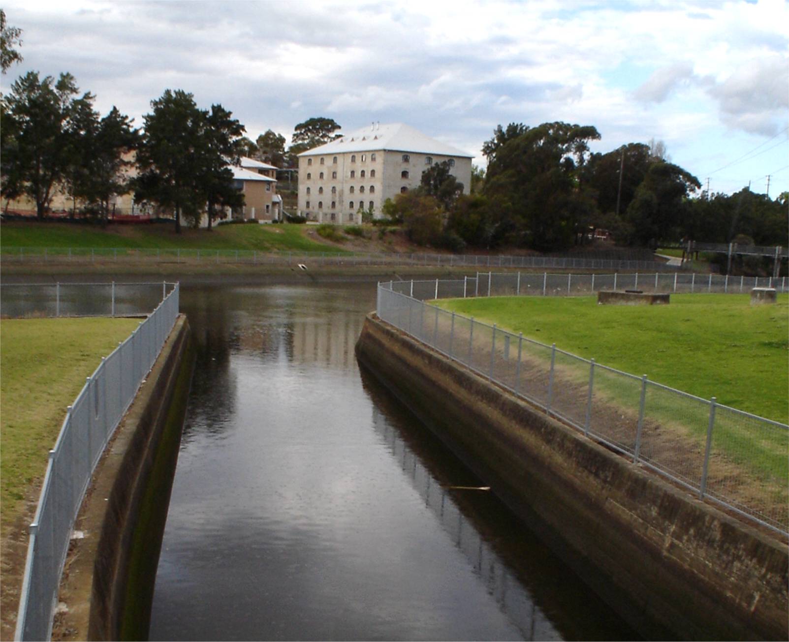
In the 1830s a dam was built across the river, however this did not provide a clean water supply and the structure itself began to damage the river's ecology by preventing tidal flushing of deposited urban silt. A second dam was built to serve a Sugar Mill at the new village of Canterbury Vale. The location took advantage of the water supply and barge transport. The Mill closed in 1855, however other polluting industries were later to follow including wool washes, tanneries and boiling down works. Despite the increasingly doubtful quality of the water, the river remained a popular place in the late nineteenth century for boating, picnics and swimming. By the 1880s tree clearing resulted in erosion, silting and expansion of reed beds, blocking river flow.
 Industrial areas along the Cooks River at Canterbury
On the weekend of 25–27 May 1889, 425 millimetres of rain inundated all the low lying land. At the height of the flood, the top of the Sugarworks Dam was covered by 2 metres of water. Authorities responded to the extensive damage and loss of animals by removing the dams and weirs. A proposed series of canals connecting the river with Sydney Harbour was not commenced. A sewage farm operated near the mouth of the river from 1889 to 1916. A railway was used in both the construction of mains and filtration buildings, as well as in the day to day operation, moving screened solids throughout the farm.[2]
Concreting of the river banks commenced in the 1930s and the Cooks River Improvement Act of 1946 confirmed the policy this tidying up of an undisciplined stream within neat cement boundaries. Engineers diverted the original river mouth to accommodate Sydney Airport runways.
Initiatives from 1976 onwards have attempted to preserve and return the natural features of the river system with tree planting, pollution traps and landscaping. Footpaths and a cycle track were built to increase recreational usage of the river. The NSW State Government has committed $2.9 million to the restoration of the sheet piling on the banks of the river.[3] In November 2007 the Federal Australian Labor Party, then in opposition, made an announcement of $2million for environmental projects on the Cooks River.[4]
See also
References
- ^ a b "Sydney river given 'open sewer' status". ABC Newcastle (Australian Broadcasting Corporation). 24 October 2011. http://www.abc.net.au/news/2011-10-24/sydney-river-given-open-sewer-status/3596832/?site=newcastle. Retrieved 24 October 2011.
- ^ The Botany - Rockdale Sewage Farm Railway Thorpe, N.J. Australian Railway Historical Society Bulletin, August, 1969 pp165-177
- ^ Cooks River Remediation - 07/06/2006 - PRIV - NSW Parliament
- ^ (18 November 2007). Labor to fund Sydney river if elected. Sydney Morning Herald. Fairfax Media.
- Hansard NSW legislative Assembly 7 June 2006 http://www.parliament.nsw.gov.au/prod/PARLMENT/hansArt.nsf/V3Key/LA20060607034
External links
Categories:- Rivers of New South Wales
- Cooks River
- Creeks and canals of Sydney


Wikimedia Foundation. 2010.