- Safita
Infobox Settlement
official_name = Safita
other_name =
native_name = صا فيتا
nickname =
settlement_type =
motto =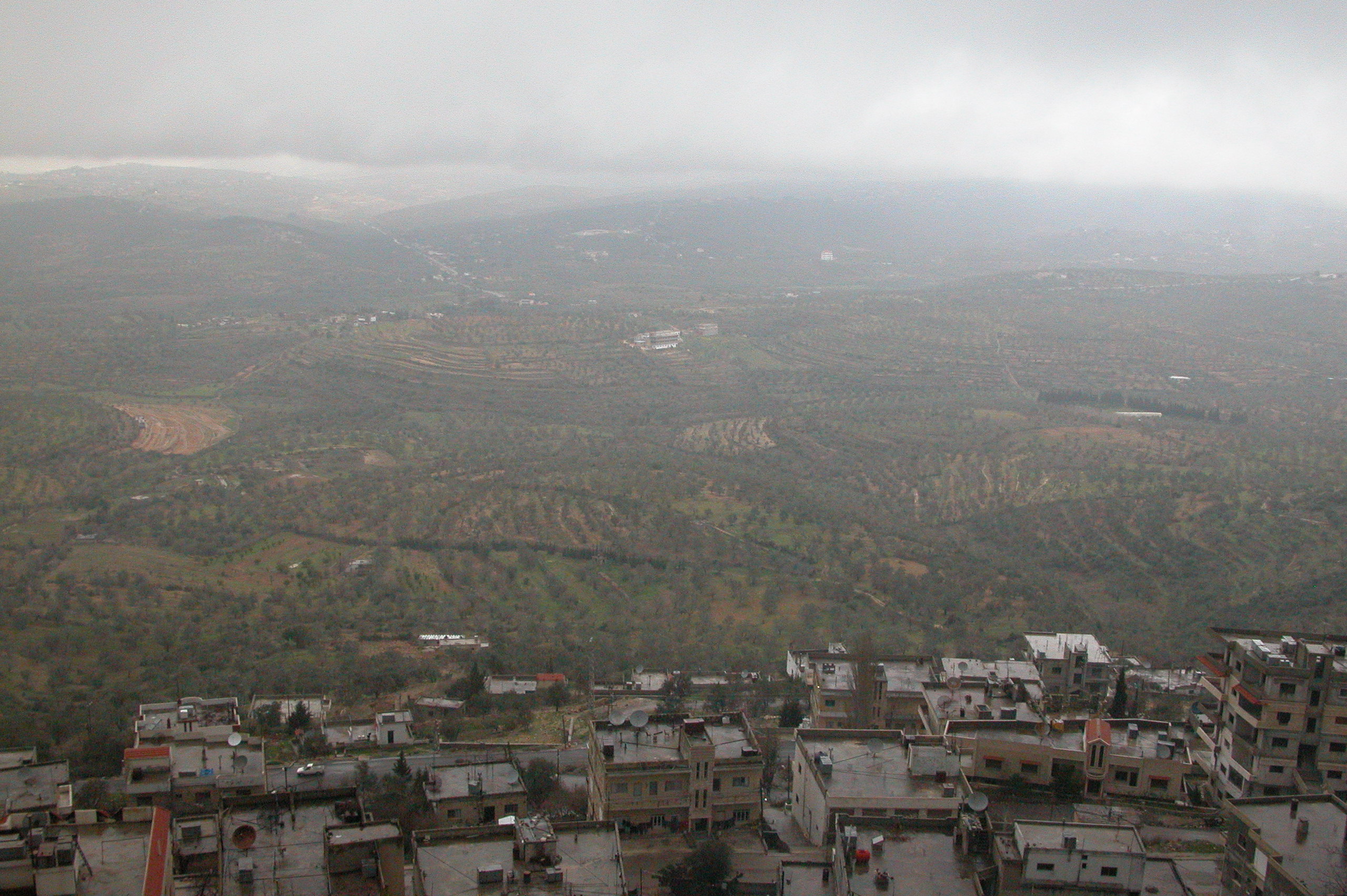
imagesize = 250px
image_caption = View of Safita from Chastel Blanc
flag_size =
image_
seal_size =
image_shield =
shield_size =
image_blank_emblem =
blank_emblem_type =
blank_emblem_size =
mapsize =
map_caption =
mapsize1 =
map_caption1 =
image_dot_
dot_mapsize =
dot_map_caption =
dot_x = |dot_y =
pushpin_
pushpin_label_position =bottom
pushpin_mapsize =250
pushpin_map_caption =Location in Syria
subdivision_type = Country
subdivision_name = Flag|Syria
subdivision_type1 = Governorate
subdivision_name1 =Tartous Governorate
subdivision_type2 = District
subdivision_name2 =Safita District
subdivision_type3 =
subdivision_name3 =
subdivision_type4 =
subdivision_name4 =
government_footnotes =
government_type =
leader_title =
leader_name =
leader_title1 =
leader_name1 =
leader_title2 =
leader_name2 =
leader_title3 =
leader_name3 =
leader_title4 =
leader_name4 =
established_title =
established_date =
established_title2 =
established_date2 =
established_title3 =
established_date3 =
area_magnitude =
unit_pref =Metric
area_footnotes =
area_total_km2 =
area_land_km2 =
area_water_km2 =
area_total_sq_mi =
area_land_sq_mi =
area_water_sq_mi =
area_water_percent =
area_urban_km2 =
area_urban_sq_mi =
area_metro_km2 =
area_metro_sq_mi =
area_blank1_title =
area_blank1_km2 =
area_blank1_sq_mi =
population_as_of =
population_footnotes =
population_note =
population_total =
population_density_km2 =
population_density_sq_mi =
population_metro =
population_density_metro_km2 =
population_density_metro_sq_mi =
population_urban =
population_density_urban_km2 =
population_density_urban_sq_mi =
population_blank1_title =Ethnicities
population_blank1 =
population_blank2_title =Religions
population_blank2 =
population_density_blank1_km2 =
population_density_blank1_sq_mi =
timezone =
utc_offset =
timezone_DST =
utc_offset_DST =
latd=34|latm=49|lats=|latNS=N
longd=36|longm=07|longs=|longEW=E
elevation_footnotes =
elevation_m =
elevation_ft =
postal_code_type =
postal_code =
area_code = 43|43
blank_name =
blank_info =
blank1_name =
blank1_info =
website =
footnotes =Safita ( _ar. صا فيتا, ArTranslit|Ṣāfītā) is a city in north-western
Syria , located to the southeast ofTartous and to the northwest ofKrak des Chevaliers . The city has a population of 33,000. It is located on the tops of 3 hills and the valleys in between them, in the coastal mountain ranges of Syria. It was important during thecrusade s, and was inhabited by the Knights Templar of the castle Chastel Blanc while part of theCounty of Tripoli .History
The city has been inhabited since the times of the
Phoenicians , and several archaeological discoveries have been made, including Phoenician and Canaanite settlements.In
1102 ,Raymond IV of Toulouse began to take the land of the Banu Ammars Emirs of Tripoli. A four-year siege on Tripoli resulted in full control of the city and many lands surrounding it, including Safita.Mamluk SultanBaibars captured the castle in1271 .Chastel Blanc
Chastel Blanc (called by natives, 'Burj Safita' which means Safita Tower) was built by the
Knights Templar during the Crusades upon prior fortifications. Constructed on the middle hill of Safita's three hills, it offers a commanding view of the surrounding countryside, and was a major part of the network of Crusader fortifications in the area. From the roof, one can see from theMediterranean Sea to the snow-covered mountains ofLebanon , andTripoli . From Chastel Blanc it would have been possible to see the Templar strongholds atTartus andRuad Island to the northwest,Chastel Rouge on the coastline to the southwest,Akkar to the south, andKrak des Chevaliers (the headquarters of the SyrianKnights Hospitallers ) to the southeast. The tower is the remaining keep of the original castle. It has a height of 28 meters, a width of 18 meters, and a length of 31 meters. A large bell is on the western wall, and its sound can be heard up to 5 kilometers from Safita. The castle had to be restored in 1170 and 1202 following damages due to earthquakes. The keep in its current shape probably dates from the reconstruction after 1202."]
From the other fortifications of the castle, only a portal at 45 meters to the East of the keep can still be seen today. During French colonialism, efforts were made to restore the tower, causing great discomfort to the villagers that lived very close to it.
ister cities
*
Marrickville ,Australia [ [http://www.marrickville.nsw.gov.au/MARRICKVILLE/TEMPLATE/RESOURCES/DOCUMENTS/BusinessPapers/Council/Council1105bpsup1.pdf Supplementary Business Paper for Council Meeting 11/05] . 13 December 2005. Marrickville City Council. Retrieved on 1 July 2007.]Notes
External links
* [http://www.safita1.com News website on Safita (in Arabic)]
* [http://www.safitaclub.com News website on Safita (in Arabic)]

Wikimedia Foundation. 2010.