Mashta Al-Helou

Mashta Al-Helou
Mashta Al Helou
مشتى الحلو
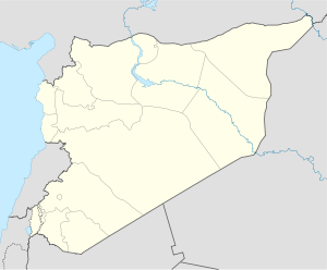
Mashta Al Helou is located in Syria
Mashta Al Helou
Location in Syria
Coordinates: 34°52′35.22″N 36°15′25.33″E / 34.87645°N 36.2570361°E / 34.87645; 36.2570361
Country  Syria
Governorate Tartus Governorate
District Safita District
Elevation 465 m (1,526 ft)

Mashta Al Helou (Arabic: مشتى الحلو‎, also known as Mashta Al Hulw or Mashta Al Helo) is a nice, picturesque village amid Helou Mountain. It is located in the region of Tartous Governorate and the Safita District. To be more specific is located in the Syrian coastal mountain range. It is approximately 233 km away from Damascus, 68 km from Homs and 45 km from Tartous.

Tourism

Mashta Al Helou is one of many tourist villages in the area and is ranked among the best tourist villages in Syria. In Mashta Al Helou there are many tourist services like restaurants, hotels, resorts and swimming-pools. It is distinguished by its mountainous climate, it being moderate during the summer and cold during the winter. It is known to snow in some winters. Tourists find Mashta Al Helou a summer escape from the heat and enjoy its fresh air. Like much of Syria, Mashta Al Helou is surrounded by glamorous, ancient monuments that are frequented by many. This lies as a testament to the country's rich architectural history.

External links

Coordinates: 34°52′N 36°15′E / 34.867°N 36.25°E / 34.867; 36.25


Wikimedia Foundation. 2010.

Игры ⚽ Поможем написать реферат

Look at other dictionaries:

  • Mashta Al Helou — Infobox Settlement official name = Mashta Al Helou other name = native name = مشتى الحلو nickname = settlement type = motto = imagesize = image caption = flag size = image seal size = image shield = shield size = image blank emblem = blank emblem …   Wikipedia

  • Mashta Al Helou — arabisch ‏مشتى الحلو‎, DMG Maštā l Ḥalū Mashta Al Helou …   Deutsch Wikipedia

  • Mashta al Hulw — Original name in latin Masht al ulw Name in other language Machta Heilou, Machta Helou, Machta Hlou, Mashta al Hulw, Masht al ulw, mshty alhlw State code SY Continent/City Asia/Damascus longitude 34.87517 latitude 36.25311 altitude 548 Population …   Cities with a population over 1000 database

  • Tartus — Infobox Settlement official name = Tartus other name = native name = طرطوس nickname = settlement type = motto = imagesize = 250px image caption = Hamrat Street flag size = image seal size = image shield = shield size = image blank emblem = blank… …   Wikipedia

  • Ash-Shaykh Badr — For the depopulated Palestinian village, see Sheikh Badr. Ash Shaykh Badr الشيخ بدر …   Wikipedia

  • Kafroun — (ar) الكفرون Administration …   Wikipédia en Français

  • Drekish — Duraykish دريكيش …   Wikipedia

  • Maten Al-Sahel — is a small village in Syria 280 km north west of Damascus, near the Mediterranean coast. Contents 1 Geography 1.1 Getting there 1.2 Prices 2 Demographics …   Wikipedia

  • Outline of Syria — The …   Wikipedia

Share the article and excerpts

Direct link
Do a right-click on the link above
and select “Copy Link”