- Chatswood, New South Wales
-
Chatswood
Sydney, New South Wales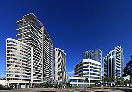
Pacific Highway, ChatswoodPopulation: 13,513(2006 census)[1] Established: 1876 Postcode: 2067 Area: 2.9 km² (1.1 sq mi) Location: 10 km (6 mi) north of Sydney CBD LGA: City of Willoughby State District: Willoughby Federal Division: North Sydney, Bradfield Suburbs around Chatswood: Roseville Castle Cove Middle Cove Chatswood West Chatswood North Willoughby Lane Cove Artarmon Willoughby Chatswood is a suburb on the North Shore of Sydney, in the state of New South Wales, Australia. Chatswood is located 10 kilometres north of the Sydney central business district and is the administrative centre of the local government area of the City of Willoughby. Chatswood West is a separate suburb. Chatswood has a predominantly Asian population.
Contents
History
Chatswood was named after Charlotte Hartnett, wife of then Mayor of Willoughby, Richard Hartnett (a pioneer of the district) and the original "wooded" nature of the area. The moniker derives from her nickname "Chattie" and was shortened from Chattie's Wood to Chatswood.
Residential settlement of Chatswood began in 1876 and grew with the installation of the North Shore railway line in 1890 and also increased with the opening of the Harbour Bridge in 1932.[2]
Economy
Chatswood is one of the North Shore’s major commercial and retail districts. The Australian headquarters of Vodafone, CSR Limited and Carter Holt Harvey[3] as well as offices of Nortel Networks, Optus, Smith's Snackfood, IBM, NEC, Leighton Holdings and Cisco Systems are located in Chatswood. A number of high-density residential towers are also located in Chatswood.

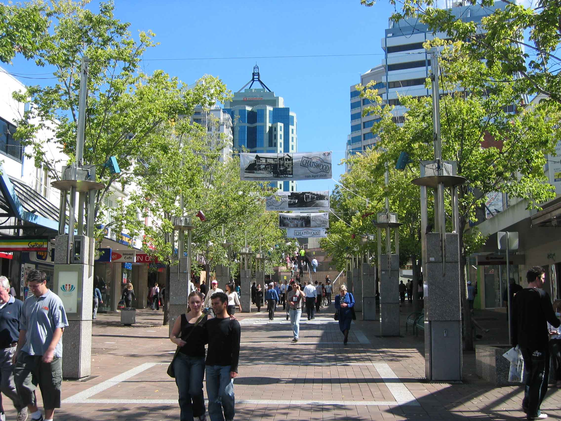
Chatswood has two major shopping centres, Chatswood Chase and Westfield Chatswood. There are also a few smaller shopping centres such as 'Lemon Grove' on the pedestrian mall and the 'Mandarin Centre' [4] beside Westfield on the corner of Albert Avenue and Victor Street. 'Metro Chatswood' [5] is a new shopping centre currently under construction above the Chatswood railway and bus interchange featuring retail, high rise office and apartment towers. The 'Interchange' was a small shopping centre and bus interchange built in the late 1980s which provided pedestrian access between the two halves of Victoria Avenue but was demolished to accommodate the construction of the Epping to Chatswood railway line and subsequently 'Metro Chatswood'.
 Chatswood skyline
'Chatswood Chase', completed in 1983, features a David Jones store, K Mart, Coles and 120 specialty stores, focusing on designer-label brands. 'Westfield Chatswood', owned and managed by The Westfield Group, originally opened on January 30, 1986 and was redeveloped in the late 1990s to incorporate a previously free-standing Grace Bros store.[6] It now features a Myer department store, Target, Coles supermarket, Toys 'R' Us, JB Hi-Fi, Rebel Sport, Hoyts cinema complex, and 300 speciality stores. There is also a second Hoyts cinema complex in the 'Mandarin Centre'.
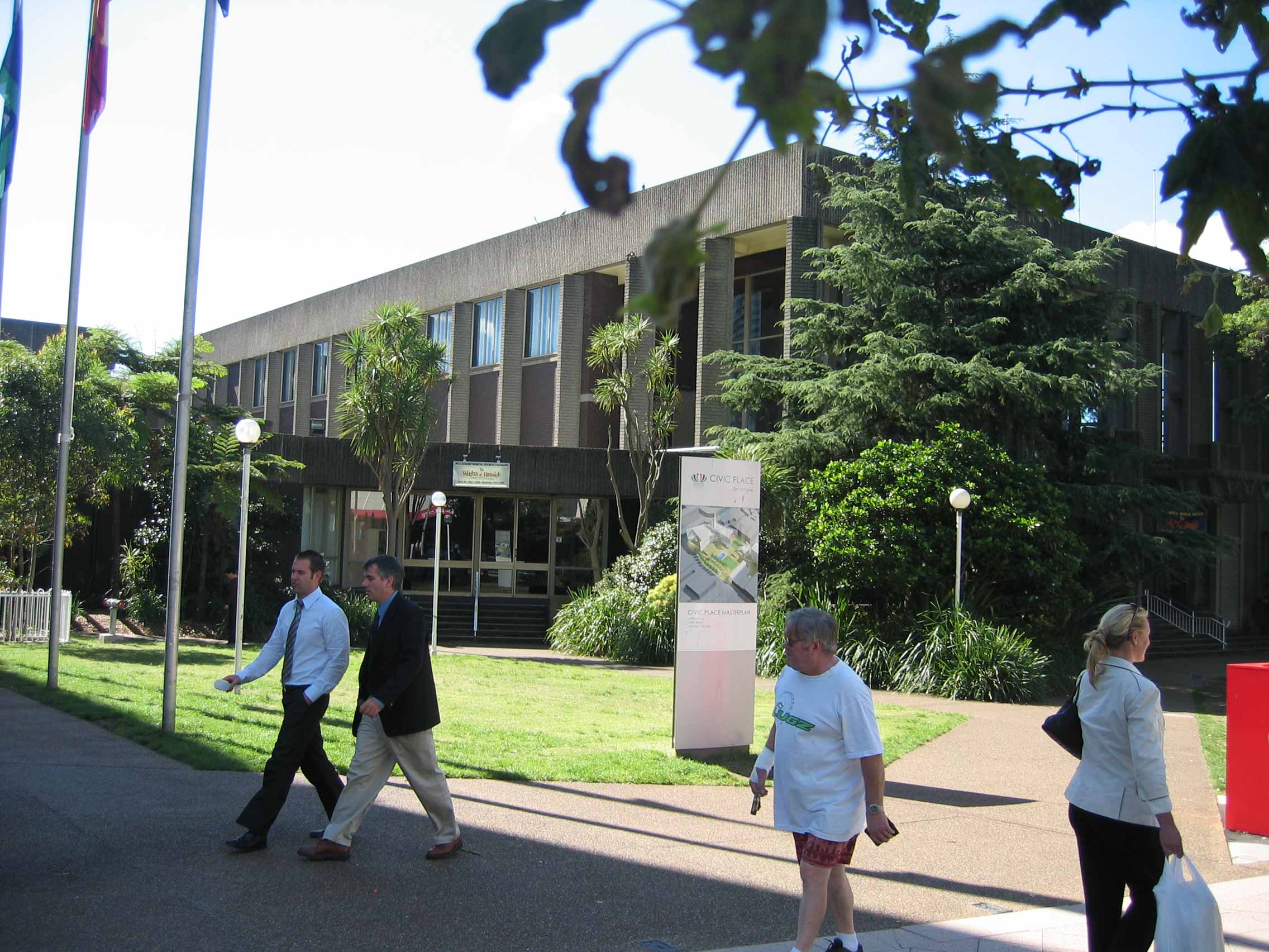
The Melody Markets are held each Thursday and Friday in Chatswood Mall, Victoria Avenue and feature food and craft stalls, and live music. 'Civic Place' which includes the administrative offices of the City of Willoughby will be redeveloped to provide retail, hotel, office space and arts facilities.[7]
There are a number of Chinese (including Cantonese), Vietnamese and Greek restaurants and eateries.[8] There are two hotels in Chatswood: The Mantra, near Chatswood railway station and The Sebel, near Westfield shopping centre. The Chatswood Club, located on Help Street adjacent to Pacific Highway, is a venue hall which caters to weddings, birthdays, cocktail parties, and other age-appropriate festivities.
Transport
Chatswood railway station is on the North Shore Line and the Northern Line of the CityRail network. Rail services run south to the Sydney CBD and continue west to Strathfield and beyond. Rail services run north to Hornsby and peak hour services run to Gosford, Wyong and Newcastle. The Epping to Chatswood railway line, opened in 2009, connects Chatswood to Epping.
Chatswood is a major bus terminus with services to Bondi Junction, Sydney, North Sydney, Mosman, Balmoral Beach, Manly, Warringah Mall/Brookvale, UTS Ku-ring-gai, Belrose, Narrabeen, Mona Vale, Eastwood, Gladesville, West Ryde, North Ryde, Macquarie University, Macquarie Park, Parramatta and Dundas. An interstate bus service between Sydney and Brisbane via the North Coast stops at Chatswood. Major roads through Chatswood include the Pacific Highway, Mowbray Road, Boundary Street, Willoughby Road and Eastern Valley Way and Victoria Avenue.The latter forms a pedestrian mall for the section running through the main retail area.
Climate
Climate data for Chatswood Month Jan Feb Mar Apr May Jun Jul Aug Sep Oct Nov Dec Year Average high °C (°F) 26.5
(79.7)26.4
(79.5)25.2
(77.4)22.7
(72.9)19.6
(67.3)17.2
(63.0)16.7
(62.1)18.3
(64.9)20.7
(69.3)22.7
(72.9)24.2
(75.6)25.7
(78.3)22.2 Average low °C (°F) 17.5
(63.5)17.7
(63.9)16.1
(61.0)12.9
(55.2)9.9
(49.8)7.7
(45.9)6.4
(43.5)7.1
(44.8)9.3
(48.7)12.0
(53.6)14.1
(57.4)16.3
(61.3)12.3 Precipitation mm (inches) 105.7
(4.161)109.9
(4.327)126.6
(4.984)107.7
(4.24)106.2
(4.181)116.3
(4.579)85.2
(3.354)72.3
(2.846)62.6
(2.465)76.0
(2.992)78.7
(3.098)83.3
(3.28)1,131.6
(44.551)Source: [9] Schools
Chatswood is home to private and public, primary and secondary schools. These include:
- St Pius X College (years 5–12, Catholic boys school)
- Mercy Catholic College (years 7–12, Catholic girls school)
- Our Lady of Dolours (years K–6, Catholic primary school)
- Chatswood Public School (years K–6)
- Chatswood High (years 7–12).
- Mowbray House School operated in Chatswood from 1906 until its closure in 1954.
Parks
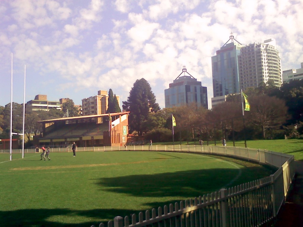
Chatswood Oval is located south of the railway station. Beauchamp Park, located on Beauchamp Avenue, features a playground, an oval, a fenced dog area and a bike track. It was named after William Lygon, 7th Earl Beauchamp, the Governor of New South Wales. Chatswood is close to Lane Cove National Park.
Demographics
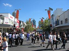 Victoria Ave and Archer St, view towards Chatswood Station
In the 2006 Australian census, the total population of Chatswood was 13,513 people; 6,256 (46%) were male and 7,257 (54%) were female. The number of residents born in Australia was 4,690. Of those born overseas, the most common countries were China (excluding Hong Kong, Macau, and Taiwan) (1,465), Hong Kong (1,032), South Korea (991), the United Kingdom (404), and Japan (346). Based on country of birth of parents, the most common ancestry groups were Chinese (4,179), Australian (2,143), English (2,019), Irish (765), Scottish (572), and Italian (371). 1,474 people did not state their ancestry. 5,315 people speak English only and 6,927 can speak other languages, the most common being the Chinese languages (3,749), Korean (1,020), and Japanese (390). The largest religious affiliation was Christianity (6,605); the most common included Catholicism (3,054), Anglicanism (1,410), and Presbyterianism and Reformed (599). 3,326 people were categorised as no religion and 1,863 people did not state their affiliation.[1]
Culture
Willoughby Spring Festival
The Willoughby Spring Festival is an annual event in Chatswood. The festival is the second-largest in Lower Northern Sydney and is intended as testimony to a modern, multicultural and prosperous Chatswood. For more information visit Spring Festival.
Gallery
-

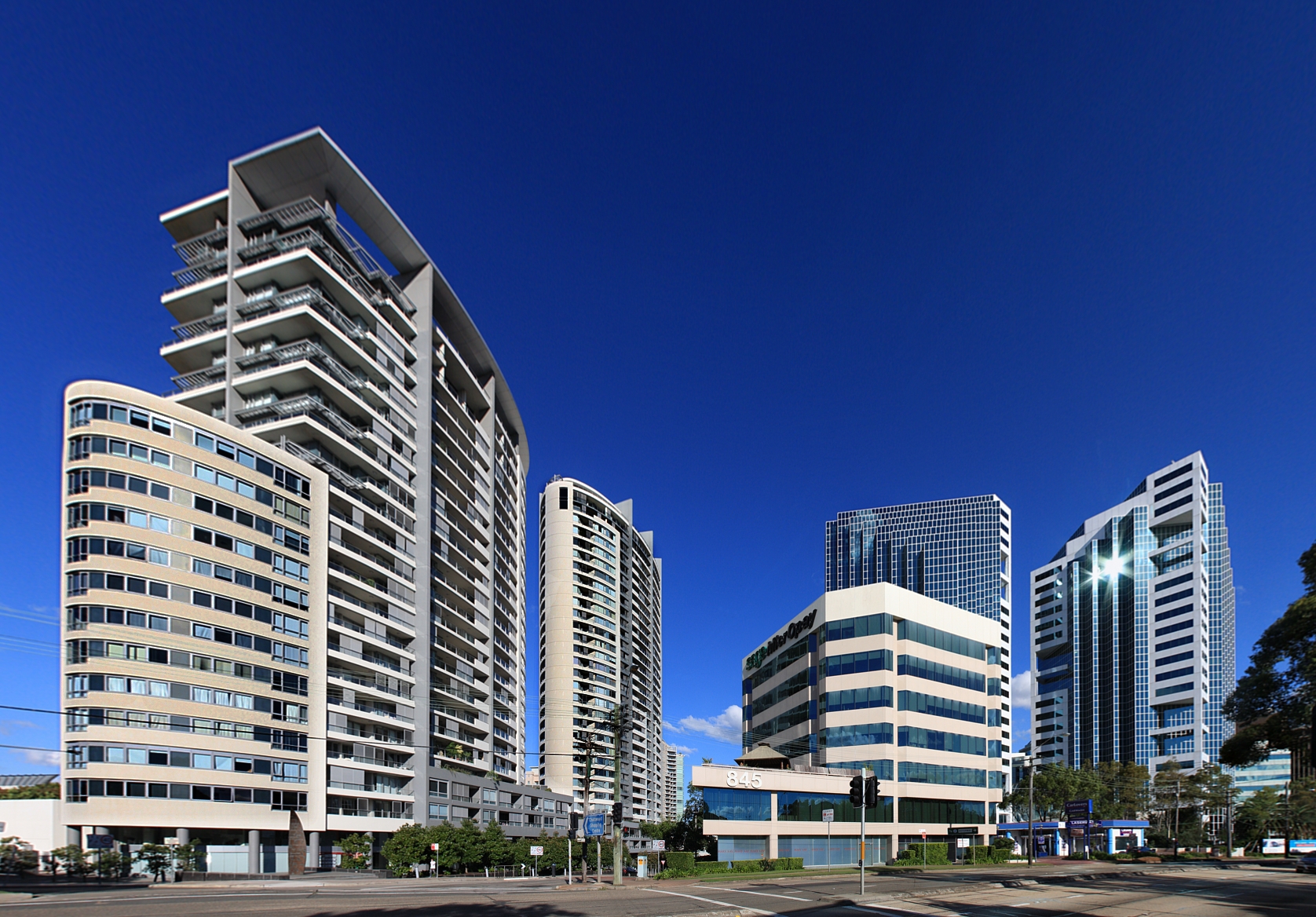
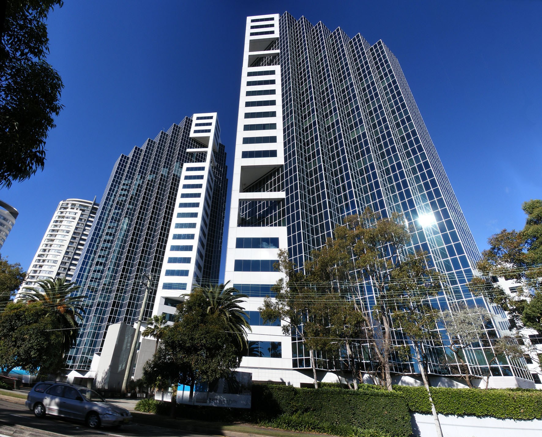
Apartments and commercial buildings on the Pacific Highway
-
Chatswood Civic Place (now demolished)
-
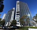
Zenith building Pacific Highway, Chatswood
-
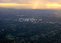
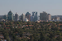
Looking over Chatswood and the surrounding area
-
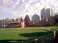
Chatswood Oval and the Trumper Pavillion
References
- ^ a b "2006 Census Community Profile Series : Chatswood (State Suburb)". Australian Bureau of Statistics. Accessed 15 May 2010.
- ^ http://www.willoughby.nsw.gov.au/ Willoughby City Council
- ^ "Contact." Carter Holt Harvey. Retrieved on January 28, 2009.
- ^ The Mandarin Centre is located in Chatswood
- ^ Metro Chatswood Shopping Centre and Office Space For Lease in Sydney - Home
- ^ Westfield - Chatswood
- ^ Welcome to Willoughby City Council - 2007 Media Releases
- ^ Menulog lists 43 restaurants (Sep 2008)
- ^ "Weatherzone". http://www.weatherzone.com.au/climate/station.jsp?lt=site&lc=66131.
External links
- Willoughby City Council
- Chatswood/Roseville - community profile
- Chatswood West/Lane Cove North - community profile
- Chatswood Directory - Business and services directory
Coordinates: 33°48′03″S 151°10′47″E / 33.80077°S 151.17960°E
Suburbs of City of Willoughby · North Shore · Sydney Artarmon · Castlecrag · Castle Cove · Chatswood · Gore Hill · Middle Cove · Naremburn · Northbridge · Roseville · St Leonards · WilloughbyList of Sydney suburbs Categories:- Suburbs of Sydney
- Central business districts in Australia


Wikimedia Foundation. 2010.