- Gosford, New South Wales
Infobox Australian Place | type = city
name = Gosford
state = nsw
caption =
pop = 301,551fact|date=August 2008 (2006)
poprank =
density = 165
est =
area = 1028
timezone = AEST
utc = +10
timezone-dst = AEST
utc-dst = +11
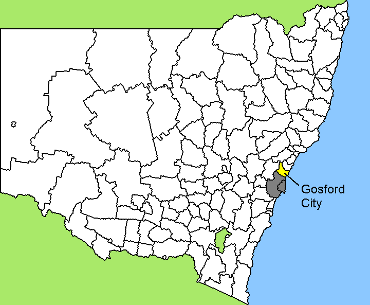
lga = City of Gosford
stategov = Gosford
elevation= 10
fedgov = Robertson
dist1 = 76
elevation= 20
maxtemp = 23.0
mintemp = 11.0
rainfall = 1306.0
location1 = Sydney
elevation= 10Gosford is a city located on the Central Coast of
New South Wales ,Australia , approximately 80km north of theSydney central business district . The city is situated at the northern extremity ofBrisbane Water , an extensive northern branch of theHawkesbury River estuary andBroken Bay . The city is the administrative centre of the Central Coast region, which is the third largest urban area in New South Wales after Sydney and Newcastle. Gosford is the 18th largestlocal government area in Australia with a total resident population of 158,157.History
Until European settlement, the area around Gosford was occupied by two groups of
Australian Aborigine s, theGuringai and Darkinjung peoples, with the Guringai being principally coastal-dwellers and the Darkingung occupying land to the west. Fact|date=June 2008Along with the other land around the Hawkesbury River estuary, the
Brisbane Water district was explored during the early stages of the settlement of Sydney. In the early 1800s some pioneering European settlers began occupying the land, for timber-cutting (mainlyironbark and Australian red cedar), lime production andgrazing . Fact|date=June 2008Gosford itself was explored by
Governor Phillip between 1788 and 1789. The area was of difficult access and settlement did not start before 1823. By the late 1800s the agriculture in the region was diversifying, withmarket garden s and citrus orchards occupying the rich soil left after the timber harvest. The first road between Hawkesbury, (near Pittwater) to Brisbane Water was only a cart wheel track even in 1850. [ [http://www.gosford-p.schools.nsw.edu.au/about/gosfordhistory.htm History of Gosford ] ]Convicts once lived and worked in the Gosford area. In 1825, Gosford's population reached 100, of which 50% were convicts.East Gosford was the first centre of settlement. Gosford was named in 1839 after
Archibald Acheson, 2nd Earl of Gosford - a friend of the then GovernorGeorge Gipps . Fact|date=March 2008In 1887, the rail link to Sydney was completed, requiring a bridge over the Hawkesbury River and a tunnel through the sandstone ridge west of Woy Woy. The introduction of this transport link, and then the Pacific Highway in 1930 accelerated the development of the region.
Gosford became a town in 1885 and was declared a municipality in 1886. [ [http://www.centralcoastaustralia.com.au/AreaInfo/towns_Gosford.asp Gosford - Central Coast Australia ] ]
City centre
Gosford proper is located in a valley with President's Hill on the city's western border and Rumbalara Reserve on its eastern border, and Brisbane water to the city's south. Mann Street, Gosford's main street and part of the Pacific Highway, runs north-south contains the frontage for much of its commercial district. The
Central Coast Highway runs past Gosford's waterfront area, while its predecessor the Pacific Highway takes on several names through the CBD itself. Mann Street contains the main public transport links for Gosford, with Gosford railway station (CityRail andCountryLink ) and the termini for several bus routes.In the centre of Gosford is a shopping and community precinct, including Kibble Park, William Street Mall, Gosford City Library, the Imperial Shopping Centre, the Gosford Town Shopping Centre and a full range of shops, cafes, banks and services, especially along William Street Mall.
More recently, the Gosford CBD has suffered a decline as more commercial activity has relocated to nearby
Erina , particularlyErina Fair .Fact|date=March 2008 To address this, there have been proposals to revitalise the city centre by more adequately connecting it to the waterfront, and provide more employment and entertainment areas. Fact|date=March 2008However, there has been little concerted effort at State or Local Government level. POV-statement|date=March 2008Facilities
Gosford is also home to
*Gosford Hospital - the largest hospital on the Central Coast
*Gosford High School - the only selective high school on the Central Coast
* The Central Coast Conservatorium (in the original Gosford Courthouse)
* TheBluetongue Central Coast Stadium in Grahame Park, adjacent to theCentral Coast Leagues Club . Originally built for the short-livedNorthern Eagles team in the NRLrugby league competition, since 2005 it is now the home of the Central Coast MarinersA-League football (soccer) team and was the home venue of theCentral Coast Rays rugby unionAustralian Rugby Championship team
* Gosford Racecourse
* Gosford showground
* The headquarters of the NSW State Government's workers compensation fund, WorkCover.ister cities and twin towns
* Edogawa,
Japan
*Nitra ,Slovakia See also
*
List of cities in Australia
*Electoral district of Gosford , a seat in theNew South Wales Legislative Assembly References
External links
* [http://www.kincumber.com/ Kincumber Business and Community website]
* [http://www.avocabeach.com/ Avoca Beach Business and Community website]
* [http://www.wyong.com/ Wyong Business and Community website]
* [http://www.cityofgosford.com/ Central Coast NSW Business and Community website]
Wikimedia Foundation. 2010.