Willoughby Parish, Cumberland
- Willoughby Parish, Cumberland
Infobox Australian cadastral
name = Willoughby
state = New South Wales
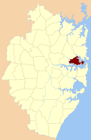
imagesize = 180
caption = Location of the parish within Cumberland
lga = Municipality of Mosman
county = Cumberland
former hundred = Packenham
est = 1835
near-nw = Gordon
near-n = Gordon
near-ne = Manly Cove
near-e = Pacific Ocean
near-se = Alexandria
near-s = Petersham
near-sw = Concord
near-w = Hunters Hill
Willoughby Parish, Cumberland is one of the 57 parishes of Cumberland County, New South Wales, a cadastral unit for use on land titles. The suburb of Willoughby and the City of Willoughby LGA are in a similar area.
References
* [http://www.gnb.nsw.gov.au/name_search/extract?id=SXYbvqWAJP Geographic Names Board of New South Wales]
Wikimedia Foundation.
2010.
Look at other dictionaries:
Concord Parish, Cumberland — Concord New South Wales Location of the parish within Cumberland Established: 1835 Hundred (for … Wikipedia
Alexandria Parish, Cumberland — Infobox Australian cadastral name = Alexandria state = New South Wales imagesize = 180 caption = Location of the parish within Cumberland lga = Woollahra, Waverley county = Cumberland former hundred = Sydney est = 1835 near nw = St. Lawrence near … Wikipedia
Petersham Parish, Cumberland — Infobox Australian cadastral name = Petersham state = New South Wales imagesize = 180 caption = Location of the parish within Cumberland lga = Municipality of Leichhardt county = Cumberland former hundred = Sydney est = 1835 near nw = Hunters… … Wikipedia
St. Philip Parish, Cumberland — Infobox Australian cadastral name = St. Philip state = New South Wales imagesize = 180px caption = Location in Sydney city highlighted in blue lga = City of Sydney county = Cumberland former hundred = Sydney est = 1835 near nw = Willoughby near n … Wikipedia
St. James Parish, Cumberland — Infobox Australian cadastral name = St. James state = New South Wales imagesize = 180px caption = Location in Sydney city highlighted in green lga = City of Sydney county = Cumberland former hundred = Sydney est = 1835 near nw = St. Philip near n … Wikipedia
Hunters Hill Parish, Cumberland — Infobox Australian cadastral name = Hunters Hill state = New South Wales imagesize = 180 caption = Location of the parish within Cumberland lga = City of Ryde county = Cumberland former hundred = Parramatta est = 1835 near nw = South Colah near n … Wikipedia
Cumberland County, New South Wales — Map of all coordinates from Google Map of all coordinates from Bing Export all coordinates as KML … Wikipedia
List of abbeys and priories in England — Contents 1 Overview 1.1 Article layout 2 Abbreviations and key … Wikipedia
Hampton Roads — Coordinates: 36°58′N 76°22′W / 36.967°N 76.367°W / 36.967; 76.367 … Wikipedia
Lower North Shore (Sydney) — The Lower North Shore is an informal term for the lower northern suburbs of Sydney, in the state of New South Wales, Australia which are located on the north shore of Sydney Harbour. The area includes suburbs in the local government areas of… … Wikipedia