Hunters Hill Parish, Cumberland
- Hunters Hill Parish, Cumberland
Infobox Australian cadastral
name = Hunters Hill
state = New South Wales
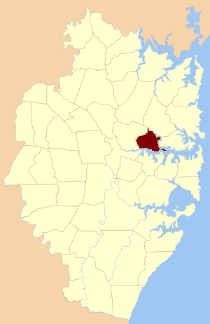
imagesize = 180
caption = Location of the parish within Cumberland
lga = City of Ryde
county = Cumberland
former hundred = Parramatta
est = 1835
near-nw = South Colah
near-n = Gordon
near-ne = Gordon
near-e = Willoughby
near-se = Petersham
near-s = Concord
near-sw = St. John
near-w = Field of Mars
Hunters Hill Parish, Cumberland is one of the 57 parishes of Cumberland County, New South Wales, a cadastral unit for use on land titles. The suburb of Hunters Hill, and the Municipality of Hunter's Hill are in the same area.
References
* [http://www.gnb.nsw.gov.au/name_search/extract?id=MackoerXTR Geographic Names Board of New South Wales]
Wikimedia Foundation.
2010.
Look at other dictionaries:
St. John Parish, Cumberland — Infobox Australian cadastral name = St. John state = New South Wales imagesize = 180 caption = Location of the parish within Cumberland lga = City of Parramatta county = Cumberland former hundred = Parramatta est = 1835 near nw = Castle Hill near … Wikipedia
Field of Mars Parish, Cumberland — Infobox Australian cadastral name = Field of Mars state = New South Wales imagesize = 180 caption = Location of the parish within Cumberland lga = City of Parramatta county = Cumberland former hundred = Parramatta est = 1835 near nw = Castle Hill … Wikipedia
Concord Parish, Cumberland — Concord New South Wales Location of the parish within Cumberland Established: 1835 Hundred (for … Wikipedia
Willoughby Parish, Cumberland — Infobox Australian cadastral name = Willoughby state = New South Wales imagesize = 180 caption = Location of the parish within Cumberland lga = Municipality of Mosman county = Cumberland former hundred = Packenham est = 1835 near nw = Gordon near … Wikipedia
Petersham Parish, Cumberland — Infobox Australian cadastral name = Petersham state = New South Wales imagesize = 180 caption = Location of the parish within Cumberland lga = Municipality of Leichhardt county = Cumberland former hundred = Sydney est = 1835 near nw = Hunters… … Wikipedia
Cumberland County, New South Wales — Map of all coordinates from Google Map of all coordinates from Bing Export all coordinates as KML … Wikipedia
Lower North Shore (Sydney) — The Lower North Shore is an informal term for the lower northern suburbs of Sydney, in the state of New South Wales, Australia which are located on the north shore of Sydney Harbour. The area includes suburbs in the local government areas of… … Wikipedia
North Shore (Sydney) — North Shore New South Wales Chatswood Population: 207,241 ( … Wikipedia
United Kingdom — a kingdom in NW Europe, consisting of Great Britain and Northern Ireland: formerly comprising Great Britain and Ireland 1801 1922. 58,610,182; 94,242 sq. mi. (244,100 sq. km). Cap.: London. Abbr.: U.K. Official name, United Kingdom of Great… … Universalium
Philip Sheridan — Philip Henry Sheridan … Wikipedia