- Morisset, New South Wales
-
"Morisset" redirects here. For other uses, see Morisset (disambiguation).
Morisset
Lake Macquarie, New South Wales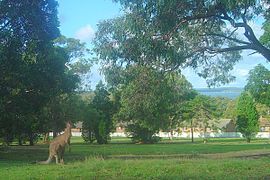
View from Morisset HospitalPopulation: 3,108 (2006 census) Established: 1887 Postcode: 2264 Coordinates: 33°06′54″S 151°30′04″E / 33.115°S 151.501°ECoordinates: 33°06′54″S 151°30′04″E / 33.115°S 151.501°E Area: 3.7 km² (1.4 sq mi) Location: - 27 km (17 mi) NNE of Wyong
- 111 km (69 mi) NNE of Sydney
- 45 km (28 mi) SW of Newcastle, New South Wales
LGA: City of Lake Macquarie Parish: Morisset State District: Lake Macquarie Federal Division: Charlton Suburbs around Morisset: Cooranbong Dora Creek Lake Macquarie Mandalong Morisset Bonnells Bay Wyee Wyee Point Lake Macquarie Morisset is a commercial centre and suburb of the City of Lake Macquarie in New South Wales, Australia, and is located west of Lake Macquarie just off the Sydney-Newcastle Freeway.
Contents
History
The town is named for Major James Thomas Morisset, who camped there in 1823 while making the first overland journey from Sydney to Newcastle. Historically there has been considerable confusion over the spelling of the suburb: Morissett, Morriset, Morrissett and Morrisset have been used.[citation needed]
The earliest settlement in the area was at Cooranbong in 1826, about 5 kilometres (3.1 mi) west of the current town and near the foot of the Watagan Mountains.[citation needed] Initially, various kinds of agriculture were conducted, and before long forestry became an important industry. Most of the transport to the area at the time was by river boat on Dora Creek meaning that Cooranbong was the most accessible part of town. The town of Morisset itself was essentially non-existent until 1887, when the Sydney-Newcastle railway was built. Morisset sprang up as a sawmill town clustered around the train station, and the township was proclaimed on 3 December.[citation needed]
In 1908, a psychiatric hospital opened on a large estate along the lake shore. At its height in the 1960s, Morisset Mental Hospital had 1,600 patients. The Hospital continues to dominate Morisset's reputation, although it is now only a 130 bed hospital.[1]
In more recent times, the Morisset Peninsula to the east of the town has become the main residential area. It has experienced a high rate of growth since the construction of Eraring Power Station in 1986. Most of Bonnells Bay is now what long-time residents quaintly refer to as "high-density housing", although by city standards it is decidedly low-density. Several retirement villages have been built, most of them only in the last decade. Subdivision of larger blocks has come close to saturation in many suburbs, with only a few hobby-farms still remaining, although the majority of the Morisset district and peninsula remain bushland and National Park and Aboriginal reserves.[citation needed]
Education
Morisset contains a state primary school, a state high school and a Catholic school. Morisset Public School opened in 1891 and started accommodating high school classes in 1951. These classes transferred to a new high school campus, Morisset High School, at the start of the 1965 school year, with the public school returning to purely primary education.[citation needed]
A Catholic primary school, St John Vianney School, opened on 17 January 1962, and was initially administered by the Sisters of St Joseph until becoming part of the Roman Catholic Diocese of Maitland-Newcastle in 1966.[2]
Transport
Morisset railway station, located on Dora Street, is linked to Sydney and Newcastle by CityRail services on the Newcastle and Central Coast Line, and to Maitland and towns further north by CountryLink services on the Main North Line.
The train station serves as a terminus for bus services 278 and 279 covering the Morisset Peninsula towns and 280 to Cooranbong. These services are operated by Hunter Valley Buses, which acquired the previous provider Toronto Bus. In July 2009, Rover Coaches commenced a new weekday service, Route 163, to Cessnock and Kurri Kurri.[3][4]
Further reading
- Iron Horse and Iron Bark: A history of Morisset and district, Beryl Mullard, ISBN 0-9579322-0-0
- A Private World on a Nameless Bay - a history of Morisset Hospital, Morisset Hospital Historical Society, ISBN 0-646-39273-5
References
- ^ "Morisset Hospital". Hunter New England Area Health Service. http://www.hnehealth.nsw.gov.au/services_and_facilities/morisset_hospital. Retrieved 12 April 2010.
- ^ St John Vianney School (2008). "St John Vianney, Morisset - History". http://morisset.catholic.edu.au/history.htm. Retrieved 10 November 2009.
- ^ "Route 163 timetable". 6 July 2009. http://www.rovercoaches.com.au/ttables/tt163.pdf.
- ^ "Govt permits Cessnock-Morisset bus service". ABC Online. 21 January 2009. http://www.abc.net.au/news/stories/2009/01/21/2470974.htm. Retrieved 10 November 2009.
External links
- History of Morisset - Excerpt from Lake Macquarie: Past and Present
- Morisset Hospital Historical Society
Categories:- Suburbs of Lake Macquarie

Wikimedia Foundation. 2010.