- Mandurah
-
This article is about the city of Mandurah. For the local government area, see City of Mandurah. For the Northern Territory locality, see Mandorah, Northern Territory.
Mandurah
Western Australia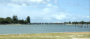
Peel Inlet and Old Mandurah Bridge
 Mandurah
Population: 85,814(2010)[1] (21st) • Density: 636.1/km² (1,647.5/sq mi) Postcode: 6210 Area: 106.6 km² (41.2 sq mi) Time zone: AWST (UTC+8) Location: - 72 km (45 mi) SSW of Perth
- 108 km (67 mi) N of Bunbury
- 18 km (11 mi) NW of Pinjarra
- 18 km (11 mi) S of Rockingham
LGA: State District: Mandurah, Murray-Wellington, Dawesville Federal Division: Brand, Canning Coordinates: 32°31′44″S 115°43′23″E / 32.529°S 115.723°E
Mandurah (
 /ˈmændʒʉrɑː/, /ˈmændʒrə/ or /ˈmændʉrə/) is the second-largest city in Western Australia and is located approximately 72 kilometres (45 mi) south of the state capital, Perth.
The city attracts a large number of tourists, including many international visitors.[citation needed] The city centre foreshore is home to a variety of wildlife including dolphins, pelicans, shags, and an abundance of marine life including the blue manna crab which has become synonymous with the area. The city is also known for its protected waterways, beaches and boating and fishing activities.[citation needed]
Contents
Geography
Mandurah has grown from isolated holiday communities along the shores of the Peel-Harvey Estuary to a major regional city in just over a decade, in a similar vein to the Gold Coast in Eastern Australia, in recent times forming a conurbation with nearby Rockingham and the capital Perth along the coast.
Mandurah has also become a popular lifestyle alternative for Perth retirees and its connection with the Perth CBD has been strengthened with the opening of the Perth-Mandurah railway line in December 2007 and a direct road connection to the Kwinana Freeway built by late 2010. A housing affordability survey of 227 cities in 2008 ranked it the least affordable city in Australia.[2]
Geology
The waters of the Peel Inlet and Harvey Estuary (one of Australia's larger inlet systems) form the centre of Mandurah. The estuary is approximately twice the size of Sydney Harbour. The city lies in and around this freshwater system which in turn feeds into the Indian Ocean. The city and its suburbs have many kilometres of ocean coastline most of which is sandy beaches. Mandurah also has a number of suburbs built around artificially created canal systems that extend from the Peel Inlet, such as Halls Head, Dudley Park and Wannanup.
In terms of geology, much of Mandurah lies on the dune systems which dominate South Western WA's coastline, progressively grading towards the Swan Coastal Plain as one travels inland. The area has infertile soils due to the dunes being rather sandy, having poor water retention qualities. Limestone outcrops are found to the north of the city especially along the Mandurah Line. Mandurah is the closest city to Yalgorup National Park which is home to modern thrombolites as well as an array of flora and fauna.
Political
Most of the city is governed by the City of Mandurah, although a couple of suburbs east of the Serpentine River are governed by the Shire of Murray.
Mandurah is typically considered a marginal area for both major parties at both state and federal politics. Northern Mandurah lies in the safe Labor seat of Brand, held by Gary Gray, while southern and central Mandurah lies in the more marginal Canning, held by the Liberal Party's Don Randall. State politics also highlight a significant divide, with northern Mandurah located in the safe Labor seat of Mandurah held by David Templeman, while southern Mandurah located in the safe Liberal seat of Dawesville, held by Deputy Premier Kim Hames.
Climate
Sharing a similar climate to Perth, Mandurah has a typical Mediterranean climate (Köppen classification Csa) with warm summers and cool winters. During summer (December to February), the average maximum temperature is 27 °C (80 °F) with an average minimum temperature of 19 °C (66 °F). At its extreme it can get very hot, often having a couple of days exceed 40 °C (104 °F) in the later half of summer. In winter (June to August), the average maximum temperature is 15 °C (59 °F) with an average minimum temperature of 9 °C (48 °F). Mandurah's proximity to the ocean moderates diurnal temperatures somewhat, with temperatures a few kilometres inland often 4 or 5 degrees warmer during summer days (or cooler during winter nights). Frosts are very rare as a result, but do occur annually around suburbs such as Greenfields. The current weather station opened in 2001 and is situated right on the coastline, causing data recorded to appear warmer during winter nights and cooler in summer days compared to surrounding areas.
Mandurah also receives a moderate though highly seasonal rainfall of about 850mm a year, however recent trends have seen this once reliable rainfall drop significantly. In addition, most of the winter rains are usually accompanied by severe winds and storms capable of causing widespread damage, making Mandurah one of the windiest cities in Australia. These conditions are perfect for tornado formation, which Mandurah's climate is remarkable for producing one of the highest densities of tornadoes in the world [1].
Climate data for Mandurah, Western Australia Month Jan Feb Mar Apr May Jun Jul Aug Sep Oct Nov Dec Year Record high °C (°F) 41.0
(105.8)39.5
(103.1)37.8
(100.0)32.9
(91.2)28.8
(83.8)25.6
(78.1)22.2
(72.0)21.4
(70.5)25.6
(78.1)32.4
(90.3)37.7
(99.9)39.6
(103.3)41.0
(105.8)Average high °C (°F) 29.3
(84.7)29.6
(85.3)27.6
(81.7)24.4
(75.9)20.6
(69.1)18.1
(64.6)17.3
(63.1)17.7
(63.9)19.2
(66.6)21.2
(70.2)24.4
(75.9)27.0
(80.6)23.0 Average low °C (°F) 17.2
(63.0)17.1
(62.8)15.8
(60.4)13.9
(57.0)11.2
(52.2)9.7
(49.5)9.0
(48.2)9.2
(48.6)9.9
(49.8)10.7
(51.3)13.6
(56.5)15.5
(59.9)12.7 Record low °C (°F) 10.1
(50.2)9.7
(49.5)6.6
(43.9)5.1
(41.2)2.4
(36.3)0.9
(33.6)1.9
(35.4)0.6
(33.1)3.1
(37.6)3.8
(38.8)4.3
(39.7)9.5
(49.1)0.6
(33.1)Precipitation mm (inches) 9.6
(0.378)13.3
(0.524)19.6
(0.772)44.0
(1.732)126.2
(4.969)189.7
(7.469)175.4
(6.906)126.6
(4.984)84.7
(3.335)51.8
(2.039)22.8
(0.898)11.6
(0.457)875.1
(34.453)Source: [3] History
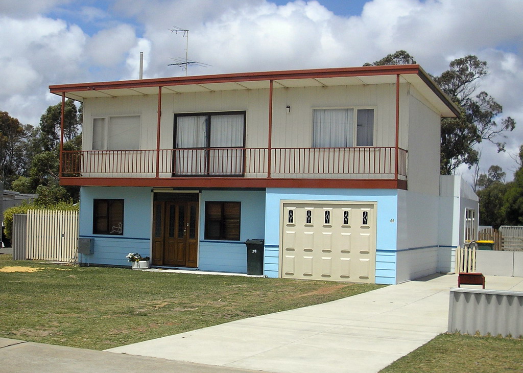
 Example of an older-style coastal home at Mandurah
The Noongar (or Bibbulmun) people, who inhabited the South West of Western Australia, named the area Mandjar ('meeting place'). After European settlement the name changed, possibly due to mispronunciation, to Mandurah.
In December 1829, Thomas Peel arrived in Western Australia from the United Kingdom with workmen, equipment and stores on the ship Gilmore. He had financed the trip in exchange for a grant of land in the Swan River Colony. Unfortunately for him, the contract stipulated that he was to arrive by no later than 1 November 1829 and, as such, his original land grant was forfeited. Undaunted, Peel built a small settlement named Clarence south of the Swan River colony at what is known today as Woodman Point. Many problems with the settlement along with Peel's own ill-health led him to lead the remaining Clarence settlers to the area known today as Mandurah. Thomas Peel died in 1865 but Mandurah continued to grow, albeit very slowly, over the years leading to the 20th Century.
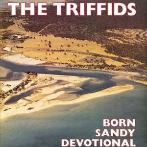
 The Triffids' album cover for Born Sandy Devotional showing what is now the suburb of Halls Head in 1961
Since its founding, Mandurah was administered under the Murray Road Board until 1949, when the Mandurah Road Board was established. However, dissension within the board during the 1950s saw it suspended while Commissioner Richard Rushton oversaw the town's affairs. On 26 April 1960, the Mandurah Road Board was reconstituted, and on 1 July 1961, in accordance with the Local Government Act 1960, the Shire of Mandurah was founded.
With a mining boom in nearby Pinjarra, Jarrahdale and Wagerup and an industrial boom in Kwinana combined with an idyllic lifestyle by the coast saw Mandurah grow rapidly, and on 1 July 1987 was upgraded to the Town of Mandurah. Just three years later on 14 April 1990. Mandurah became the fifth non-metropolitan settlement in Western Australia to become a city.[4]
Economy and employment
Much of Mandurah's economy is based on tourism, retail and manufacturing/construction, and to a lesser extent on mining and agriculture.
Tourism
Mandurah is considered to be the unofficial gateway to the South West and possesses a variety of tourist attractions, especially based around the water. It is a major fishing and crabbing area in Western Australia, with the city well-known for the Blue Manna Crab (Portunus pelagicus) with a festival held in early March known as Crabfest.
Like neighbouring settlements Bunbury and Rockingham dolphins and whales frequent the city annually and dolphin and whale watching are a popular pastime. In December, the canal areas in Mandurah becomes well-known for their Christmas lights and special boat cruises are often promoted as a result.
Two zoos lie within the outskirts of the city, as well as a miniature village, a tourist railway and a national park.
Retail
Mandurah has seven day trading during the summer, as well as during school and public holiday periods. Mandurah has five distinct shopping areas, including Centro Mandurah (formerly known as the Mandurah Forum) located at the intersection of Pinjarra and Mandurah Roads. The Bridge Quarter (or The Foreshore) located in the CBD and Dolphin Quay/Mandurah Ocean Marina built at the intersection of Mandjar Bay and the Peel Inlet. There are also smaller retail areas in Meadow Springs, Greenfields, Halls Head and Falcon.
Mining
Although not a mining settlement, Mandurah has a number of mines within two hours of the city. This includes bauxite mining and alumina refining at Pinjarra and Wagerup with the Huntly Mine at Pinjarra the largest in the world. Mandurah is also just one hour away from the Boddington Gold Mine, which has recently become Australia's largest producing gold mine.[5]
Transport
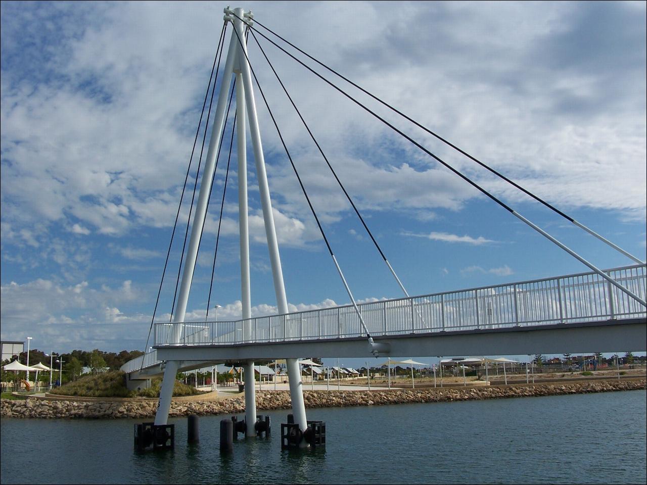
 Mandurah Ocean Marina Bridge
Highway 1 bisects the city of Mandurah as Mandurah Road towards Fremantle and Old Coast Road towards Bunbury. Meanwhile Pinjarra and Gordon/Lakes Roads serve as major east-west corridors for the northern part of the city. The Kwinana Freeway and Forrest Highway also provides a rural bypass for the city. The recently opened Mandjoogoordap Drive (formerly the Mandurah Entrance Road) also provides a direct link from the Kwinana Freeway.
The Mandurah Estuary Bridge was constructed in 1985 to 1986, and was the first incrementally launched box girder bridge in Australia. The Dawesville Channel (also known as the Dawesville Cut), a large man-made channel, was opened in April 1994. The channel was created to allow saline seawater from the Indian Ocean to flush into the Peel Inlet to reduce the incidence of algal blooms which had plagued the estuary for many years.
Public transport in Mandurah is covered by Transperth due to its proximity to Perth itself, with eleven bus routes servicing the city while the Mandurah railway line, opened in December 2007, links Mandurah to Perth via Mandurah railway station with a travel time of approximately 50 minutes. Mandurah is also a stop on Transwa bus services between Perth and the South West.
Media
Mandurah lies at the southern end of the Perth TV license area, and as such it is served by five analogue free to air stations: ABC (now branded as ABC1), Seven, Nine, Ten and SBS, (branded as SBS One). Additional digital-only channels available include One HD, ABC2, ABC3, ABC News 24, SBS Two, 7Two, 7mate, GEM HD and GO!. In April 2010 a new community station, West TV, began transmission (in digital format only).
Since it lies close to two TV boundaries, Mandurah also receives the GWN, WIN and Ten West stations that service regional and remote Western Australia. Digital services of all three stations will be aired in Mandurah by 2011.
Two local newspapers service the city, the weekly Mandurah Coastal Times and the Mandurah Mail Link.
Mandurah also receives all the Perth radio stations in addition to 1116 kHz 6MM (AM) and the FM stations of Class (96.5FM) and Coast FM (97.3FM).
Water use
Mandurah is at the centre of a water recycling project known as the Halls Head Indirect Water Reuse Project. Based in Mandurah it has recently been awarded the Western Australian Water Corporation Award for Water Treatment and Recycling. An aquifer is used to filter the areas sewage water providing safe, quality irrigation water for local parks, gardens and ovals [2]. Mandurah is also linked to Perth's water supply.
Sport
Mandurah is home to the Peel Thunder Football Club in the West Australian Football League, Mandurah City in the Football West State League and the Pirates Rugby Union club in the RugbyWA competition. Greyhound racing is held weekly at the Greyhounds WA Mandurah venue.[6] Mandurah also hosts an SBL (State Basketball League) team called Mandurah Magic.
Mandurah boasts many golf courses in the area including the Mandurah Country Club, Meadow Springs Golf Club, Secret Harbour. Mandurah is a private, tree lined course. Meadow Springs is a public course inhabited by kangaroos. Secret Harbour is a public links course near the beach. One club, The Cut, was voted the best golf course in Western Australia
Mandurah is famous for its beaches along the coast. There are many family friendly beaches such as Doddis Beach, Blue Bay and Mandurah Beach. There are also many surf beaches around Wannanup and Dawesville such as Avalon, 4th Groyne, Pyramids and The Wedge.
In popular culture
A photograph of Mandurah adorns the cover of the 1986 album Born Sandy Devotional by The Triffids.
Electro pop duo Tim and Jean hail from Mandurah.[7]References
- ^ Australian Bureau of Statistics (31 March 2011). "Regional Population Growth, Australia, 2009–10 – Western Australia". http://www.abs.gov.au/ausstats/abs@.nsf/Products/3218.0~2009-10~Main+Features~Western+Australia?OpenDocument. Retrieved 4 September 2011.
- ^ Maiden, Samantha (21 January 2008). "Australian homes the world's least affordable, survey says". The Australian. http://www.news.com.au/story/0,23599,23081706-2,00.html.
- ^ "Climate statistics for Mandurah". Australian Bureau of Meteorology. http://www.bom.gov.au/climate/averages/tables/cw_009887.shtml.
- ^ http://www.mandurah.wa.gov.au/council/history History of Mandurah
- ^ http://www.perthnow.com.au/business/boddington-gold-mine-to-eclipse-kalgoorlie-super-pit/comments-e6frg2qc-1225826377222
- ^ Greyhounds WA Mandurah
- ^ Steph Hughes (21 November 2009). "Tim & Jean: Home and Hosed". http://www.abc.net.au/triplej/homeandhosed/blog/s2727551.htm. Retrieved 2 February 2011.
External links
Suburbs of the Mandurah region | Peel Region | Western Australia City of Mandurah Bouvard · Clifton · Coodanup · Dawesville · Dudley Park · Erskine · Falcon · Greenfields · Halls Head · Herron · Lakelands · Madora Bay · Mandurah · Meadow Springs · Parklands · San Remo · Silver Sands · Wannanup
Nearby suburbs Barragup · Furnissdale · Golden Bay · Keralup · North Yunderup · Singleton · Stake Hill
Towns and localities in the Peel region of Western Australia Major centres Mandurah · Boddington · Dwellingup · Pinjarra · South Yunderup · Waroona
Minor settlements /suburbs Banksiadale · Barragup · Birchmont · Blythewood · Bouvard · Carcoola · Chadoora · Clifton · Coodanup · Coolup · Crossman · Dawesville · Dudley Park · Erskine · Etmilyn · Fairbridge · Falcon · Furnissdale · Greenfields · Halls Head · Hamel · Herron · Holyoake · Inglehope · Keralup · Kooljerrenup · Lake Clifton · Lakelands · Lower Hotham · Madora Bay · Marradong · Marrinup · Meadow Springs · Meelon · Mount Cooke · Mount Wells · Myara · Nambeelup · Nanga Brook · Nirimba · North Dandalup · North Yunderup · Oakley · Parklands · Point Grey · Preston Beach · Quindanning · Ranford · Ravenswood · San Remo · Silver Sands · Solus · Stake Hill · Teesdale · Wagerup · Wannanup · West Coolup · West Pinjarra · Whittaker · Wuraming
Cities of Western Australia Capital city Metropolitan cities Regional cities Large towns Cities of Australia Australian Capital Territory New South Wales Albury · Armidale · Bathurst · Broken Hill · Cessnock · Coffs Harbour · Dubbo · Gosford · Goulburn · Grafton · Griffith · Lake Macquarie · Lismore · Lithgow · Maitland · Newcastle · Nowra · Orange · Queanbeyan · Sydney · Tamworth · Wagga Wagga · WollongongNorthern Territory Queensland Brisbane · Bundaberg · Cairns · Caloundra · Gladstone · Gold Coast · Gympie · Hervey Bay · Mackay · Maryborough · Mount Isa · Rockhampton · Sunshine Coast · Toowoomba · TownsvilleSouth Australia Adelaide · Mount Gambier · Murray Bridge · Port Augusta · Port Lincoln · Port Pirie · Victor Harbor · WhyallaTasmania Victoria Western Australia Categories:- Cities in Western Australia
- Coastal cities in Australia
- Australian Aboriginal placenames
- Mandurah


Wikimedia Foundation. 2010.