- North Dandalup, Western Australia
-
North Dandalup
Western AustraliaPopulation: 343 (2006 Census)[1] Postcode: 6207 Location: - 71 km (44 mi) from Perth
- 15 km (9 mi) from Pinjarra
- 22 km (14 mi) from Dwellingup
LGA: Shire of Murray State District: Murray-Wellington Federal Division: Canning Localities around North Dandalup: Nambeelup Keysbrook Keysbrook Nambeelup North Dandalup Keysbrook Ravenswood Meelon Meelon Coordinates: 32°31′08″S 115°58′05″E / 32.519°S 115.968°E
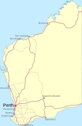
North Dandalup is a small town in the Peel region of Western Australia along the South Western Highway between Serpentine and Pinjarra. Its local government area is the Shire of Murray. At the 2006 census, North Dandalup had a population of 343.[1]
Contents
History
The name "Dandalup", a Noongar Aboriginal name relating to the rivers in the area, was shown on maps from 1835 onwards, but its meaning is unclear. When the Pinjarra to Picton Junction railway was joined to Perth in 1894, North Dandalup, near where the river of that name crossed the railway, was noted as a stopping place.[2]
Whittaker's timber railway ran from North Dandalup into the Darling Ranges where they had been granted a forestry concession of 36,000 acres (150 km2).[3]
Land for a school was set aside in 1899 and the school commenced operations in April 1900, and a hall and recreation ground were built in 1915. The town was finally gazetted in 1972, a year after work began on the construction of nearby South Dandalup Dam. On 28 October 1994 the $50 million North Dandalup Dam was opened 6 km from the town.[4]
Present day
North Dandalup today has a primary school, hall, convenience store and fuel station. Nearby North Dandalup Dam offers recreational facilities and activities. It lies close to the North Dandalup Important Bird Area.
Transport
North Dandalup is located on the South Western Highway and the turnoff for Dwellingup, Western Australia for travellers from Perth, Del Park Road, is located in the town.
North Dandalup serves as a stop on the Australind passenger train from Perth to Bunbury.
Preceding station Transwa Trains network Following station towards PerthAustralind towards BunburyReferences
- ^ a b Australian Bureau of Statistics (25 October 2007). "North Dandalup (L) (Urban Centre/Locality)". 2006 Census QuickStats. http://www.censusdata.abs.gov.au/ABSNavigation/prenav/LocationSearch?collection=Census&period=2006&areacode=UCL521100&producttype=QuickStats&breadcrumb=PL&action=401. Retrieved 23 July 2011.
- ^ Western Australian Land Information Authority. "History of country town names". http://www.landgate.wa.gov.au/corporate.nsf/web/History+of+country+town+names. Retrieved 2007-01-17.
- ^ Australian Railway Historical Society Bulletin, May, 1965 pp 81-86
- ^ Water Corporation of WA. "North Dandalup Dam". http://www.watercorporation.com.au/D/dams_dandalup_north.cfm. Retrieved 2006-10-30.
External links
- North Dandalup Dam (Water Corporation)
Towns and localities in the Peel region of Western Australia Major centres Mandurah · Boddington · Dwellingup · Pinjarra · South Yunderup · Waroona
Minor settlements /suburbs Banksiadale · Barragup · Birchmont · Blythewood · Bouvard · Carcoola · Chadoora · Clifton · Coodanup · Coolup · Crossman · Dawesville · Dudley Park · Erskine · Etmilyn · Fairbridge · Falcon · Furnissdale · Greenfields · Halls Head · Hamel · Herron · Holyoake · Inglehope · Keralup · Kooljerrenup · Lake Clifton · Lakelands · Lower Hotham · Madora Bay · Marradong · Marrinup · Meadow Springs · Meelon · Mount Cooke · Mount Wells · Myara · Nambeelup · Nanga Brook · Nirimba · North Dandalup · North Yunderup · Oakley · Parklands · Point Grey · Preston Beach · Quindanning · Ranford · Ravenswood · San Remo · Silver Sands · Solus · Stake Hill · Teesdale · Wagerup · Wannanup · West Coolup · West Pinjarra · Whittaker · Wuraming
Categories:- Towns in Western Australia
- Peel (Western Australia)
Wikimedia Foundation. 2010.

