- Mandurah, Western Australia
Infobox Australian Place | type = suburb
name = Mandurah
state = wa
imagesize = 160
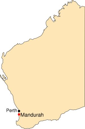
caption = Location of Mandurah, Western Australia
lga = City of Mandurah
lga2 = Shire of Murray
postcode = 6210
est =
pop = 67,813
pop_footnotes = (2006) [Census 2006 AUS|id=UCL516800|name=Mandurah (Urban Centre/Locality)|accessdate=2008-02-13|quick=on|]
area = 106.6
stategov = Mandurah, Murray-Wellington, Dawesville
fedgov = Brand, Canning
dist1 = 72 | dir1 = SSW | location1 = Perth
dist2 = 108 | dir2 = N | location2 = Bunbury
dist3 = 18 | dir3 = NW | location3 = Pinjarracoord|-32.529|115.723|type:city(70000)_region:AU-WA_scale:30000|format=dms|display=titleMandurah is a city in
Western Australia located approximately convert|72|km|mi|0 south of the state capital, Perth,Western Australia .Mandurah is the fastest-growing regional city in Australia, having experienced hypergrowth for several years.Fact|date=June 2008 The city grew from isolated holiday communities along the shores of the
Peel-Harvey Estuary , and, with the growth of Perth, it has become a popular lifestyle alternative. Mandurah's connection with the Perth CBD has been strengthened with the opening of the Perth-Mandurah railway line in December 2007. A housing affordability survey of 227 cities in the 2008 ranked it the least affordable city in Australia. [ [http://www.news.com.au/story/0,23599,23081706-2,00.html Australian homes the world's least affordable, survey says | NEWS.com.au ] ]The city centre foreshore is home to a variety of wildlife including
dolphin s,pelican s, shags, and an abundance of marine life including the blue manna crab which has become synonymous with the area.The city welcomes thousands of tourists every year, including many international visitors. Mandurah is famous for its protected waterways, superb beaches and excellent boating and fishing activities.
A photograph of Mandurah adorns the cover of the 1986 album
Born Sandy Devotional byThe Triffids Geography
The waters of the Peel Inlet and Harvey Estuary (one of
Australia 's larger inlet systems) form the centre of Mandurah. The estuary is approximately twice the size of Sydney Harbour. The city lies in and around this freshwater system which in turn feeds into theIndian Ocean . The city and its suburbs have many kilometres of ocean coastline most of which is sandybeach es. Mandurah also has a number of suburbs built around artificially created canal systems that extend from the Peel Inlet.The area is governed by the
City of Mandurah , although a couple of suburbs east of the Serpentine River are governed by theShire of Murray .Climate
Sharing a similar climate to Perth, Mandurah has a typical Mediterranean climate with warm summers and cool winters. During summer (December to February), the average maximum temperature is 27°C (80°F) with an average minimum temperature of 19°C (66°F). At its extreme it can get very hot, often having days exceeding 40°C (104°F) in the later half of summer. In winter (June to August), the average maximum temperature is 15°C (59°F) with an average minimum temperature of 9°C (48°F). Mandurah's proximity to the ocean moderates summer temperatures somewhat, with temperatures a few kilometres inland often 4 or 5 degrees warmer. Mandurah's climate is remarkable for producing one of the highest densities of
tornado es in the world [http://www.inflowimages.com/TornadoesInWa/TornadosInWA.htm] .History
The
Noongar (or Bibbulmun) people, who inhabited the South West of Western Australia, named the area Mandjar ('meeting place'). After European settlement the name changed, possibly due to mispronunciation, to Mandurah.In December 1829,
Thomas Peel arrived in Western Australia from theUnited Kingdom with workmen, equipment and stores on the ship "Gilmore". He had financed the trip in exchange for a grant of land in theSwan River Colony . Unfortunately for him, the contract stipulated that he was to arrive by no later than 1 November 1829 and, as such, his original land grant was forfeited. Undaunted, Peel built a small settlement named Clarence south of the Swan River colony at what is known today asWoodman Point . Many problems with the settlement along with Peel's own ill-health led him to lead the remaining Clarence settlers to the area known today as Mandurah. Thomas Peel died in 1865 but Mandurah continued to grow, albeit very slowly, over the years.Transport
The Mandurah Estuary Bridge was constructed in 1985 to 1986, and was the first incrementally launched
box girder bridge in Australia. TheDawesville Channel (also known as the "Dawesville Cut"), a large man-made channel, was opened in April 1994. The channel was created to allow saline seawater from the Indian Ocean to flush into the Peel Inlet to reduce the incidence ofalgal bloom s which had plagued the estuary for many years.Transperth ’s Mandurah railway line, opened in December 2007, links Mandurah to Perth.Water use
Mandurah is at the centre of a water recycling project known as the "Halls Head Indirect Water Reuse Project". Based in Mandurah it has recently been awarded the Western Australian Water Corporation Award for Water Treatment and Recycling. An
aquifer is used to filter the areas sewage water providing safe, quality irrigation water for local parks, gardens and ovals [http://www.csiro.au/csiro/content/standard/ps7t,,.html] .Sport
Mandurah is home to the
Peel Thunder Football Club in theWest Australian Football League ,Mandurah City in theFootball West State League and thePirates Rugby Union club in theRugbyWA competition.Greyhound racing is held weekly at the Greyhounds WA Mandurah venue. [ [http://greyhoundswa.com.au/GeneralInfo/Venues/Mandurah/tabid/110/Default.aspx Greyhounds WA Mandurah] ]References
External links
* [http://www.mandurah.wa.gov.au/ City of Mandurah] website
* [http://www.visitmandurah.com/ Visitors to Mandurah] website

Wikimedia Foundation. 2010.