- Port Jackson
-
Coordinates: 33°51′30″S 151°14′00″E / 33.85833°S 151.2333333°E
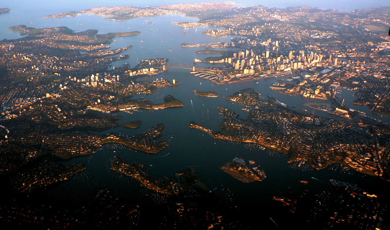
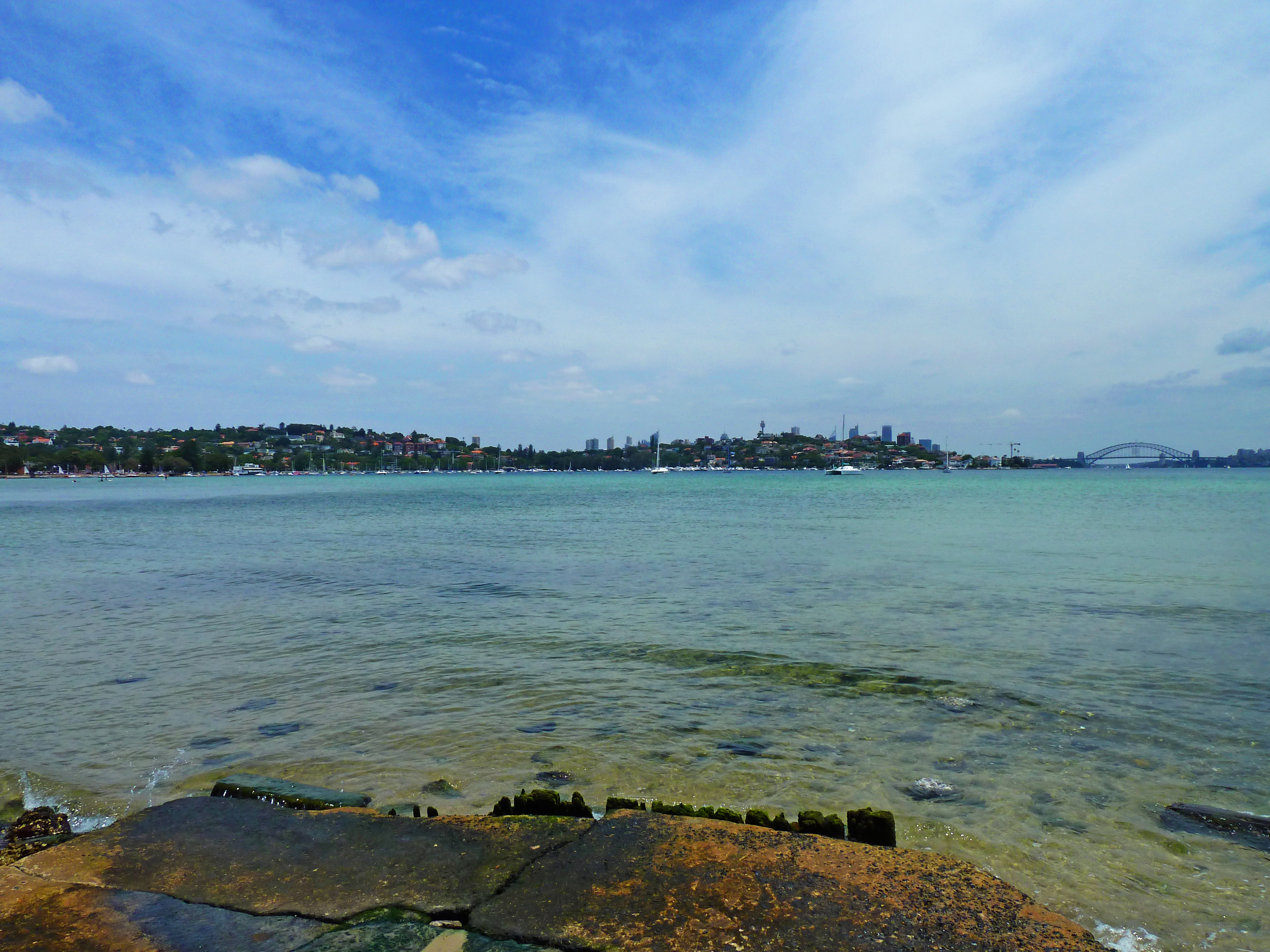
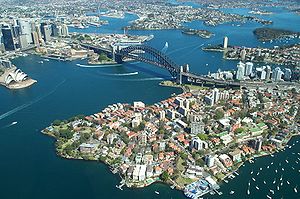 Sydney Harbour and Port Jackson displaying Sydney Harbour Bridge and the Sydney Opera House. The CBD is located to the far left of the photo.
Port Jackson, containing Sydney Harbour, is the natural harbour of Sydney, Australia. It is known for its beauty, and in particular, as the location of the Sydney Opera House and Sydney Harbour Bridge. The location of the first European settlement in Australia, the harbour has continued to play a key role in the history and development of Sydney.
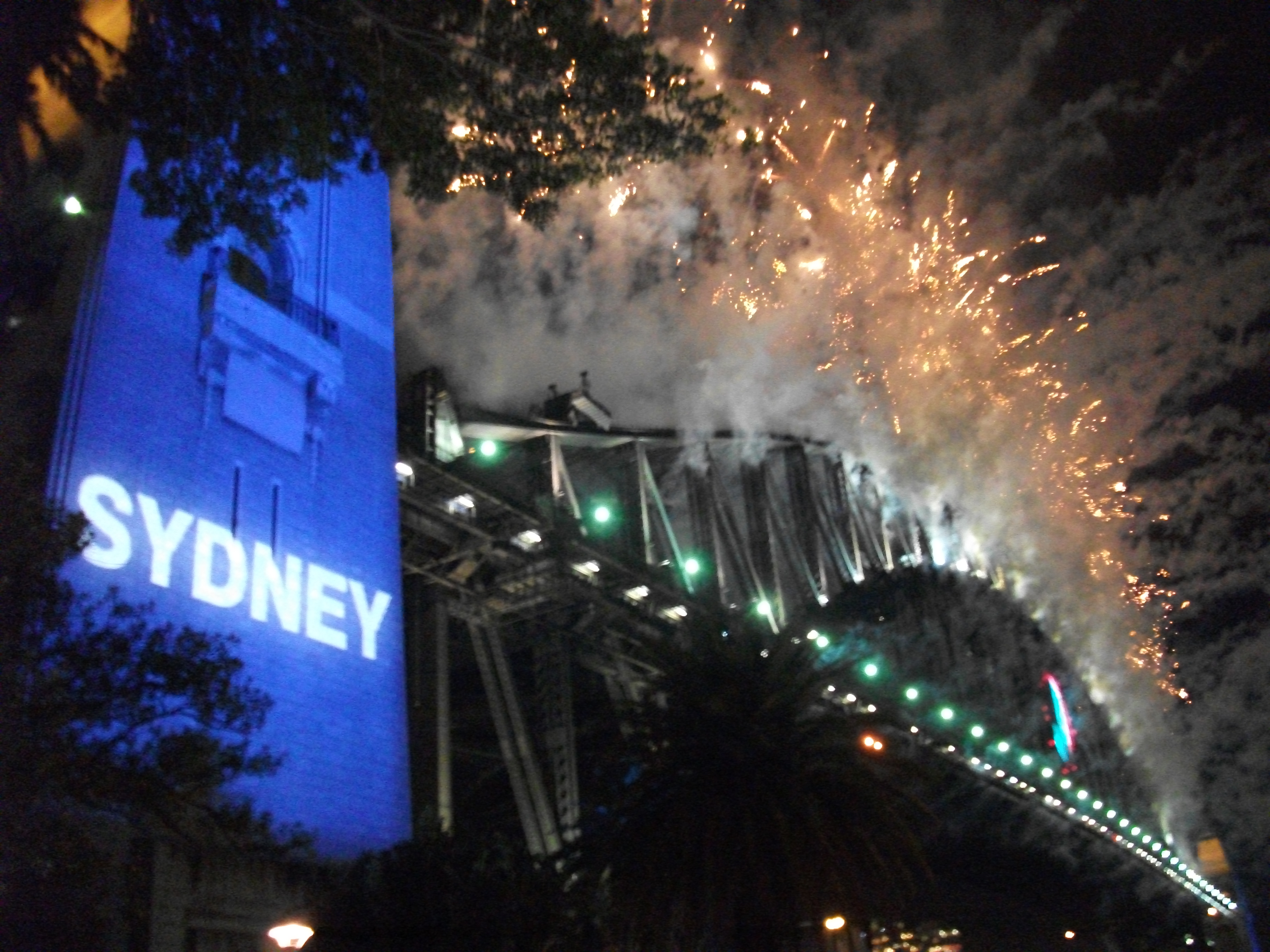
It is used as the location of Sydney New Year's Eve and the starting point of the Sydney to Hobart yacht race.
Contents
History
 Port Jackson
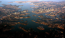
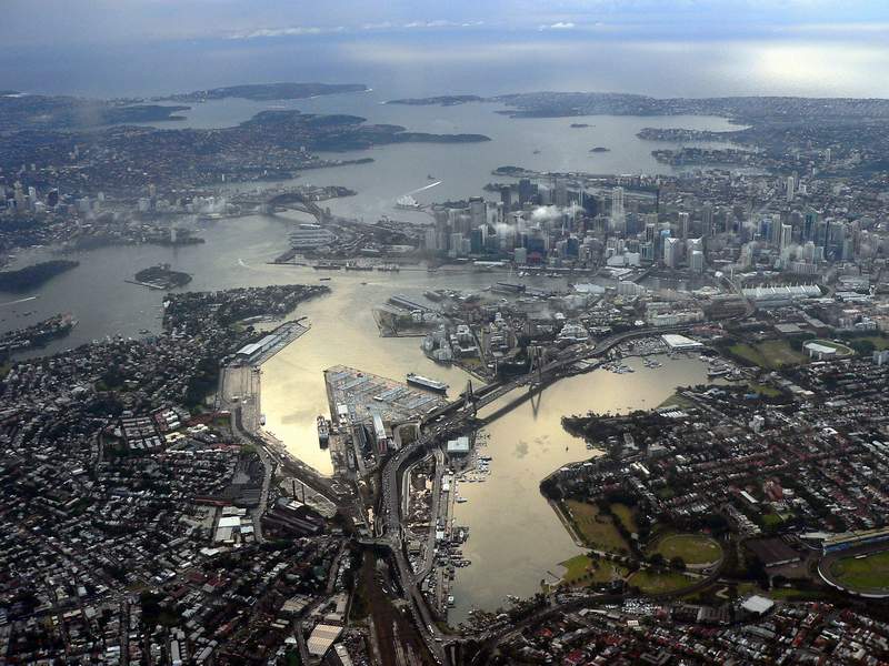
 View of Port Jackson and Sydney's CBD.
The land around Port Jackson was occupied at the time of European discovery and colonisation by various tribes including the Gadigal, Cammeraygal, Eora and Wangal peoples. The Gadigal people are said to have occupied the land stretching along the south side of Port Jackson from what is now South Head, in an arc west through to Petersham. The Cammeraygal lived on the northern side of the harbour. The area along the southern banks of the Parramatta River, west of Petersham to Rose Hill, was reported to belong to the Wanegal. The Eora people lived on the southern side of the harbour, close to where the First Fleet settled.
The first recorded European discovery of Sydney Harbour, was by Lt James Cook in 1770 - Cook named the inlet after Sir George Jackson, (one of the Lord Commissioners of the British Admiralty, and Judge Advocate of the Fleet).[1] His ship's log notation states "at noon we where...about 2 or 3 miles from the land and abrest of a bay or harbour within there appeared to be a safe anchorage which I called Port Jackson."
Eighteen years later, on 21 January 1788, after arriving at Botany Bay, Governor Arthur Phillip took a longboat and two cutters up the coast to examine Cook's Port Jackson. Phillip first stayed over night at Camp Cove, then moved down the harbour, landing at Sydney Cove and then Manly Cove before returning to Botany Bay on the afternoon of the 24th.
Phillip returned to Sydney Cove in H.M. Armed Tender Supply on 26 January 1788, where he established the first colony in Australia, later to become the city of Sydney.
In his first dispatch from the colony back to England, Governor Phillip noted that "...we had the satisfaction of finding the finest harbour in the world, in which a thousand sail of the line may ride in the most perfect security..."[2]
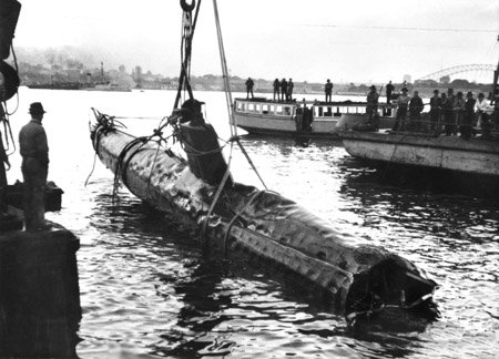
 A Japanese Ko-hyoteki class midget submarine, believed to be Midget No. 14, is raised from Sydney Harbour on 1 June 1942.
In 1942, to protect Sydney Harbour from a submarine attack, the 'Sydney Harbour anti-submarine boom net' was constructed. It spanned the harbour from Green (Laings) Point, Watsons Bay to Georges Head, Mosman, which is on the other side of the harbour. On the night of 31 May 1942, three Japanese midget submarines attempted to enter the harbour, one of which became entangled in the western end of the boom net's central section. Unable to free their submarine, the crew detonated charges to destroy it, killing themselves in the process. The anti-submarine boom net was demolished soon after World War II, and all that remains are the foundations of the old boom net winch house, which can be viewed on Green (Laings) Point, Watsons Bay. Today, that Japanese midget submarine remains on static display at the Australian War Memorial.[3]
Fortifications
A number of former fortifications line Sydney Harbour, some of which are now heritage listed. The earliest date from the 1830s, and were designed to defend Sydney from seaborn attack or convict uprisings. There are four historical fortifications located between Taronga Zoo and Middle Head, Mosman, they are: the Middle Head Fortifications, the Georges Head Battery, the Lower Georges Heights Commanding Position and a small fort located on Bradleys Head, known as the Bradleys Head Fortification Complex. The forts were built from sandstone quarried on site and consist of various tunnels, underground rooms, open batteries and casemated batteries, shell rooms, gunpowder magazines, barracks and trenches.[4][5]
Geography
Geologically, Port Jackson is a drowned river valley, or ria. It is 19 km long with an area of 55 km². The estuary's volume at high tide is 562 million cubic metres. The perimeter of the estuary is 317 kilometres.
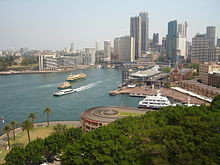
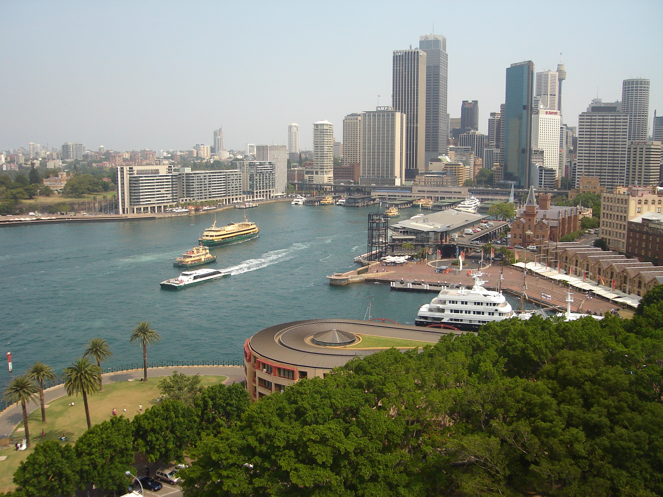
According to the Geographical Names Board of New South Wales, Port Jackson is "a harbour which comprises all the waters within an imaginary line joining North Head and South Head. Within this harbour lies North Harbour, Middle Harbour and Sydney Harbour."[6] These three harbours extend from the single entrance (known as Sydney Heads (North and South Heads)). North Harbour is the shortest, and is really just a large bay extending to Manly. Middle Harbour extends to the north-west. It is bridged at The Spit and Roseville. Its headwaters lie in Garigal National Park. The longest arm, Sydney Harbour, extends west as far as Balmain, where it is fed by the estuaries of the Parramatta and Lane Cove rivers. Port Jackson is bridged by the Sydney Harbour Bridge and the ANZAC Bridge (formerly known as the Glebe Island Bridge). A tunnel, the Sydney Harbour Tunnel passes underneath the Harbour, to the east of the bridge, and in 2005 it was proposed that a third harbour crossing, this time a railway line, be constructed to the west of the bridge. The harbour is heavily embayed. The bays on the south side tend to be wide and rounded, whereas those on the north side are generally narrow inlets. Sydney's major central business district begins at Circular Quay, a small bay on the south side that has, over time, had its semicircle reclaimed by land to the point where it is a rectangular quay. The northern side of the harbour is mainly used for residential purposes.
The waterways of Port Jackson are managed by the New South Wales Maritime Authority.
Islands
There are several islands within the harbour, including Shark Island, Clark Island, Fort Denison, Goat Island, Cockatoo Island, Spectacle Island, Snapper Island and Rodd Island. Some other former islands, including Bennelong Island, Garden Island and Berry Island, have subsequently been linked to the shore by land reclamation.
Tributaries and waterways
- Tank Stream is a fresh water course which empties into Sydney Cove. Today it is little more than a storm water drain but originally it was the fresh water supply for the fledgling colony of New South Wales in the late 18th century. It originated from a swamp to the west of present day Hyde Park and at high tide entered Sydney Cove at the intersection of Bridge and Pitt Streets.
- Middle Harbour is the northern arm of Sydney Harbour. It begins as a small creek (Middle Harbour Creek) at St Ives Chase.[7] It joins Port Jackson between the two headlands, Middle Head and Grotto Point Reserve, adjacent to the Sydney Heads.
- Iron Cove Creek is located in the inner-western suburbs of Croydon, Ashfield, Haberfield and Five Dock. Iron Cove Creek traverses mostly through residential areas and parkland, making a two kilometre journey from where it surfaces in Croydon to where it empties along with Hawthorne Canal into Iron Cove, which is a bay of the Parramatta River.
- Duck River a tributary of the Parramatta River entering at Silverwater is fed by two creeks, Duck Creek and A'Beckett Creek. It drains localties around the suburbs of Silverwater and Auburn and was named in light of the large population of ducks which inhabit the stream.
- Parramatta River is the main tributary of Sydney Harbour, a branch of Port Jackson. The river begins at confluence of Toongabbie Creek and Darling Mills Creek west of Parramatta and travels in an easterly direction to a line between Greenwich Point, Greenwich, and Robinsons Point, Birchgrove. Here it flows into Port Jackson, still about 21 km from the ocean.[8]
- Lane Cove River is a tributary of the Parramatta River, its lower reaches form an arm of Sydney Harbour. The lower reaches of the Lane Cove River are tidal and merge into Sydney Harbour at Greenwich and Hunters Hill.
- Johnstons Creek is located in the inner-western suburbs of Glebe, Annandale, Forest Lodge and Stanmore. It rises in Stanmore and flows in a generally northward direction towards Rozelle Bay. The creek passes beneath the stands of Harold Park Paceway prior to emptying into Rozelle Bay at Bicentennial Park Glebe. Orphan School Creek is a tributary of Johnstons Creek.
Maritime transport
Sydney Ferries is an agency of the New South Wales Department of Transport, providing ferry services on Sydney Harbour and the Parramatta River in Sydney, Australia. Most ferry wharves, aside from those concentrated around the Central Business District, lie on the northern banks of the harbour, or on the southern bank, east of the Harbour Bridge. There is a lesser concentration of ferry wharves in the western areas of the harbour.
A service runs to Parramatta, along the Parramatta River, which is serviced by the RiverCat vessels, a large catamaran type ferry.
In addition to the state owned ferry service, private ferry operators run a fast commuter service between Manly and the city during peak times. Fast services on this route are now offered by private operators, following the Government decision in December 2009 to cease the premium service operated by Sydney Ferries.
Finally, a small number of water taxi and water limousine operators are active on the harbour, offering transport to individuals and groups who do not wish to travel by ferry. These water taxis are not restricted by timetables or specific routes,[9] and can also provide a service to or from private wharfs and houses on the waterfront.
Derivative unit of measure
A Sydharb is a unit of volume used in Australia for water. One sydharb (or sydarb), also called a Sydney Harbour, is the amount of water in the Sydney Harbour (Port Jackson): approximately 500 gigalitres (410,000 acre·ft).[10]
References
- ^ McDermott, Peter Joseph (1878-11-06). "Pacific Exploration". The Brisbane Courier (Brisbane Newspaper Company Ltd): pp. 5. http://ndpbeta.nla.gov.au/ndp/del/article/1376345?searchTerm=James+Cook. Retrieved 2008-11-05.
- ^ NSW Govt Printer (1892), Historical Records of New South Wales, Vol 1, Part 2 (1783-1792) pages 67-70. cited in statusquo.org
- ^ NPWS plaque
- ^ DECC | Defence heritage in and around Sydney Harbour
- ^ heritage.nsw.gov.au
- ^ Geographical Names Board of New South Wales (16 July 1976), "Port Jackson", Geographical Names Register of New South Wales, http://www.gnb.nsw.gov.au/name_search/extract?id=ujjtvqWAMa
- ^ UBD Citylink Street Directory Page 155 Map reference F4
- ^ UBD City Link Street Directory Page191 Map Reference A12
- ^ http://www.watertaxis.com.au/ecms/home/pages/common/show-story.cfm?story_id=6243&parent_menu_item_id=3078&menu_id=0
- ^ "Australian Conventional Units of Measurement in Water" (PDF). Australian Water Association. Archived from the original on 2005-10-30. http://web.archive.org/web/20051030001225/http://www.awa.asn.au/Content/NavigationMenu/Information/UnitsofMeasurement.pdf. Retrieved 2006-03-10.
External links
- NSW Maritime Authority
- Maps maintained by the New South Wales Maritime Authority, which legally is the owner of the harbour bed:
- Sydney Harbour Federation Trust Established by the Australian Government to plan for the future of former Defence and other special Commonwealth Lands around Sydney Harbour.
- Geographic Names Board of New South Wales reference to Port Jackson
- A Living Harbour A history of Sydney Harbour from ABC Radio National
Events 1996–97 · 1997–98 · 1998–99 · 1999–2000 · 2000–01 · 2001–02 · 2002–03 · 2003–04 · 2004–05 · 2005–06 · 2006–07 · 2007–08 · 2008–09 · 2009–10 · 2010–11 · 2011–12
Venues Main venuesOther vantage pointsRelated Bridge Effect · 9pm Family Fireworks · Midnight FireworksCategories:- Geography of Sydney
- Ports and harbours of New South Wales
- Visitor attractions in Sydney
- Sydney New Year's Eve
- Bays of New South Wales
- Sydney Harbour

Wikimedia Foundation. 2010.