- Five Dock, New South Wales
Infobox Australian Place | type = suburb
name = Five Dock
city = Sydney
state = nsw
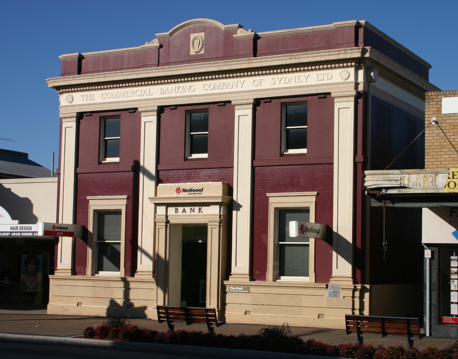
caption = Old bank building on Great North Road, FiveDock
lga = City of Canada Bay
postcode = 2046
est = 1794
pop = 7,328
area = 2.45
propval = $742,000
stategov = Drummoyne
fedgov = Lowe
near-nw = Concord
near-n = Wareemba
near-ne = Russell Lea
near-w = Canada Bay
near-e = Rodd Point
near-sw = Croydon
near-s = Ashfield
near-se = Haberfield
dist1 = 10
dir1 = west
location1=Sydney CBD Five Dock is a
suburb in the inner-west ofSydney , in the state ofNew South Wales ,Australia . Five Dock is located 10kilometres west of theSydney central business district , in the Local Government Area of theCity of Canada Bay .Location
Five Dock lies roughly at the foot, or southern end, of the Drummoyne peninsula. More precisely, Five Dock lies between
Parramatta Road and theCity West Link Road to the south and Hen and Chicken Bay, on theParramatta River , along with the suburbs of Wareemba and Russell Lea, to the north. Its total area is 2.45 km². [ [http://www.canadabay.nsw.gov.au/ City of Canada Bay Council | Home ] ]Rodd Point lies to the east. Haberfield adjoins Five Dock to the south-east. Iron Cove forms a small section of the suburb's eastern boundary. Ashfield and Croydon lie on the other side of
Parramatta Road , to the south. The suburbs of Canada Bay and Concord adjoin Five Dock's western boundary. Burwood lies just beyond Croydon, to the south-west.From the heart of the shopping centre, it is approximately 7.5 kilometres to Sydney's
central business district , measured in a straight line from the original SydneyGeneral Post Office in Martin Place. By road, this same distance is about 9-10 kilometres, depending on the route taken. [Approximate measurements made using Sydney and Blue Mountains 2004 Street Directory, UBD, 40th Edition, ISBN 0-7319-1465-1 and [http://www.bikely.com/ Bikely] .]History
Indigenous heritage
Relatively little trace of indigenous occupation of the
City of Canada Bay area remains today. It is thought thatParramatta Road was gradually constructed over an old Aboriginal pathway, although nothing is left of this. It is known however, that prior to the arrival of theFirst Fleet inPort Jackson in 1788, theSydney area was home toindigenous Australians from theEora group. The word Eora means simply 'the people' and the Eora were divided up into smaller tribes. Eight of these smaller groups have been identified as living along the banks of theParramatta River . One of these groups, theWangal (sometimes spelt Wanngal, Wann-gal or Wanegal) people, inhabited a large area on the southern side of theParramatta River , stretching roughly fromSydney Cove in the east to somewhere around Rosehill in the west. It is believed that Woollarawarre Bennelong was a member of theWangal clan.The mangrove-lined shores of the
Parramatta River were once an abundant source of food for the Wangal and the indigenous diet included Sydney cockles,Sydney rock oyster s, Hairy mussels and Hercules club whelks. The remains of these meals, known as shell middens, can be seen in several areas, including Rodd Park in the neighbouring suburb of Rodd Point and at Cabarita Park in nearby Cabarita. When the Europeans arrived, these shell middens could be found virtually all along the shores of Sydney Harbour. However, the European settlers used the materials in the middens to make lime for building mortar. As a result of this and of building activity along the foreshores, there are very few middens surviving today.It is believed that the first contact by Europeans with the Wangal clan may have occurred on
5 February 1788 during an exploration of theParramatta River , which was led byCaptain John Hunter . This meeting, (which may be apocryphal), is recalled in the name of the suburb Breakfast Point, as it took place while Hunter was having breakfast.Governor Phillip's notes suggest that an outbreak of smallpox in early 1789 would have had a devastating impact on the indigenous population in Canada Bay. Phillip not only recorded that half of the local aboriginal population was estimated to have died from the disease, but he also noted that the Aboriginal people always "retired from where the diseases appeared". The Wangal people are today remembered in local names such the "Wangal Bushland Reserve" in Mortlake, "Wangal Place" in Five Dock and the suburb Wareemba.
Origin of the name
The earliest written reference to "Five Dock" is in "The Sydney Gazette" of
February 3 ,1805 , which mentions Five Dock Bay. However, the name probably dates back to the days of the First Settlement. All of the sources referenced are in agreement that it was derived from the shape of the bay along theParramatta River . It appears that the names "Five Docks" and "Five Dock" were initially used interchangeably with the latter eventually became the accepted name.According to a publication from the Maritime Services Board, Port of Sydney, (Volume 9, No 3, September 1965), "At the NE point of the bay there were five water worn indentations that were likened to docks, hence the name Five Dock." [http://www.gnb.nsw.gov.au/name_search/extract?id=JPQlXtqban] . There is widely contradictory information, however, about how many of these natural formations still exist. The Maritime Services Board publication concludes that there "are two of the five remaining". However, Eric Russell's "Drummoyne: a western suburbs' history from 1794" states that one was lost with the construction of the 1881
Gladesville Bridge , but "the others remain in 1982". Other sources give different numbers again. According to "The Book of Sydney Suburbs", "three of them were affected by the construction of the southern approaches to the Gladesville Bridge".Early European exploration and settlement
The first European exploration of the Canada Bay municipality occurred soon after the arrival of the
First Fleet in 1788. This expedition was led by Captain John Hunter of the HMS Sirius and included exploration of Iron Cove, Drummoyne, Five Dock Bay and Hen and Chicken Bay. In the 1790s, following the expedition, there were scattered and irregular efforts to create a settlement on the north-western side ofIron Cove Creek and, later on, along what is nowParramatta Road .On
December 13 ,1794 ,Major Francis Grose granted some of the land on the peninsula to privates and NCOs from theNew South Wales Corps as farmland. This area, part of the agricultural district of Concord, became known as the District of York Place. However, this attempt to settle the area was largely unsuccessful and most of these grants were subsequently annulled. In 1806, Governor King made a grant of 6 km² of land to John Harris. This grant included the area presently made up of Five Dock, Wareemba, Russell Lea, Rodd Point and Drummoyne. This large property became known as "Five Dock Farm". It was never occupied by John Harris despite him having a house built there. Harris nevertheless asserted his rights to the land against squatters and trespassers by placing several warning notices in the "Sydney Gazette". The area remained almost untouched for thirty years as a consequence.The earliest local roads were developed by the auctioneer
Samuel Lyons , who purchased "Five Dock Farm" from Harris in 1836. "Lyons Road" bears his surname today. Lyons soon subdivided the land into 133 lots and sold them at auction. These were 12-24 hectare blocks of land and were generally used for large country-style residences such as Barnstaple Manor.Late 19th century
The late 19th century began to see increases in Five Dock's population as the public transport system improved. Ferry services to the area had started operation in 1834. However, ferries were really only useful to those who lived close to the
Parramatta River . People living further inland would have been faced with a long walk to Ashfield Station until 1874, when the area began to be served by horse-buses, running along what is nowParramatta Road .Recognised in "Sands' Sydney Directory" for the first time in 1870, Five Dock was slowly growing in importance. In 1861, the area's first school was opened in the grounds of "St Albans Anglican Church". This eventually became "Five Dock Public School". New premises for the school were completed in 1876 and classes there began in 1887. After campaigning by local residents,
local government was established in Five Dock onJuly 25 ,1871 , despite opposition from other locals. The area was linked toHunters Hill by bridge in 1881 with the construction of the originalGladesville Bridge .The suburb was nevertheless distinctly rural when a steam-powered tramway system, was introduced on
October 14 ,1890 . The new steam tram ran from Leichhardt and terminated at the intersection of Great North Road and Lyons Road. From Leichhardt, an electric tram continued to Circular Quay. The tram line was extended from Lyons Road all the way to Abbotsford in 1893.Despite this significant development, which heralded an era of many changes, descriptions of Five Dock from 1890 mention its market gardens, farmland and large country estates. This was not particularly intense farming as many of the estates were described as being heavily wooded. The local issues of the time were primarily rural ones: stray horses and cattle had to be dealt with, badly driven horse buggies and carts were a menace to pedestrians, roads and footpaths were poorly maintained, and there were a great many open drains. Probably the biggest nuisance to local residents was the herding of cattle through the suburb. In fact, during the 1890s, the movement of cattle through Five Dock, on its way to the abattoirs on Glebe Island, provoked such consternation and outrage that it was the subject of complaints to parliament as well as local council debate. Nevertheless, at the turn of the century, the area was on the brink of great changes. These were changes which had already occurred in the more prosperous neighbouring suburb of Drummoyne, and meant that Five Dock would soon begin to lose its rural charm.
20th century
A colourful and lively debate arose in 1921 and 1922 over attempts by local residents to change the suburb's name. Five Dock was variously described in letters to the local newspaper, "The Drummoyne Examiner", as a 'horrible name', 'a stigma', 'distasteful', 'very ugly', 'unwholesome', 'peculiar' and giving an 'impression of squalor'. The question of whether the name should be changed was put to the vote in a local referendum on
December 2 ,1922 , with the 'no' vote carrying the day.Briefly, during the early 1930s, the Five Dock Locality of the
New Guard (a kind of fascist paramilitary organisation primarily based in Sydney) grew rapidly and had close to 300 members in Five Dock at its very peak.New Guard meetings were held weekly. However, numbers in the Five Dock Locality began to dwindle sharply during 1932, even before the attempted kidnapping of Jack Lang and his dismissal.The pace of change in Five Dock quickened when private bus services started operating there in 1917, until being replaced by public buses in 1933. Further tram services which ran directly to the city centre came into service and more land subdivisions were made. As a result, by the end of the 1920s, Five Dock had largely lost the rural character it had maintained since the beginning of European settlement. It underwent further subdivisions during this decade and many of its brick houses date from this period.Extensive industrial, as well as residential, development took place during the first half of the twentieth century in both Five Dock and Drummoyne. Eventually, as land values increased, industry moved away. In recent years, several large former industrial sites have been redeveloped as residential housing.
Local Names
Many Five Dock streets are named after mayors, aldermen and other associated with local government, including Charles Street, Corden Avenue, Henley Marine Drive, Hill Street, Howley Street, Ingham Avenue, Kerin Avenue, McGrath Avenue, McKinnon Avenue, Myler Street, Preston Avenue, Sutton Street, Timbrell Drive, Udall Avenue, West Street and William Street.
Another series of streets is named after early landowners, subdividers and prominent local businessmen, including Ramsay Road, Taylor Street, Mitchell Street, Betts Avenue, Friend Avenue, Harris Road, Gildea Avenue and Bennett Avenue. Rickard Street, Noble Street, Heath Street and Augusta Street were named after Sir Arthur Rickard and members of his family. Rodd Road, Trevanion Streetand Barnstaple Road are named after Brent Clements Rodd and members of his family. A few streets take their name from local residents, including Mackaness Close and Langsworth Way.
The
Great White Fleet visited Sydney in August 1908 and several localstreet name s recall ships in the fleet. Connecticut Avenue is named after the USS "Connecticut" (BB-18). Illinois Street is named after the USS "Illinois" (BB-7). Minnesota Avenue takes its name from the USS "Minnesota" (BB-22). New Jersey Road takes its name from the USS "New Jersey" (BB-16).A few streets are named after prominent people: Queens Road after Queen Victoria; Garfield Avenue after American President James Garfield, Kingsford Avenue after
Charles Kingsford Smith , Bevin Avenue afterErnest Bevin and Henry Lawson Avenue afterHenry Lawson , who lived on Great North Road briefly in 1922. The name of Coronation Avenue commemorates the coronation of King George VI.A good number of streets take their names from well-known buildings or residences of the area. Arlington Street is named after the old Arlington Hotel. Other streets in this category include Erina Avenue, Fairlight Street, Longview Street, Maida Street, Murralong Avenue, Waterview Street and Wymstom Parade.
The name of Kirrang Street is taken from the aboriginal name for wattle. Wangal Place takes its name from the
Wangal people, the original inhabitants of the region. Great North Road andParramatta Road were named geographically for their destinations. York Avenue is a reference to York Place, an early name for part of the area. Regatta Road was named after the Drummoyne Regatta, which took place in the nearbyParramatta River .Churches
t Albans Anglican Church
St Albans Anglican Church is a 1924 Gothic church, constructed of brick and stone. It is well-built church, using locally quarried stone, and remains very well preserved. It is a heritage item and is listed in the Department of the Environment and Heritage's [http://www.deh.gov.au/cgi-bin/ahdb/search.pl?mode=place_detail;search=town%3Dfive%2520dock%3Bkeyword_PD%3Don%3Bkeyword_SS%3Don%3Bkeyword_PH%3Don%3Blatitude_1dir%3DS%3Blongitude_1dir%3DE%3Blongitude_2dir%3DE%3Blatitude_2dir%3DS%3Bin_region%3Dpart;place_id=102001 Australian Heritage database] . Significant or attractive features of the church include its interior carpentry, the
pipe organ (which dates from 1891 and was built by W. Davidson) and itsstained glass . Some of the stained glass was transferred from the earlier church on the site and dates from around 1909. St Albans rectory is on the same large site as the church, and together they form an important group. The foundations of the rectory, like those of the church, are constructed of local stone.chools
All Hallows' Parish School, Domremy College, Five Dock Public School, Lucas Gardens School,
Rosebank College .Domremy College Five Dock
Named after Joan of Arc's birthplace, Domremy, Domremy College is a Catholic Secondary School for girls. It is located on First Avenue, opposite Five Dock Park. The school was founded in 1911, initially having just 12 students. The school originally taught students from infants through to the end of senior school. This was later scaled back to just years 7 to 10. However, since 1985, the school has taught girls from year 7 through to year 12. The Domremy Convent group is listed on the NSW Heritage Office State Heritage Register. [ [http://www.heritage.nsw.gov.au/07_subnav_01_2.cfm?itemid=1510042 Heritage Branch Website - Online Database ] ]
Houses
Housing in Five Dock consists mainly of detached dwellings. Like many suburbs in the inner-west of
Sydney , Five Dock has some well-preserved examples of AustralianFederation architecture andCalifornia Bungalow style residences. Many of these homes have been renovated however, and have not retained all of their original features. In the 1920s, the area experienced a housing boom and many older houses date from around this period. In addition, there is a diverse range of otherarchitectural style s to be found in Five Dock, including many with an Italian or Greek influence. These are typically large brick constructions with big gardens and often featuring ornamental decorations such as arches, columns and statuettes.The majority of dwellings in Five Dock are detached houses, frequently with generously sized gardens. According to the 2001 census, of the 3,176 dwellings in the suburb, 1,718 consist of separate houses, 397 are other types of houses and 746 are apartments. Despite the preponderance of houses, Post-World War II development has involved a high proportion of apartment construction. Recently, several major
residential development s have been completed. A example is the 'Pendium' development in Garfield Street, which includes 102 apartments, a refurbished supermarket and the local library. Another recent example is the redevelopment of the formerEnergyAustralia site in Fairlight Street into 93 units [http://www.canadabay.nsw.gov.au/eservice/content/council/images/0415Agenda.pdf] .As of October 2005, there are a total of 51 items in the suburb that are heritage listed by the NSW Heritage Office [http://www.heritage.nsw.gov.au/] . In addition, the skateboard track in Five Dock Park is being considered for listing as a heritage item under the State Heritage Items Project [http://www.heritage.nsw.gov.au/07_subnav_08_1.htm] .
Commercial Area
The Five Dock retail and commercial centre is made up of a long line of shops, banks, restaurants and other services which run for about 500 metres along Great North Road in a section between Lyons Road and Queens Road. It features a high proportion of small local businesses, which range from hairdressers, florists and dentists to
hardware store s, accountants, delis and restaurants. During 2003 and 2004, Canada Bay Council finished enhancements to the shopping strip by burying overhead electrical cables and phone lines, widening, repaving and fencing off footpaths, planting new trees and installing new street furniture. This has reinforced the emergence of this section of Great North Road as a cafe and restaurant strip. The Five Dock telephone exchange is located at 190-192 Great North Road.Parks
Five Dock has two separate stretches of publicly accessible foreshore on the
Parramatta River . One of these foreshore stretches constitutes a small section of the Bay Run, a popular 7 km walking and cycling track which passes through several other suburbs along its way around Iron Cove. The other foreshore area lies on Hen and Chicken Bay and Kings Bay, and features a pedestrian and bike path leading around the bay towards Abbotsford.In addition, there are several public parks located around Five Dock, the three largest being Timbrell Park, Five Dock Park and Halliday Park. A large section of Barnwell Park Golf Course, which is owned by Canada Bay Council, is located in Five Dock. The northern part of the golf course lies on reclaimed land.
Five Dock Park and Oval
Five Dock Park is listed on the [http://www.heritage.nsw.gov.au/07_subnav_01_2.cfm?itemid=1510001 NSW Heritage Office State Heritage Register] and centres around The Five Dock War Memorial. The plaque at the memorial says that the foundation stone was laid in 1923. The memorial was renovated and rededicated in 1987. The park also contains a number of recreational facilities, including a large skate boarding area, a bowling club,
tennis court s, an oval (used for junior rugby league matches and cricket), childcare facilities and an off-leash area for dogs. Originally constructed in 1979, the park's skate boarding andbmx area was extremely popular during the 1980s but gradually fell into disrepair. An article published in the Village Voice in 2002 said the National Skateboarders' Association had nominated Five Dock skate park as one of the three worst in NSW because it was in such a poor condition, with a subsequent [http://www.villagevoice.com.au/article/20061116/NWS09/611160957 article] discussing calls for its upgrade. The skate park has subsequently been completely redeveloped into what is claimed to be the largest skate bowl and one of the best in theSouthern Hemisphere . The new skatepark opened in 2007 was built next to the 'old bowl' and was designed by Mick Mulhall and Chad Ford. [http://www.canadabay.nsw.gov.au/news/five_dock_skate_park_opens.html] .Transport
Road
The major regional roads that run through or adjoin Five Dock include
Parramatta Road , Lyons Road, Queens Road, Great North Road and the City West Link.Bus
Five Dock is well-connected to the city centre and surrounding suburbs by public
Sydney bus routes. These services include the following routes:
*409 Burwood Station - Five Dock Shops - Ashfield Station - Hurlstone Park
*436 Circular Quay - Railway Square - Rodd Point - Chiswick
*437 Circular Quay - Railway Square - Leichhart - Rodd Point - Five Dock Shops
*438 Circular Quay - Railway Square - Leichhart - Five Dock Shops - Abbotsford
*L38 Circular Quay - Railway Square - Leichhart - Five Dock Shops - Abbotsford (limited stops)
*460 Five Dock Shops - Canada Bay - Concord Hospital
*461Queen Victoria Building - Ashfield - Burwood Station
*471 Rockdale Station - Arncliffe - Earlwood - Canterbury - Ashfield - Haberfield - Five Dock Shops
*472 Rockdale Station - Bexley North Station - Earlwood - Ashfield - Haberfield - Five Dock Shops
*492 Rockdale Station - Bexley - Kingsgrove - Campsie - Croydon Park - Burwood - Five Dock - Drummoyne
*499 Hurstville Station - Bexley North Station - Earlwood - Campsie - Croydon Park - Burwood - Five Dock - Rodd Point - Drummoyne
*502 Wynyard Station - Rozelle - Drummoyne - Russell Lea - Five Dock - Canada Bay - Bayview Park
*L03 Circular Quay - Rozelle - Drummoyne - Russell Lea - Five Dock - Canada Bay - Mortlake (limited stops)Train and Ferry
The closest
CityRail railway stations to Five Dock are Ashfield and Croydon; both being just over 2.5 km from the main shopping centre. The major suburban station of Strathfield is also within fairly close driving distance. "Croydon Station" was originally named "Five Dock Station" when it opened in 1875. The name was changed to "Croydon" soon afterwards. There are ferry services to the city from the nearby suburbs of Drummoyne, Chiswick and Abbotsford.Population
Demographics
Five Dock is an established suburb with a population of 7,328 in the 2001 census. Like the nearby suburbs of Haberfield and Leichhardt, Five Dock has a large population of Italian immigrants, as well as some Greek, living scattered all over the area Fact|date=March 2008. Roughly 13% of the population was born in
Italy (in 2001). This Italian influence is reflected in several ways, for instance in the style of the suburb's restaurants, cafes and delis. Five Dock Public School has had anItalian language teaching program since 1981 and there are local private language schools offering Italian classes. In addition, Five Dock has an annual street festival called Ferragosto, based on the traditional Italian festival of the same name.Notable residents
* John Harris, a military surgeon and magistrate, one of the first European landowners.
*Samuel Lyons , a former convict who became a wealthy landowner and prominent citizen, purchasing "Five Dock Farm" in 1838.
* Sir Thomas Henley, alderman and mayor of Drummoyne who was largely responsible for the reuniting of Five Dock and Drummoyne Councils in 1902.
*Peter Dodds McCormick , the composer ofAdvance Australia Fair , became headmaster of Five Dock Public School in 1865.
*Jeff Fenech , the Australian boxer, is from Five Dock [http://www.smh.com.au/articles/2004/01/05/1073151241374.html] .Politics
Five Dock is in the federal seat of Lowe, an electoral division which includes the surrounding suburbs of Burwood, Concord, Drummoyne, Haberfield, Homebush, Mortlake, Rhodes and Strathfield. It is a marginal Labor seat which has been held by John Murphy since 1998.
In the NSW parliament, Five Dock is in the electoral division of Drummoyne, which is somewhat smaller than the federal division, but occupies much of the same area. The seat is held by
Angela D'Amore of theAustralian Labor Party .Local issues
Residential developments and population growth
As the Sydney
Metropolitan area is projected to continue experiencing population growthFact|date=March 2008, urban consolidation and renewal is an issue facing many suburbs. Major residential developments in Five Dock include the following:
* Kings Bay Estate - Developer: St Hilliers, Landcom, former Hycraft carpet factory site, 4.25 ha, 267 dwellings, 2001, 11-27 Harris Road.
* Pendium Apartments - Developer: Barclay Mowlem, 102 dwellings, supermarket and library, 2004, 4-12 Garfield Street.
* Axis - 9,030 square metres, 93 dwellings, formerEnergyAustralia site, 57-63 Fairlight Street & 48 Great North Road.In addition, a significant number of smaller-scale residential redevelopments have been completed in recent years. A example is Prego, adjoining the Kings Bay Estate at 92-96 Kings Road, which has 12 dwellings.
Commercial developments
Prior to being redeveloped as residential housing, the site at 11-27 Harris Road was the subject of a development application for a major shopping centre to be known as "Five Dock Marketplace" in 1993. This was submitted to the local council by Restifa & Partners and was to include a Woolworths supermarket, along with
specialty store s. The proposal was rejected for several reasons. Aside from concern over increased local traffic, the most significant reason was probably that it was considered that such a major shopping centre would have a detrimental effect on the existing shopping precinct. A report prepared for Drummoyne Council considered that it would create a two-pole shopping centre as it was located too far from the existing shopping area along Great North Road.Traffic congestion
Although most of Five Dock's streets are quiet residential areas, the suburb has several major roads that suffer from
traffic congestion . This is the result of a combination of local traffic and the fact that the suburb lies along one of the major east-west road transport corridors between the city and the M4 connecting to the Western Suburbs andGreater Western Sydney . The worst areas for congestion areParramatta Road , Queens Road and Great North Road (between Lyons Road and Parramatta Road). Traffic congestion has not been helped by the fact that Great North Road was significantly narrowed in 2003 and now only carries one lane in each direction through the main shopping centre.One of the contributing factors to road congestion is that the M4 has no direct connection to the
City West Link Road so all traffic making this journey must use local roads through Five Dock. Recent controversy began in July 2002, when the NSW State Government proposed major road construction to connect these two roads directly. The government's and the RTA's preferred option was a 3.6-kilometre tunnel, which was to emerge in Haberfield. Local residents campaigned strongly against this option, arguing that it would move the current bottlenecks into Haberfield. Other reasons put forward against the tunnel included the claim that drivers would simply avoid a newtoll road and continue to useParramatta Road .All three plans for the M4 East were put on hold in April 2005, following criticism in 2004 from Sustainability Commissioner, Professor Peter Newman [http://www.smh.com.au/articles/2004/06/16/1087244980253.html] .
Craig Knowles , then Minister for Infrastructure and Planning said the government is still committed to creating a link between the M4 and the city.References
* Blaxell, Gregory. "The River: Sydney Cove to Parramatta". Eastwood, N.S.W.: Brush Farm Historical Society, 2004. ISBN 0-9751419-1-0.
* O'Mara, Jean (honours thesis). "Guarding Five Dock: a study of the Five Dock Locality of the New Guard, 1930-1935". Drummoyne, N.S.W. 1997.
* Pollon, Francis (compiler). "The Book of Sydney Suburbs". North Ryde, N.S.W.:Angus & Robertson , Revised Edition, 1991. ISBN 0-207-14495-8.
* Russell, Eric. "Drummoyne: a western suburbs' history from 1794". Drummoyne, N.S.W.: Council of the Municipality of Drummoyne, Second Edition, 1982. ISBN 0-9599312-1-X.
*
*
* (Excel Worksheet, 537 kB)
* (PDF, 186 kB)
*
*
*
* (PDF, 184 kB)
* (PDF, 1.55 MB)
*
*External links
Wikimedia Foundation. 2010.