- Rockdale railway station, Sydney
Cityrail Station alt|station_name=Rockdale|
servicearea=Eastern Suburbs & Illawarra Line|servicearea_color=#Illawarra line colour|servicearea_textcolor=white|code=RKL|suburb=Rockdale|street=Geeves Ave|distance=10.41|altitude=?|traintype=Suburban all stops
Suburban limited stops|platforms=5|tracks=5|platform_arr=1 side, 2 island|stationtype=Ground|gates=Yes|connect=Bus|disabled=Yes
facilities= [http://www.cityrail.info/facilities/facilities.jsp?n=238&giveOutput=true&facility= Link]Rockdale is a railway station on the
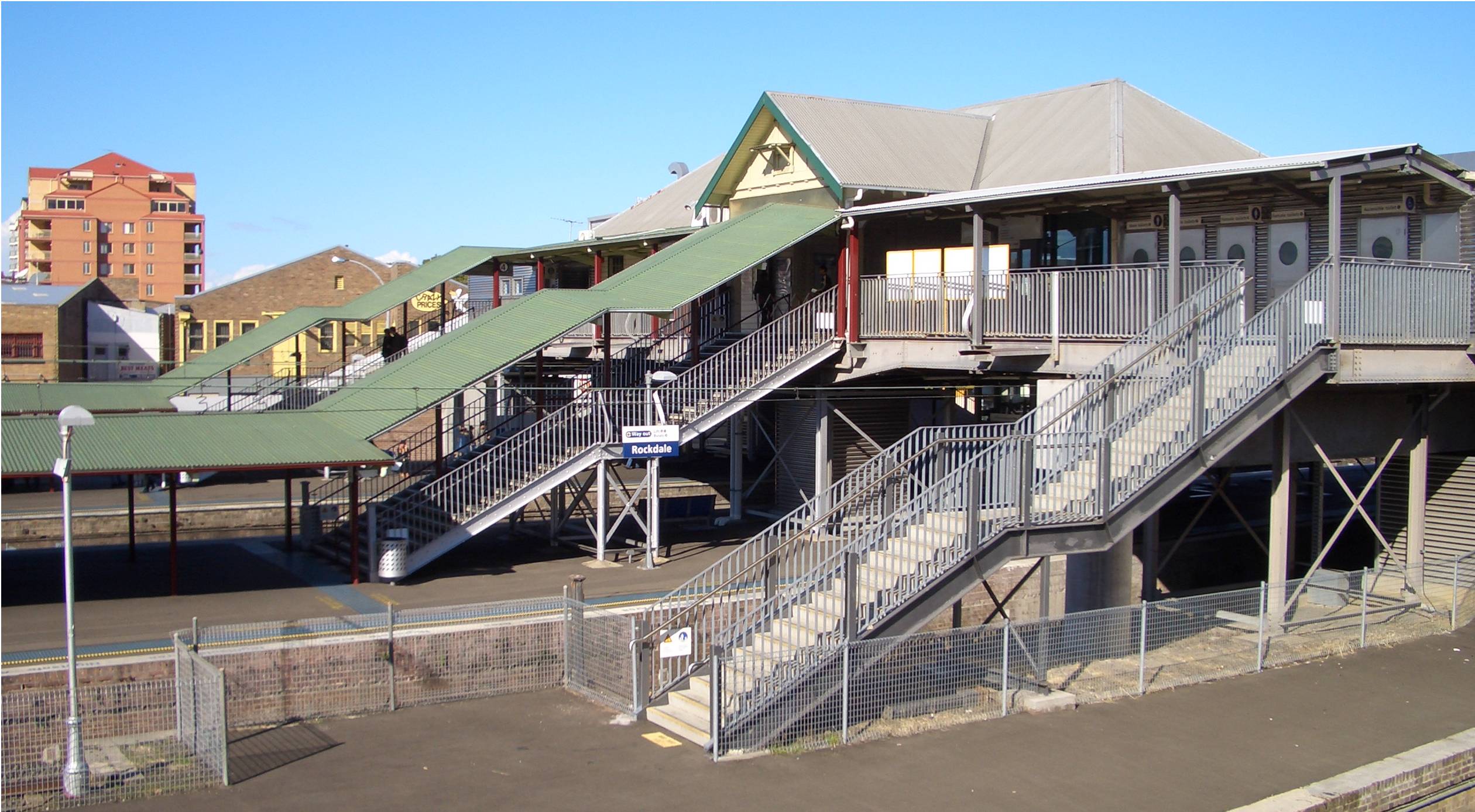
CityRail Illawarra line . Located in theSydney suburb of Rockdale, it serves a residential and commercial area. It is also the administrative centre for the local government area of theCity of Rockdale .There are some sidings for permanent way maintenance vehicles.
Platforms/Service
The station is served by four to six trains per hour, with additional trains in peak hours. Trains to the city leave from platforms 2 and 4, so passengers often prefer to wait at the top of the stairs until their train arrives, as this reduces the chance of going to the wrong platform. Outside of peak hours and on weekends, trains almost exclusively depart from platforms 4 and 5.The station sits beside a major
State Transit Authority bus interchange. Sydney government bus routes such as 400, 410, 471, 472, 476, 477, 478 and 479 serve the station.With theMay 2006 timetable the station is now included on theSouth Coast Line timetable.Platform 1:
*"Not currently in use" - former terminating platform and turnback.Platform 2:
*Illawarra line alt - all stations and limited stops services to Bondi Junction.Platform 3:
*Illawarra line alt - all stations and limited stops services to Hurstville, Mortdale, Sutherland, Cronulla and Waterfall.Platform 4:
*Illawarra line alt - all stations and limited stops services to Bondi Junction.Platform 5:
*Illawarra line alt - all stations and limited stops services to Hurstville, Mortdale, Sutherland, Cronulla and Waterfall and peak hour services to the South Coast LineAccessibility
The station has
Easy Access for wheelchairs. Ramp access is provided on the western side to Railway Street and lift access is provided on the eastern side to Geeves Avenue. Lift access is provided to the platforms.Bus Services
Rockdale Interchange
Stand A:
*425 - to Dulwich Hill - (Marrickville Road).
Stand B:
*476 - to Dolls Point - (Clareville Avenue).
*477 - to Miranda - (Kiora Road).Stand C:
*478 - to Ramsgate - (Ramsgate Road).Selected Weekdays(Monday to Friday) off peak hour services to Miranda - (Kiora Road).
*479 - to Brighton-Le-Sands - (Bay Street & The Grand Pde).Stand D:
*472 - to Five Dock - (First Avenue).
Stand E:
*492 - to Drummoyne - (Lyons & Victoria Roads).
*494 - Weekdays(Monday to Friday) peak hour services - to Campsie - (Beamish Street at Campsie railway station).Stand F:
*400 - limited stops services - to Burwood - (Burwood Road at Westfield).
Stand G:
*452 - to Beverly Hills station.
*453 - to Hurstville station.Stand H:
*400 - limited stops services - to Bondi Junction Interchange.
*410 - Weekdays(Monday to Friday) peak hour limited stops services - to Bondi Junction Interchange.
*471 - to Five Dock - (First Avenue).NightRide:
*N10 - Between Sutherland station and City(Town Hall).
*N11 - Between Cronulla station and City(Town Hall).
*N20 - to Riverwood station.Gallery
Trackplan
Neighbouring stations
External links
*Mapit-AUS-suburbscale|long=151.136658|lat=-33.952051
Wikimedia Foundation. 2010.