- Kingsgrove railway station, Sydney
Cityrail Station alt|station_name=Kingsgrove|
servicearea=Airport & East Hills Line|servicearea_color=#East Hills line colour|servicearea_textcolor=white
code=KGV|suburb=Kingsgrove|street=Mashman Avee|distance=12.62|altitude=?|traintype=Suburban all stops|platforms=2|tracks=4|platform_arr=1 Island|stationtype=Ground|gates=No|connect=Bus|disabled=Yes
facilities= [http://www.cityrail.info/facilities/facilities.jsp?n=142&giveOutput=true&facility= Link]Kingsgrove is a railway station on the East Hills railway line of the
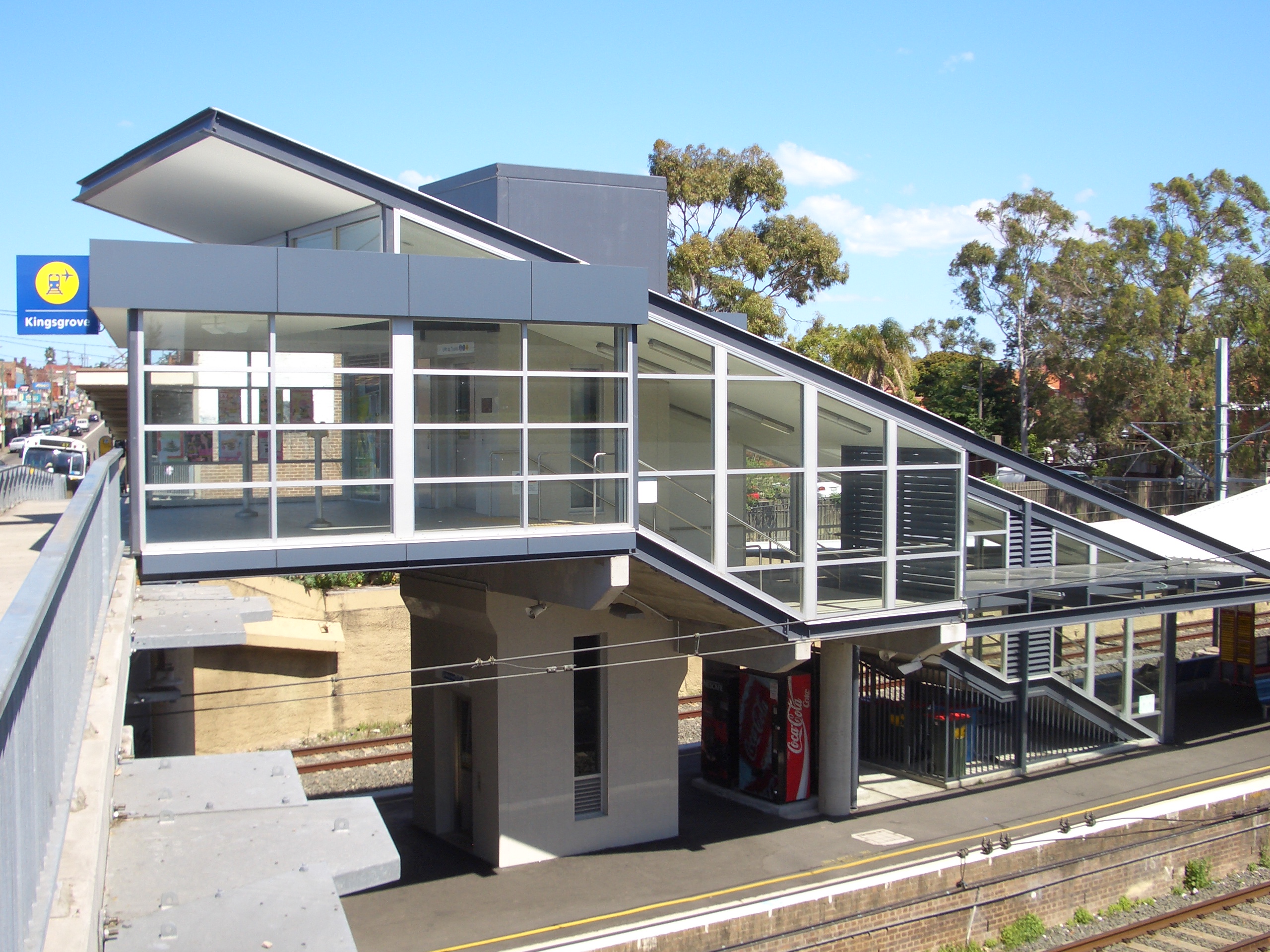
CityRail network inSydney . It serves the suburb of Kingsgrove. Kingsgrove has a single island platform which serves the inner 'local' pair of tracks, the 'main' (express) tracks pass on either side. Kingsgrove retains its original 1930s brick platform building but has had additional platform canopies and entrance built in the intervening years. This station hasEasy Access for wheelchairs. A lift provides access from the western side of Kingsgrove Road to the platform below.History
Kingsgrove railway station opened in 1931, and was the original terminus of the double track electrified section from Tempe. Until 1939, passengers transferred at Kinsgrove to a rail motor or steam service to continue their journey towards East Hillscite web|work=Nswrail.net| title=East Hills Line|url=http://www.nswrail.net/lines/show.php?name=NSW:east_hills| accessdate=25 January| accessyear=2007] . The line was duplicated beyond Kingsgrove in 1948. In 2000, the line was quadruplicated from Wolli Creek Junction to the west of Kingsgrove station as part of the Airport Line project. A turnback was provided at Kingsgrove in association with this project, and it is used in regular timetabled service occasionally. In early 2007, indicator boards on the concourse and platforms were replaced by computer monitors, providing details of train services and arrival times.
By 2010, it is anticipated that 4 tracks will be extended from Kingsgrove to Revesby as part of the Clearways Project.cite web|work=Transport Intrastructure Development Corporation| title=Kingsgrove-Revsby Quadruplication|url=http://www.tidc.nsw.gov.au/ViewSite.aspx?PageID=469| accessdate=21 January| accessyear=2007]
Accident
On the 6th of October 2000, an eight car Tangara train derailed at low speed near Kingsgrove station causing the rear three carriages to topple onto its side. The cause was a track twist as a result of very high temperatures.cite web| work=NSW Ministry of Transport | title=Kingsgrove derailment report released| url=http://www.transport.nsw.gov.au/news/media/2001/13-07-kingsgrove.html| accessdate=30 December | accessyear=2006] Ten people were hospitalised.cite web| work=Emergency Management Australia | title=Train derailment, Sydney| url=http://www.ema.gov.au/ema/emadisasters.nsf/0/e0054af0c86592c5ca256d330005aea5?OpenDocument| accessdate=30 December | accessyear=2006]
Platforms/Services
From opening until 1987, Kingsgrove was essentially served by all stations trains with occasional peak hours limited stop services. Following the opening of the East Hills- Glenfield extension in 1987, Kingsgrove was served by both all-stations local services and was a stopping point for limited stop services to Campbelltown and Macarthur. Frequency is approximately 6 trains per hour on weekday daytimes- 4 local and 2 limited stop services, with reduced frequencies on nights and weekends.
Platform 1:
*East Hills line colour>Airport & East Hills Line - all stations and limited stops services to Central and theCity Circle (anticlockwise).Platform 2:
*East Hills line colour>Airport & East Hills Line - all stations and limited stops services to East Hills, Glenfield, Campbelltown and Macarthur.Transport Links
Sydney Buses runs three routes via Kingsgrove station:
*Route 411 - West toRoselands viaBeverly Hills , East to Ashfield station viaBexley North ,Earlwood ,Dulwich Hill
*Route 492 - North toDrummoyne via Campsie, Croydon Park, Burwood, Croydon,Five Dock ,Russell Lea , South to Rockdale station via Bexley.
*Route 494 - North to Campsie, South to Rockdale station via Bexley.
Veolia Transport runs one route to and from Kingsgrove railway station:
*Route 455 -Rockdale Plaza .
NightRide runs one route via Kingsgrove station:
*Route N20 - Between Riverwood station and Rockdale station .Gallery
ee also
*
Railways in Sydney
*Railway accidents in New South Wales Notes and References
External links
Wikimedia Foundation. 2010.