- Croydon Park, New South Wales
-
Croydon Park
Sydney, New South Wales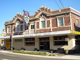
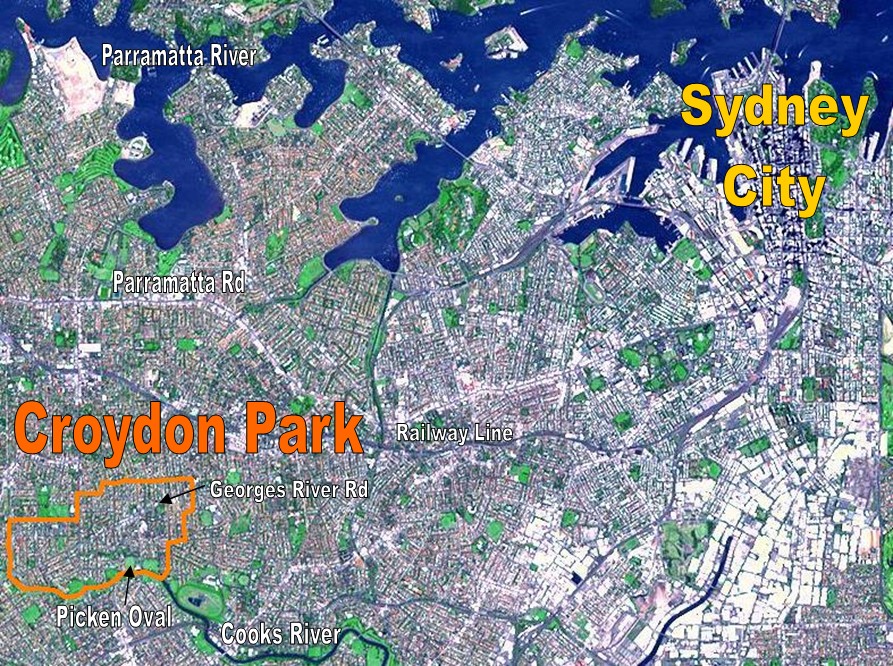
Croydon Park HotelPopulation: 10,549 (2001 census) Established: 1914 Postcode: 2133 Location: 13 km (8 mi) south-west of Sydney CBD LGA: City of Canterbury, Burwood Council, Municipality of Ashfield State District: Canterbury Federal Division: Watson Suburbs around Croydon Park: Enfield Burwood Heights Croydon South Strathfield Croydon Park Ashfield Belfield Campsie Ashbury  NASA image of Sydney's CBD and inner west suburbs, with borders of Croydon Park shown in orange
 But-Har-Gra, Georges River Road, part of Moore Theological College
Croydon Park is a suburb, in the inner-west of Sydney, in the state of New South Wales, Australia. Croydon Park is about 13 kilometres south-west of the Sydney central business district and is divided between the local government areas of the City of Canterbury, Burwood Council and Municipality of Ashfield. Croydon is a separate suburb, to the north.
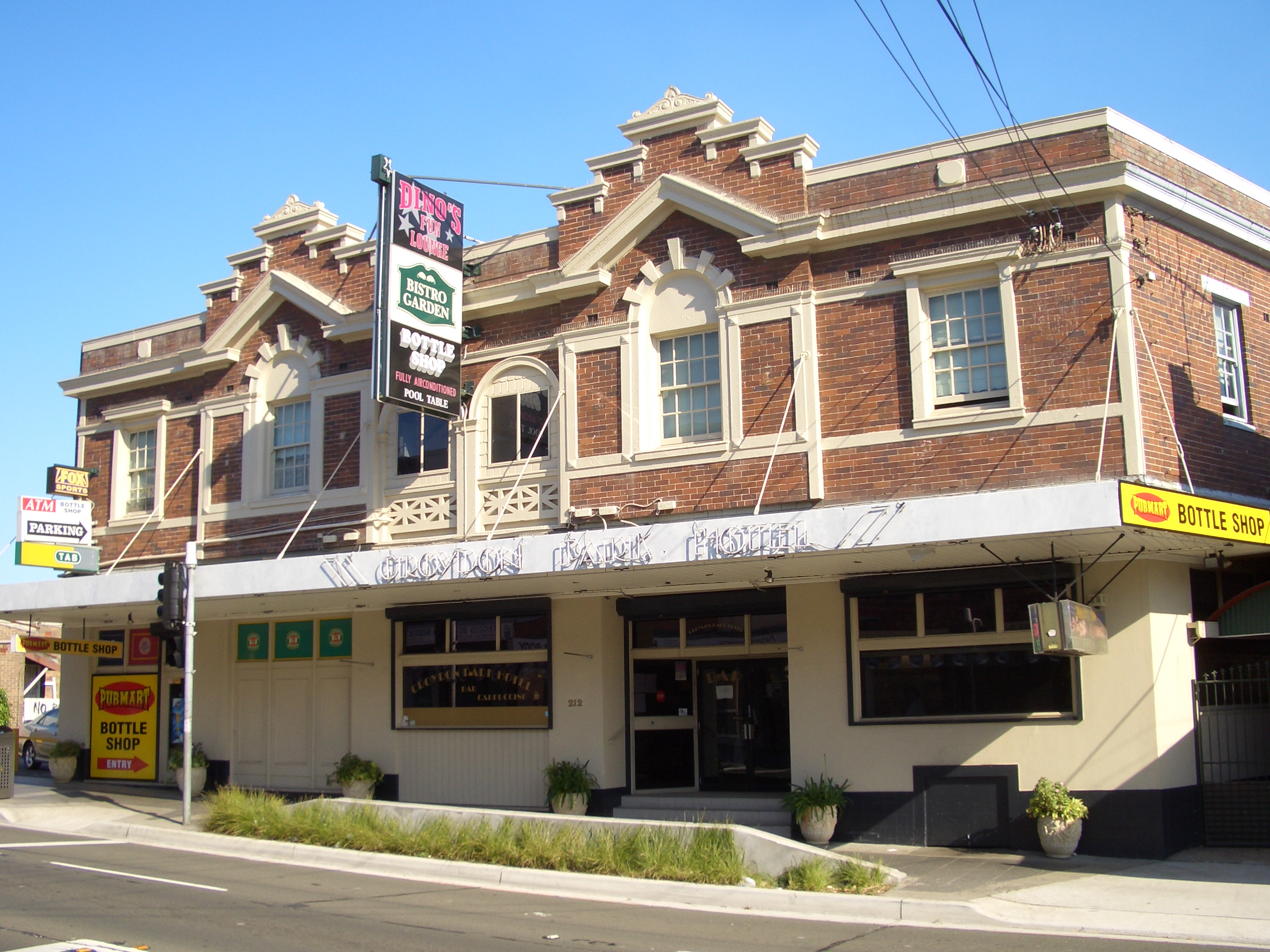
Croydon Park has a small commercial area along Georges River Road but is close to larger shopping areas in Burwood, Ashfield and Campsie. Croydon Park is a small residential suburb with many stores, particularly family owned such as Pure Gelato, Little Italy Restaurant, Little Thailand, Domino's, Croydon Park Chinese Restaurant and ANAR Charcoal Chicken. The local area is quite multicultural and this is reflected in the variety of cuisines available in restaurants in neighbouring suburbs.
Contents
History
Croydon Park was originally part of the territory of the Darug tribe which occupied much of Sydney. More specifically, it was probably home to the Wangal clan (based around Concord) but may also have been home to the Cadigal (Sydney) or Bideagal (Botany Bay) clans. There were middens along the Cooks River where the indigenous people camped. These were destroyed by early British settlers to make lime for mortar in buildings.[1]
In 1878 and 1880, following the building of a railway station at Croydon to the north, two large subdivisions of land were undertaken using the name Croydon Park. These constituted the entire area of the current suburb. A piece of flood-prone land at the junction of Croydon Road and the Cooks River was reserved as a public park. Given the name Croydon Park, it was the first reserve in the City of Canterbury. Early settlers included many people involved in the building trade and Chinese market gardeners.[2]
A primary school was established in 1886 to cater for the increasing number of children in the area. Mains water was connected in 1889 and sewerage in the 1910s. The Parents and Citizens Association at the public school believed that residents were rather left out of regular postal deliveries and a petition was prepared for their member of parliament asking for a Croydon Park post office to be opened in the area. They were successful in 1914 and the surrounding neighbourhood became a separate suburb.[1]
Transport
There is no train station at Croydon Park, but it is well serviced by buses to neighbouring stations. The 413 is the most significant service connecting to both the city and Campsie. The 400 is also a major orbital bus route travelling from Burwood to Bondi Junction via Croydon Park, Campsie, Rockdale, Sydney Airport and Eastgardens. Other services include:
- 462 & 464 Ashfield to Mortlake via Croydon Park and Burwood
- 466 Ashfield to Cabarita via Croydon Park and Burwood
- 490 Drummoyne to Hurstville via Burwood, Croydon Park and Campsie
- 492 Drummoyne to Rockdale via Burwood, Croydon Park and Campsie
There is also a cycleway along the Cooks River connecting Olympic Park at Homebush with Botany Bay.
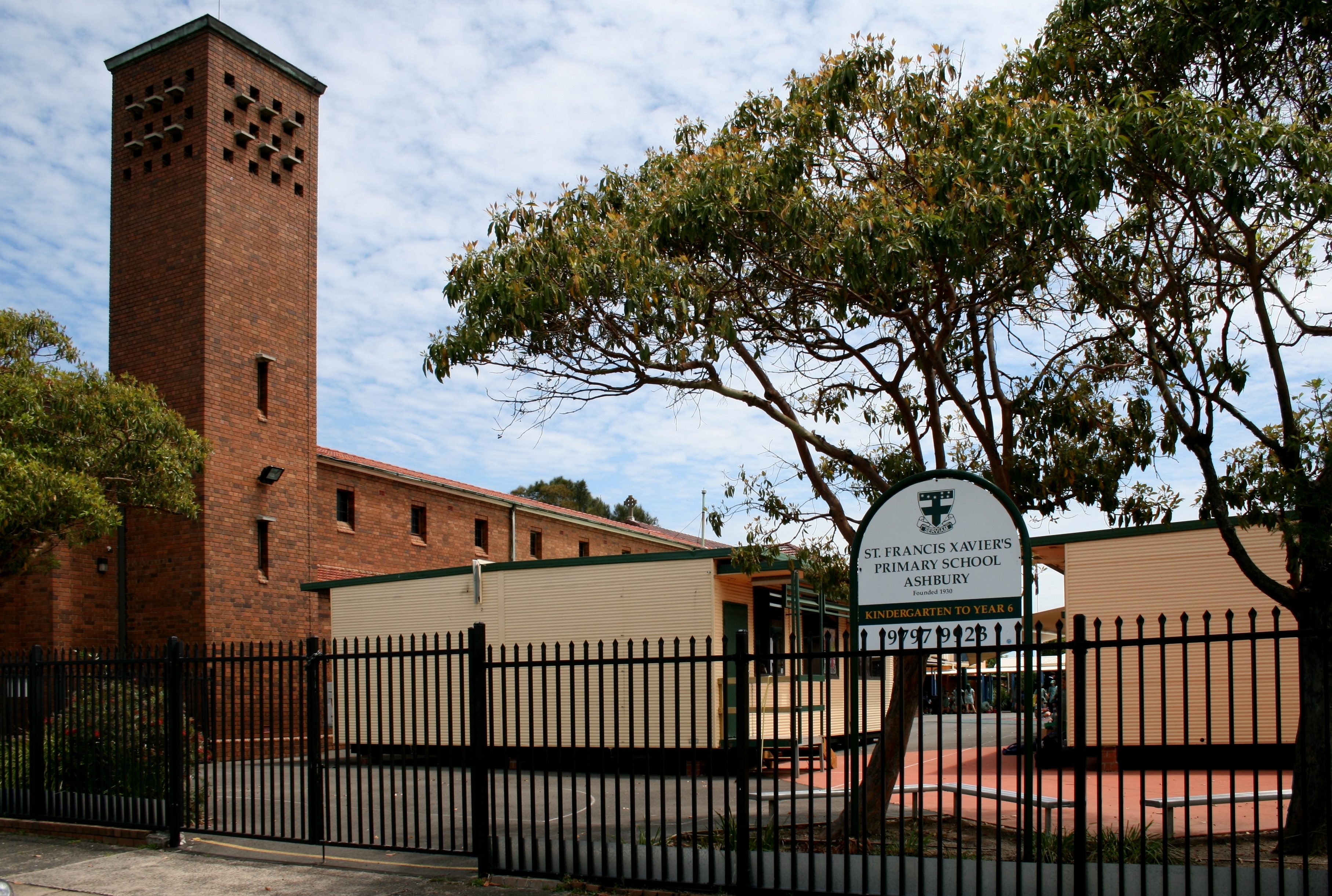
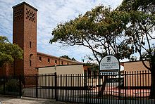 St. Francis Xavier's Catholic Primary School (with the church tower on the left).
Schools
There are two primary schools in Croydon Park: Croydon Park Public School and St Francis Xaviers Catholic School. But-Har-Gra on the Georges River Road is part of Moore Theological College.
Parks
Croydon Park, commonly mistaken for Croydon, boasts numerous parks and parklands, particularly close to the Cooks River. Picken Oval is home to the Western Suburbs Magpies Australian Rules team and is currently under redevelopment. Lees Park is a homeground of Canterbury Junior Soccer Association. Other parks and reserves include Flockhart Park, Rosedale Reserve and Croydon Park.
Population
Demographics
According to the 2001 census, Croydon Park had a population of 10,549 in 4,220 dwellings. These properties were mostly separate houses (58%) and flats (26%) with the remainder being terraces, semi-detached or townhouse style dwellings. There are a large number of migrants in the area with 45% of the population born overseas. The most common places were Italy (6.6%), Lebanon (4.0%) and China (3.8%). Almost half the population (46%) were Roman Catholics with small numbers of Anglicans (11%) and Orthodox (8%).
Notable residents
- Frederick Frost (1891-1971): twice awarded the Distinguished Conduct Medal during World War I.
- Clifford Hay (1878-1949): chief public servant to seven NSW premiers starting with William Holman in 1916.
- Brett Holman (1984-): Australian international soccer player who grew up in Croydon Park.
- Jack Mundey (1929-): union and environmental activist.
- Edward Pierson Ramsay (1842-1916): curator of the Australian Museum from 1874-1894.
- Grahame Thomas (1938-): Australian Test cricketer.
- Nikki Webster (1987-): Pop singer and performer at the 2000 Sydney Olympics opening ceremony.
Politics
Voting in Croydon Park since 2000 Elections Fed01[3] NSW03[4] Fed04[5] NSW07[6] Two Party Preferred Results Labor 56% nr 56% 68% Liberal 44% nr 44% 32% First Preference Results Labor 48% 53% 44% 55% Liberal 40% 30% 40% 28% Greens 4% 9% 10% 8% Unity Party 1% 3% nc 4% Christian Democrats nc nc 1% 4% Democrats 4% 1% 1% 1% Croydon Park is divided between three local government areas and as a result is frequently divided between different state and federal electorates as well. For the 2007 federal election, it will be wholly within the division of Lowe [7], represented by John Murphy, although in 2004 part had been in the neighbouring seat of Watson. Georges River Road is used as the boundary between the state seats of Strathfield, represented by Virginia Judge and Canterbury, represented by Linda Burney[8]. In local government elections, City of Canterbury residents are part of East Ward [9] represented by two Labor councillors and one Independent. The Municipality of Ashfield residents are in South Ward, currently represented by two Labor councillors and one Green. Burwood Council doesn't divide into wards so Croydon Park residents in that part are represented by the entire council composed of three Labor councillors, three Independent and one Unity councillor. Recent elelction results as shown in the attached table indicate the area is generally considered a Labor area but not always as strongly Labor as some other parts of the Inner West.
References
- ^ Book of Sydney Suburbs, Frances Pollon (Angus and Robertson) 1990, p.76
External links
- Croydon Park, New South Wales is at coordinates 33°53′48″S 151°06′34″E / 33.89679°S 151.10951°ECoordinates: 33°53′48″S 151°06′34″E / 33.89679°S 151.10951°E
Suburbs and localities within Burwood Council · Inner West · Sydney Burwood · Burwood Heights · Croydon · Croydon Park · Enfield · Strathfield
List of Sydney suburbs Suburbs and localities within the Municipality of Ashfield · Inner West · Sydney Ashbury · Ashfield · Croydon · Dobroyd Point · Haberfield · Hurlstone Park · Summer Hill
List of Sydney suburbs Suburbs within the City of Canterbury · South-western Sydney · Sydney Ashbury · Belfield · Belmore · Campsie · Canterbury · Clemton Park · Croydon Park · Earlwood · Hurlstone Park · Kingsgrove · Lakemba · Punchbowl · Riverwood · Roselands · Undercliffe · Wiley Park
List of Sydney suburbs Categories:- Suburbs of Sydney

![[8]](http://www.elections.nsw.gov.au/__data/assets/image/2132/sydmetro.gif)
Wikimedia Foundation. 2010.