- Clemton Park, New South Wales
-
Clemton Park
Sydney, New South Wales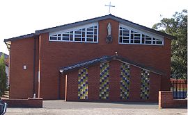
St Bernadettes Catholic Church, Bexley Road & William Street intersectionPostcode: 2206 Location: 13 km (8 mi) south-west of Sydney CBD LGA: City of Canterbury State District: Electoral district of Lakemba Federal Division: Division of Watson Suburbs around Clemton Park: Belmore Campsie Canterbury Roselands Clemton Park Earlwood Beverly Hills Kingsgrove Bexley North  William Street & Bexley Road intersection
Clemton Park is a suburb in south-western Sydney, in the state of New South Wales, Australia. Clemton Park is located 13 kilometres south-west of the Sydney central business district in the City of Canterbury. A small group of shops is located at the intersection of Bexley Road and William Street. A reserve called Clemton Park is located on Moorefields Road. Clemton Park Public School, located on Bexley Road, is for years K-6.History
This area was part of the 50-acre (200,000 m2) Laycock estate granted to Hannah Laycock (1758-1831), the wife of Quartermaster Thomas Laycock (1756-1809), in 1804.
Frederick Moore Clements, who became wealthy from selling the family health restorer, Clements Tonic, owned 40 acres (160,000 m2) near William Street until his death in 1920. 'Clementon Park' was an early suggestion for the suburb’s name but records show Clemton Park was used from 1925. [1]
References
- ^ The Book of Sydney Suburbs, page 63, Compiled by Frances Pollen, Angus & Robertson Publishers, 1990, Published in Australia ISBN 0-207-14495-8
External links
- Clemton Park, New South Wales is at coordinates 33°55′48″S 151°06′23″E / 33.93009°S 151.10631°ECoordinates: 33°55′48″S 151°06′23″E / 33.93009°S 151.10631°E
Suburbs within the City of Canterbury · South-western Sydney · Sydney Ashbury · Belfield · Belmore · Campsie · Canterbury · Clemton Park · Croydon Park · Earlwood · Hurlstone Park · Kingsgrove · Lakemba · Punchbowl · Riverwood · Roselands · Undercliffe · Wiley Park
Categories:- Suburbs of Sydney
- Sydney geography stubs


Wikimedia Foundation. 2010.