- Narwee, New South Wales
-
Narwee
Sydney, New South Wales
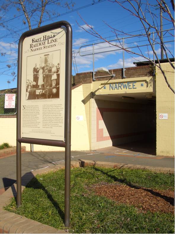
Shops on the south side of Broad Arrow RoadPostcode: 2209 Location: 18 km (11 mi) south of Sydney CBD LGA: City of Hurstville, City of Canterbury (New South Wales) State District: Oatley, Lakemba Federal Division: Banks, Watson Suburbs around Narwee: Roselands Roselands Roselands Riverwood Narwee Beverly Hills Peakhurst Penshurst Beverly Hills 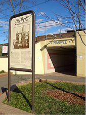 Hannans Road subway, the main access to Narwee railway station
Narwee is a suburb in southern Sydney, in the state of New South Wales, Australia. Narwee is located 18 kilometres south of the Sydney central business district and is part of the St George area. Narwee lies across the local government areas of the City of Hurstville and the City of Canterbury. The postcode is 2209, which it shares with neighbouring Beverly Hills.
The main street of Narwee is Broad Arrow Road, which runs from King Georges Road in Beverly Hills to just past Bonds Road in Riverwood. Broadarrow Road is also the boundary line between the northern part in the City of Canterbury, and the southern part in the City of Hurstville.
Contents
History
Narwee is an Aboriginal word meaning "sun", an appropriate name for an area once called 'Sunning Hill Farm'.[1] The language and dialect it was derived from is unclear. A number of Sydney suburbs developed during the 1930s have similar allegedly Aboriginal names, the origins of which are uncertain, including nearby Panania, and Jannali. Jannali supposedly means "moon" and was apparently named at the same time as Narwee, as a "sister suburb".
The name Narwee was adopted when the railway station opened on the 21st December 1931. People living there at the time were mostly poultry farmers and market gardeners, and a city florist had a large garden west of the railway station. After the railway came through, people bought up land for residences. Little building was done during the Depression and World War II, but the suburb grew rapidly in the 1950s, when the area was settled by young families. The post office opened in 1948.
Narwee Primary School is built on land given in 1809, to Richard Podmore, a free settler, who came to New South Wales as a soldier in the N.S.W. Corps in 1792, on the ship "Pitt". Land between today's Penshurst Road and King Georges Road belonged to Richard Tuckwell, another soldier from the same Company. At the time of the land, the area was covered with a very thick ironbark forest.
Tuckwell and Podmore sold their grants to Patrick Moore and Robert Gardner, both ex-convicts, in 1819 and 1820, and "Bob the Gardener", as he was known, began to clear trees and develop a farm on Podmore's grant, which he called "Sunning Hill Farm". The property was later extended to cover Emery's 30-acre (120,000 m2) grant next door. This was farmed by Gardner's adopted son, Thomas Gardner Whitehall.
At that stage there were very few farms in the district. Men earned a living by cutting down the trees and selling the logs for firewood and timber to build houses and boats. Narwee did not exist as a locality; it was called "Bob the Gardner's Farm", and there were so few people living in the area that bushrangers could easily hide for weeks in the forest without being discovered.[2]
Commercial area
The main shopping strip is located in Broad Arrow Road parallel with and adjacent to Narwee railway station. Like many small suburbs, Narwee was formerly served by two banks (Westpac and Commonwealth) and many small shops. Both banks have now closed, although the post office remains.
Transport
Narwee railway station is on the East Hills line of the CityRail network, with Riverwood to the west and Beverly Hills to the east. This station is served by an 'all stations' service that runs every 15 minutes on weekdays, and half hourly on weekends.
Churches
The largest church in the area is Narwee Baptist Church.[3]
Schools
Narwee has a public school and once had a high school. Narwee High School was located at the suburb's highest point but closed in 2001. It has been redeveloped into a complex of residential houses.
Population
According to the 2006 Australian Bureau of Statistics Census of Population, there were 5,021 people usually resident in Narwee. 43.5 % stated they were born overseas with the top countries of birth being China 13.1%, Hong Kong 3.9% and Greece 2.1%. English was stated as the only language spoken at home by 45.1% of residents and the most common other languages spoken were Cantonese 15.4%, Mandarin 8.7% and Arabic 6.0%. The most common responses for religious affiliation were Catholic 24.3%, Anglican 11.7% and Orthodox 8.2%.[4]
References
- ^ The Book of Sydney Suburbs, Compiled by Frances Pollon, Angus & Robertson Publishers, 1990, Published in Australia ISBN 0-207-14495-8, page 184
- ^ http://www.canterbury.nsw.gov.au/www/html/869-history-of-narwee.asp History of Narwee
- ^ http://www.narweebaptist.org.au/
- ^ http://id.com.au/dosydney/Default.aspx?pg=1&gid=4350
Coordinates: 33°56′51″S 151°04′15″E / 33.94762°S 151.07093°E
Suburbs and localities within the City of Hurstville · St George · Sydney Beverly Hills · Hurstville · Kingsgrove · Lugarno · Mortdale · Narwee · Oatley · Peakhurst · Peakhurst Heights · Penshurst · Riverwood
Suburbs within the City of Canterbury · South-western Sydney · Sydney Ashbury · Belfield · Belmore · Campsie · Canterbury · Clemton Park · Croydon Park · Earlwood · Hurlstone Park · Kingsgrove · Lakemba · Punchbowl · Riverwood · Roselands · Undercliffe · Wiley Park
Categories:- Suburbs of Sydney

Wikimedia Foundation. 2010.