- Mortdale, New South Wales
-
Mortdale
Sydney, New South Wales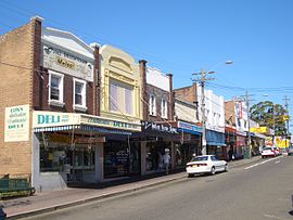
Morts Road, MortdalePostcode: 2223 Location: 17 km (11 mi) south of Sydney CBD LGA: City of Hurstville, Municipality of Kogarah State District: Oatley Federal Division: Banks Suburbs around Mortdale: Peakhurst Beverly Hills Penshurst Peakhurst Mortdale Penshurst Peakhurst Heights Oatley Hurstville Grove  Mortdale Memorial Park
 Lime Kiln Bay
Mortdale is a suburb in southern Sydney, in the state of New South Wales, Australia. Mortdale is located 20 kilometres south of the Sydney central business district and is part of the St George area. Mortdale lies across the local government areas of the City of Hurstville and Municipality of Kogarah. Mortdale extends south to Lime Kiln Bay, on the Georges River. Mortdale Heights is a locality in the south-western corner of the suburb, in which all but one street names start with "B".
Contents
History
Mortdale has been known in the past as Mort's Road, Mort's Hill, Mort's Township and Mort Dale. It was named after wool merchant Thomas Sutcliffe Mort (1816-1878) who was famous for pioneering the refrigeration of shipping meat and the construction of Mort's Dock, Balmain. Thomas Mort purchased the land from Robert Townson (1763-1827), who had been granted land in the Hurstville area with his brother John Townson.
In 1855, a small farming community started when the land around Mort's Road was subdivided into 17 farms. The Hurstville Steam Brick Company (better known as Judds Brickworks) was established in 1884 by William George Judd. The large brick-making chimneys were easily seen from around the district. The railway was extended through the district around the same time. The railway divided two of the main farms, Kemp’s orange orchard and Parkes’s farm near Victoria Avenue, and these were subdivided for housing by 1894. The railway station opened as Mortdale on the 20th March 1897.
The school opened in January 1889, and the post office and grocery store opened in November. Mortdale became a popular residential suburb in 1920s for soldiers returning from World War I.[1]
In 1921, there was a movement for Mortdale to form a separate municipality. An official 1923 inquiry into the proposed Municipality of Mortdale decided against the change, despite the separation movement having the law behind them.
Commercial area
Mortdale consists mainly of residential dwellings with some commercial and industrial developments in the north-west corner. The main shopping centre is located on Morts Road and Pitt Street, near Mortdale railway station. Commercial and industrial developments are located along Boundary Road.
A number of streets near the commercial area are named after notable streets in the Sydney CBD; These include: George Street, Martin Place, Pitt Street, Macquarie Place and Oxford Street. This is the only group of Sydney-wide streets named as such.
-

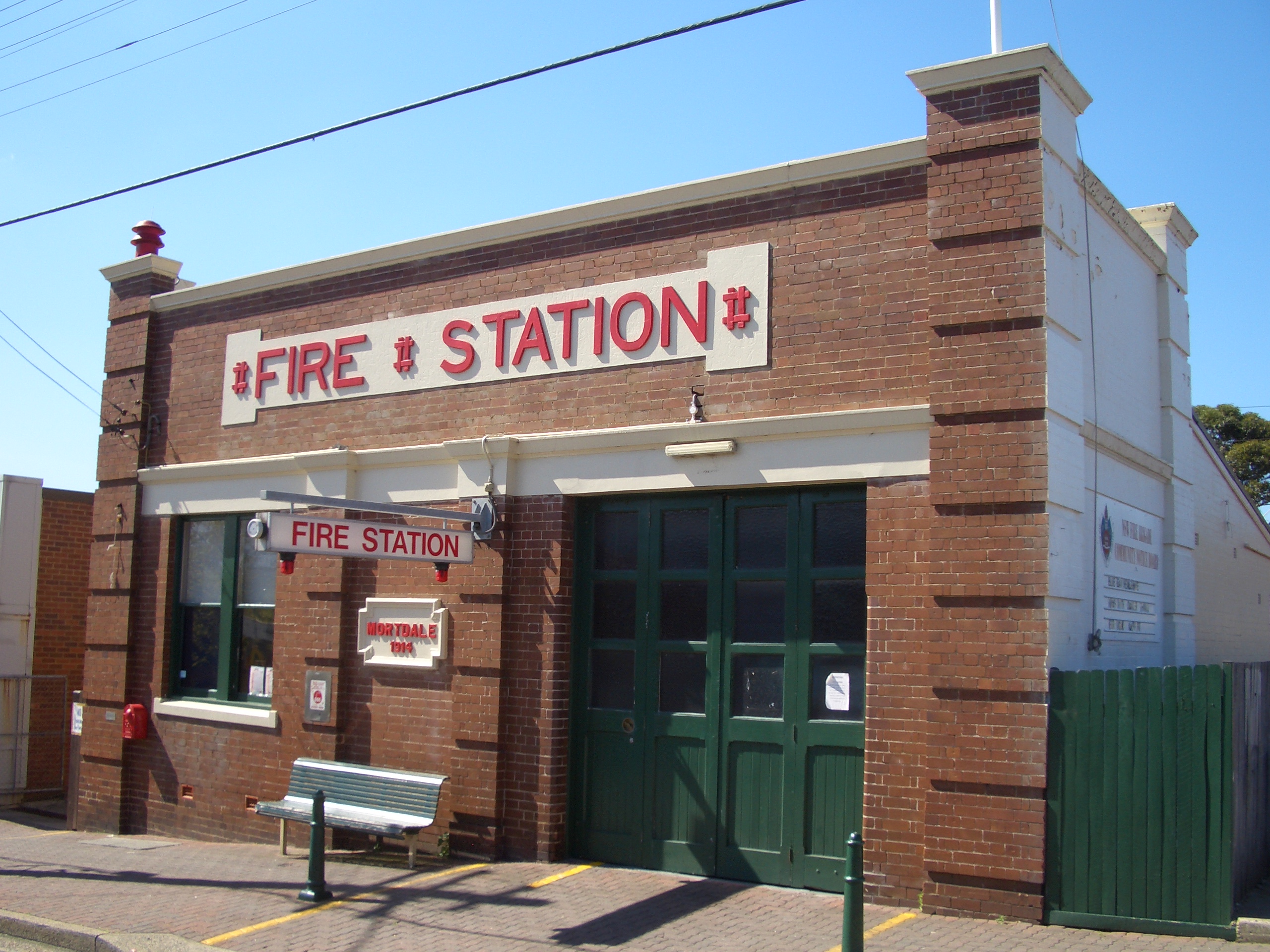
Mortdale Fire Station
-
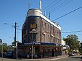
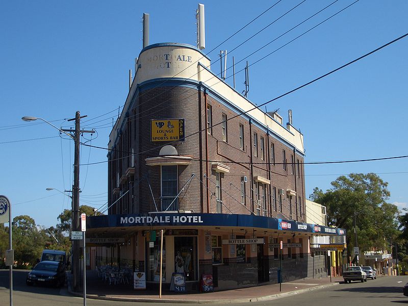
Mortdale Hotel
-

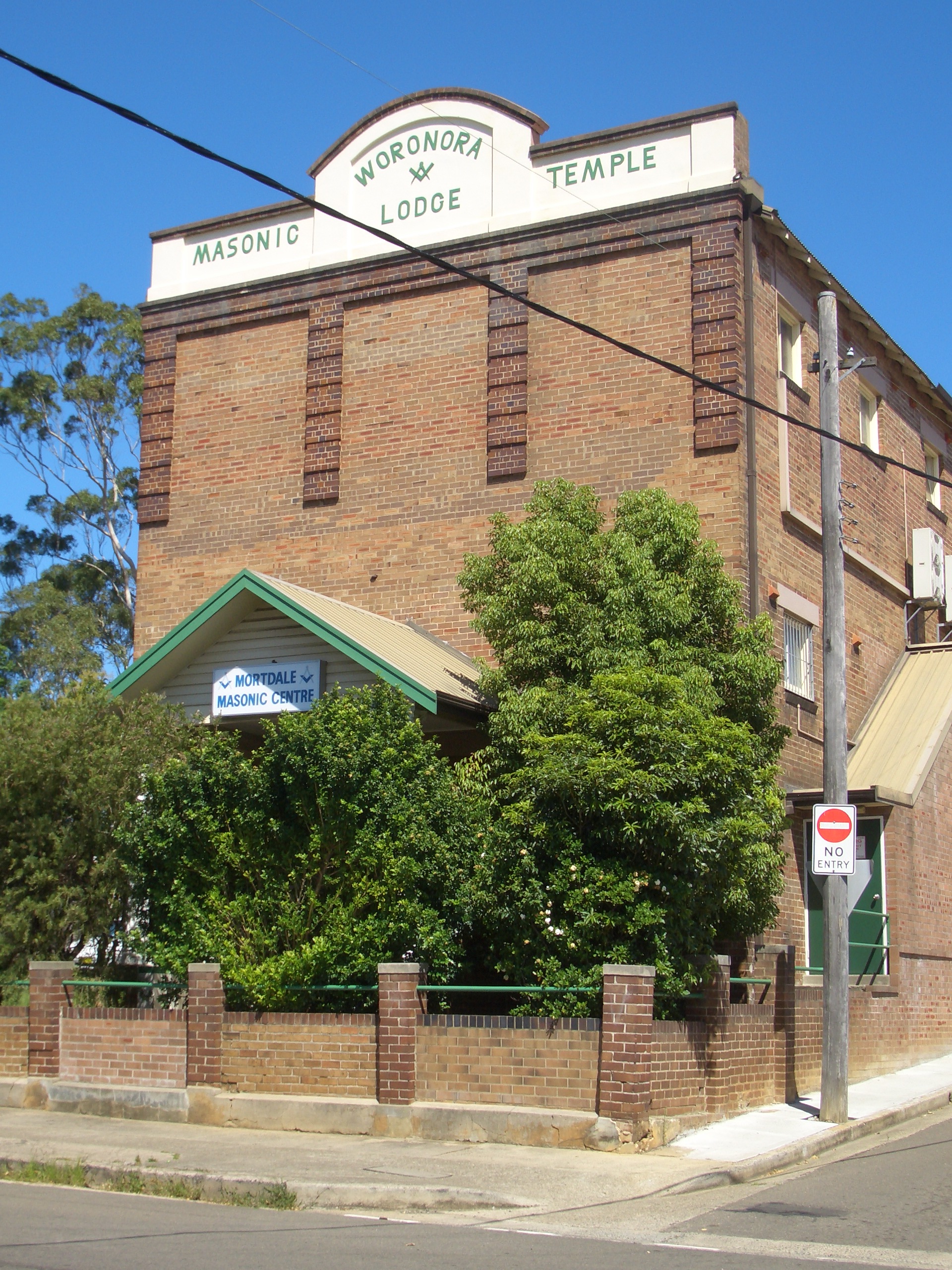
Woronora Lodge, Mortdale Masonic Centre (now demolished)
Transport
Mortdale railway station is on the Illawarra line of the CityRail network. Punchbowl bus services 944 and 945 run throughout the week, with limited services on weekends.
Churches
- Christ Church Anglican Mortdale
- Mortdale Uniting Church
- Church of Jesus Christ of Latter Day Saints (Mormons)
- Hurstville District Christadelphian Ecclesia[2]
Schools
- Mortdale Public School [3]
- Carinya Special School
- Marist College Penshurst
- Penshurst West Public School
Parks and waterways
- Mortdale Memorial Park, Oatley Heights Park, Olds Park, Renown Park, Jubilee Park, Edith Park, Beatty Street Reserve, Paddy Tyler Reserve, Hurstville Golf Course
- Lime Kiln Bay, Georges River
Landmarks
- Historic Buildings - Mortdale Fire Station, Old Police Station, Mortdale Hotel, Mortdale railway station, Mortdale RSL Club, Mortdale Bowling Club, St George Masonic Club, Mortdale Scout Hall, Mortdale Senior Citizens Centre, Ellen Subway underpass.
- Mortdale Memorial Park - Contains a perimeter of large Moreton Bay Fig trees, a classical rotunda and a decorative War Memorial. The park is popular for picnics, weddings, and concerts.
Pop culture
Mortdale has been colloquially referred to as the "Valley of the Dead" or "Death Valley", due to the Latin mort ("death")[4] and English dale ("valley"). Mortdale is also colloquially referred to as "Morty", often in relationship with the hotel. In 1992, Su Cruickshank, published a book entitled 'Bring A Plate to The Mortdale Scout Hall - The Autobiography of a Fat Tart Complete with Recipes'.
Population
Demographics
According to the 2006 Australian Bureau of Statistics Census of Population, there were 9,554 people usually resident in Mortdale. 38.6% stated they were born overseas with the top countries of birth being China 5.5%, United Kingdom 3.1% and Macedonia 2.5%. English was stated as the only language spoken at home by 64.5% of residents and the most common other languages spoken were Cantonese 5.2%, Mandarin 4.6% and Macedonian 4.4%. The most common responses for religious affiliation were Catholic 26.7%, Anglican 18.5% and Orthodox 4.4%.lll [5]
Notable residents
- Mark Gasnier - St George Rugby League Footballer
- Reg Gasnier - St George Rugby League Footballer
- Ronald Sharp - designed & built the Sydney Opera House organ
- Billy Smith - St George Rugby League footballer
References
- ^ Book of Sydney Suburbs, Frances Pollon (Angus and Robertson) 1990, page 178
- ^ Hurstville Christadelphians
- ^ Mortdale Public School
- ^ Latin Dictionary University of Notre Dame. Retrieved on 15/12/07
- ^ http://id.com.au/dosydney/default.aspx?pg=1&gid=4170
Coordinates: 33°58′10″S 151°04′11″E / 33.96932°S 151.06969°E
Suburbs and localities within the City of Hurstville · St George · Sydney Beverly Hills · Hurstville · Kingsgrove · Lugarno · Mortdale · Narwee · Oatley · Peakhurst · Peakhurst Heights · Penshurst · Riverwood
Categories:- Suburbs of Sydney
- Populated places established in 1855
-

Wikimedia Foundation. 2010.