- Georges River
Infobox River
river_name = Georges River
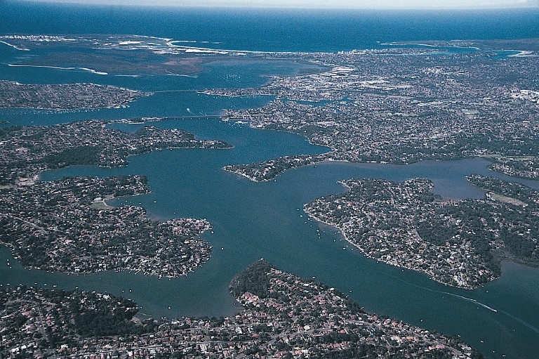
caption = The lower reaches of Georges River
origin = Appin
mouth =Botany Bay
basin_countries =Australia
length = 96km [http://www.campbelltown.nsw.gov.au/default.asp?iSubCatID=1448&iNavCatID=1402 Georges River information page, "Campbelltown City Council"] ]
elevation = 350mabc]
discharge =
watershed = 960km2abc]The Georges River is a waterway in the state of
New South Wales inAustralia . It rises to the south-west ofSydney near the coal mining town of Appin, and then flows north past Campbelltown, roughly parallelling the Main South Railway. At Liverpool it then turns east and flows past suburbs such as East Hills, Lugarno, Bangor and Blakehurst, before emptying intoBotany Bay atTaren Point in the southern suburbs of Sydney.Major tributaries include
Cabramatta Creek , Prospect Creek,Salt Pan Creek and theWoronora River . The Georges River is popular for recreational activities such as water skiing and swimming. The banks of the river along the lower reaches are marked by large inlets and indentations overlooked by steep sandstone ridges and scarps, many being home to expensive residential properties.The Georges River features some artificial lakes in the suburb of Chipping Norton, near Liverpool. These lakes, known as the Chipping Norton Lakes, are the result of sand mining and quarrying operations in the twentieth century. The Lakes are now a popular watersports and recreational facility for the residents of the south-western suburbs of
Sydney .A
weir was constructed across the river adjacent to Liverpool railway station in the nineteenth century — Liverpool Weir now forms the uppermost tidal limit and presence of salt water on the Georges River.There are currently three main Road crossings of the Georges River; Captain Cook Bridge (connecting Sans Souci to Taren Point), Tom Ugly's Bridge (connecting Blakehurst to Sylvania) and Alfords Point Bridge (connecting Padstow to Alfords Point).
Fish Inhabitants of the Georges river
The Georges River is a popular area for recreational fishing. Species present in the river include bream, whiting, yellowtail, jewfish and flathead. The river is also host to a number of commercial oyster farms. The upper ends of the Georges River are abundant with Bass during the summer months and during the winter months these bass migrate down to the Lower ends of the georges river towards the salt water to breed. Waste water inflows to the river are carefully managed to maintain the estuarine habitat.
History
The Georges (formerly George's) River was named after King George III, by Governor
Arthur Phillip .ee also
*
Georges River National Park References
Wikimedia Foundation. 2010.