- Oatley, New South Wales
-
Oatley
Sydney, New South Wales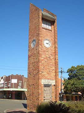
Oatley Clock Tower, Frederick StreetPopulation: 9,530 (2006 Census) Established: 1903 Postcode: 2223 Location: 18 km (11 mi) south of Sydney CBD LGA: Hurstville, Kogarah State District: Oatley Federal Division: Banks Suburbs around Oatley: Mortdale Penshurst Hurstville Grove Peakhurst Heights Oatley Connells Point Lugarno Como Oyster Bay Oatley is a suburb in southern Sydney, in the state of New South Wales, Australia. Oatley is located 21 kilometres south of the Sydney central business district and is part of the St George area. Oatley lies across the local government areas of the City of Hurstville and Municipality of Kogarah.
Contents
History
This suburb's name can be traced to James Oatley snr, watch-maker, who was transported to Botany Bay for life in 1814. Seven years later, in 1821, Governor Lachlan Macquarie granted Oatley a conditional pardon and appointed him overseer of the Town Clock for his work in installing the clock at Hyde Park Barracks.[1][2]
When a group gathered in Oatley Park in December, 1959, to form a Bowling Club, it was inevitable that the founding members should choose a clock as the club emblem. The hands on the clock were set at 15 minutes after 10 - the precise time the first meeting of the Oatley Bowls Club was opened.[3] The Club has since closed, though the greens and Club premises remain.[4]
The post office opened in 1903, thus giving the district its official suburban name of Oatley. Prior to this, the area west of the railway line was officially in the suburb of Hurstville and attached to the Hurstville Post Office with "Oatley's" in parenthesis at the end of the address. Likewise, the streets east of the railway line were officially in the suburb of Kogarah and attached to the Kogarah Post Office. In the late 1890s both Hurstville and Kogarah were much larger suburbs and were later divided up into separate suburbs.
Oatley is notable as the terminus of the first railway electrification project in Sydney, which reached this station from Sydney Central in 1926.
The Oatley campus of Alexander Mackie College of Advanced Education opened in 1981 on the site of the former Judd's Brick Works and quarry.In 1981, when many teacher's colleges were amalgamated, it became The St George Institute of Education, part of Sydney College of Advanced Education, and then a campus of the University of New South Wales. It is now a secondary school, the Oatley Senior Campus of the Georges River College.
Commercial area
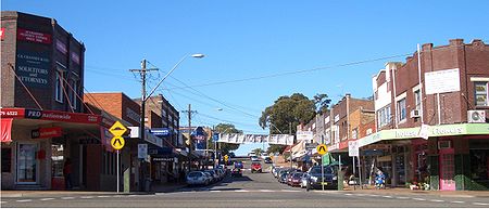

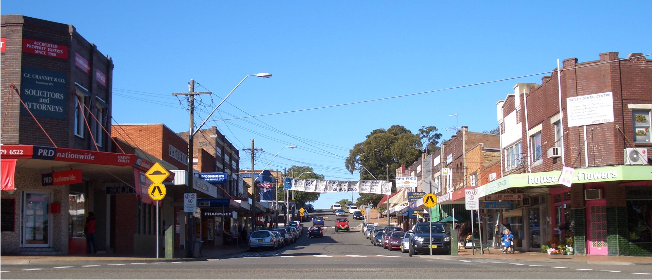
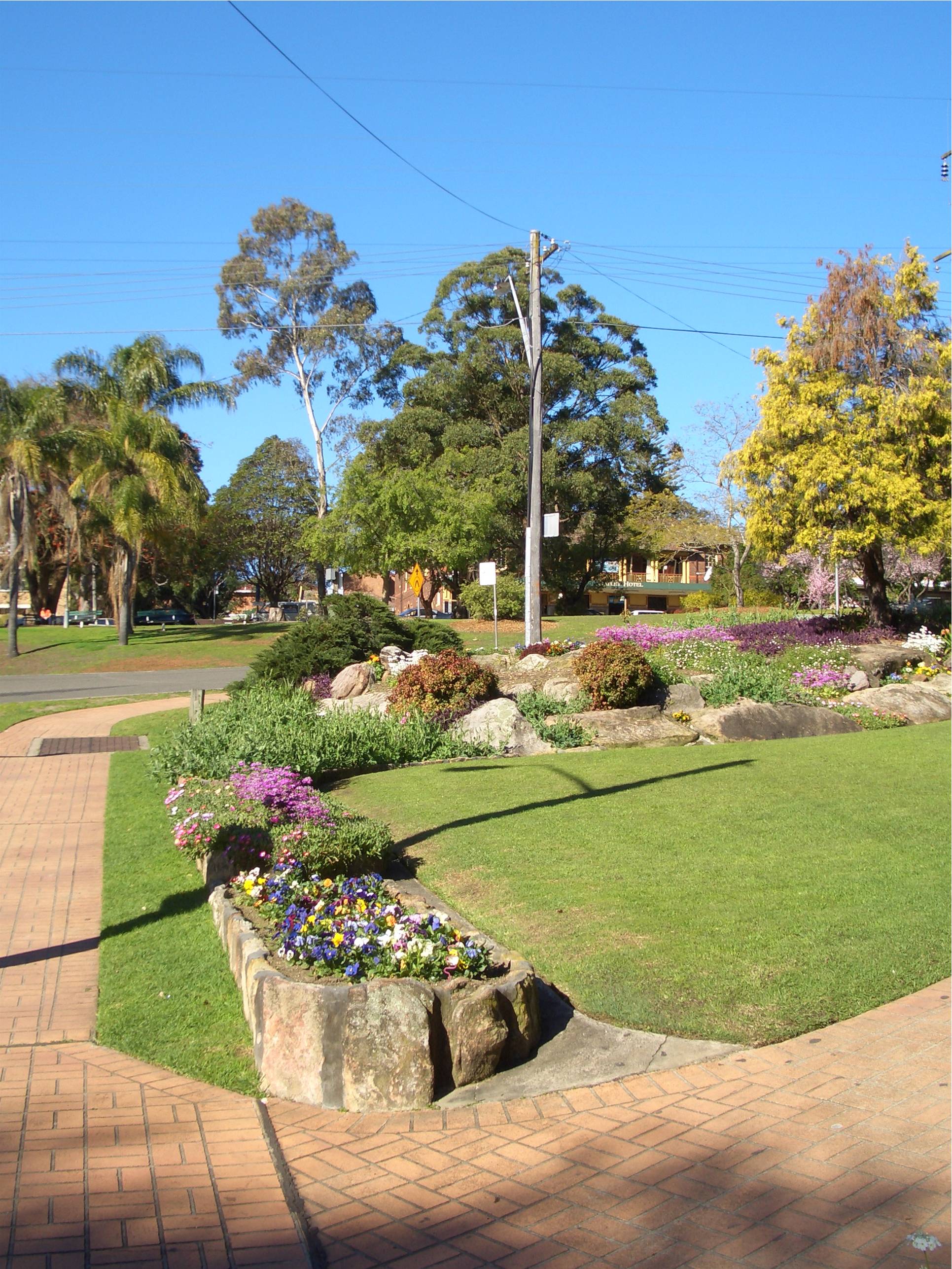
Frederick Street and Oatley Avenue intersection The traditional main shopping centre is located on Oatley Avenue and Frederick Street, near the railway station. A small group of shops and a Coles Supermarket are also located on Mulga Road in Oatley West. The village atmosphere, along with good cafes, and large parklands located in the centre of the shopping area adjacent to the train station, has led Oatley to be commonly mentioned as the most picturesque shopping village in the St George area.
Transport
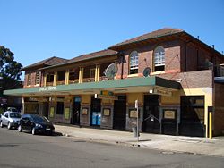
Oatley railway station is the last station on the CityRail Eastern Suburbs & Illawarra railway line before crossing the Georges River to Como in the Sutherland Shire. The 955 bus route operates a service from Oatley West, through Oatley to Hurstville.
Since 2004, local Kogarah Councillor, Mark Coure, has campaigned to upgrade the railway station to include a lift for the elderly and parents with prams and strollers.
http://www.theleader.com.au/news/local/news/general/funds-bypass-station/1868868.aspx
Parks
 Oatley Parade
The area's main attraction is Oatley Park but there are also a number of local bush parks surrounding the suburb: Oatley Point Reserve, Oatley Pleasure Grounds, Moore Reserve, Renown Park, Lime Kiln Bay Bushland Sanctuary, Giriwa Picnic Ground, Stevens Reserve, Meyer Reserve. They attract many birds both native and introduced, with Oatley Park alone recording 146 species; as many as 90 recently.[5][6]
Oatley Park
Oatley Park [7] is a tree covered area that is almost completely surrounded by water. It covers an area of about 45 hectares and it is one of the most significant areas of bushland remaining in the St George area.[8]
Oatley Park became a public recreation area on 25 March 1887. It protects important examples of natural environment which occur in all parts of the park. There is a swimming area, a playground featuring an old steamroller,[9] lookouts, barbecues, a Soccer/Cricket Oval, a castle, as well as the natural environment in the park and it has become popular with the local community. The man-made wetlands provide refuge for bird species, such as, chestnut teal, Pacific black ducks, dusky moorhens and purple swamphens. Native mammals which are uncommon in the region can still be found within the park, including the short-beaked echidna and swamp wallaby.[10][11]
Schools
- Oatley Public School[12]
- Oatley West Public School[13]
- St Joseph's Catholic School[14]
- Georges River College Oatley Senior Campus[15]- located on Hurstville Road.
Churches
- All Saints' Anglican Church[16]
- St Joseph's Catholic Church[17]
- St Paul's Anglican Church Oatley [18]
- Mortdale Oatley Baptist Church (MOBC)[19]
- Oatley Uniting Church[20]
- Oatley Christian Brethren Church
- Hurstville District Christadelphian Ecclesia[21]
 Oatley Hotel on Oatley Avenue
Landmarks
- Oatley Bay, Gungah Bay, Lime Kiln Bay, Neverfail Bay, Jewfish Bay
- Oatley Point, Lime Kiln Point, Lime Kiln Head, Jewfish Bay Point
- Hills Lookout, Websters Lookout
- The Oatley Hotel (Oatley Pub)[22]
- Oatley Library
- The 1905 George Fincham Pipe Organ located at Hurstville Christadelphian District Ecclesia is a historically-significant[23] musical instrument in the area.
Community events
- Oatley Lions Village Festival - An annual festival held on the third Saturday in October in Oatley Memorial Gardens and part of Frederick Street
- Oatley West Arts and Crafts Festival[24] - An event held at Oatley West Public school each year
- Oatley Spring Fair - A fair held biennially at Oatley Public School
Sport
Water sports and recreation are a way of life in the peninsula suburb of Oatley whose eastern, southern and western boundaries are formed by the Georges River and its bays. Oatley has many sporting teams and sporting fields:
- Renown United, the local Rugby League team, play at Renown Park.
- Oatley Rugby Club,[25] play Rugby Union at H.V Evatt Park in Lugarno.
- Oatley RSL,[26] who play at Renown Park, and All Saints Oatley West,[27] who play at Oatley Park, are the two football teams.
- Oatley Netball Club.
- Oatley RSL Youth Club Gymnastics and Sport Aerobics[28]
Population
Demographics
According to the 2006 Australian Bureau of Statistics Census of Population, there were 9,326 people usually resident in Oatley. 76.7% stated they were born in Australian. The top countries of birth for those born outside Australia being United Kingdom 4.1%, China 1.9% and New Zealand 1.1%. English was stated as the only language spoken at home by 81.0% of residents and the most common other languages spoken were Greek 2.9%, Cantonese 2.5% and Croatian 1.6%. The most common responses for religious affiliation were Roman Catholic 30.2%, Anglican 25.4% and Uniting Church 6.8%.[29]
Notable residents
- James Oatley snr
- Fiona Margaret Hall - an artistic photographer and sculptor.
- John O'Grady, novelist, who often wrote under the pseudonym 'Nino Culotta'. He lived in Algernon St., was a local builder, and frequented the Oatley pub pictured above.
- Todd Greenberg, Chief Executive Officer of the Canterbury-Bankstown Bulldogs Rugby League Club, resides in Oatley.
- Ian McNamara, ABC Radio "Australia All Over" presenter.
References
- ^ Arch Gray Collection, Society of Australian Genealogists, Sydney, NSW
- ^ AGCI Index (Australian Genealogical Computer Index), Society of Australian Genealogists
- ^ The Book of Sydney Suburbs, Compiled by Frances Pollen, Angus & Robertson Publishers, 1990, Published in Australia ISBN 0-207-14495-8, page 193
- ^ http://orao.oatleypark.com/myles2.html
- ^ Oatley Flora and Fauna Conservation Society, 2003. Birds of Oatley Park
- ^ Field, D. 21 August 2007. Ospreys spotted in Oatley and Lugarno The Leader, p9.
- ^ About Oatleypark.com
- ^ Benson, D. & Howell, J. 1990. Taken for Granted: the bushland of Sydney and its suburbs. Kangaroo Press, Kenthurst. ISBN 0 86417 331 8
- ^ Hurstville City Council
- ^ Oatley Park Wildlife, Where Light Meets Dark
- ^ Wallabies at Oatley Park, Oatley Flora and Fauna Conservarion Society, Inc
- ^ Oatley Public School
- ^ Oatley West Public School
- ^ St Joseph's Catholic School
- ^ Oatley Senior Campus - Georges River College
- ^ All Saints' Anglican Church
- ^ St Joseph's Catholic Church
- ^ St Paul's Anglican Church
- ^ Mortdale Oatley Baptist Church
- ^ Oatley Uniting Church
- ^ http://www.livingtruth.info/
- ^ http://oatleyhotel.tripod.com/home.html/
- ^ http://www.livingtruth.info/pipeorgan.html
- ^ http://www.artcraftowps.org.au/
- ^ http://www.oatleyrugby.com/
- ^ http://www.oatleysoccer.com/
- ^ http://www.asowsoccer.com.au/
- ^ http://www.oatley.gymnastics.org.au/
- ^ http://id.com.au/dosydney/Default.aspx?pg=1&gid=4640
Bibliography
- Sands and MacDougall Post Office Directory of Sydney (various years)
External links
- Oatley Park Plan of Management 24 November 2004
- Oatley Park.
- http://www.theleader.com.au/news/local/news/general/funds-bypass-station/1868868.aspx
- Oatley Flora and Fauna Conservation Society
- Kogarah Council
- NSW Heritage Office
Suburbs and localities within the City of Hurstville · St George · Sydney Beverly Hills · Hurstville · Kingsgrove · Lugarno · Mortdale · Narwee · Oatley · Peakhurst · Peakhurst Heights · Penshurst · Riverwood
List of Sydney suburbs Coordinates: 33°58′52″S 151°04′29″E / 33.98118°S 151.07479°E
Categories:- Suburbs of Sydney


Wikimedia Foundation. 2010.