- Kogarah, New South Wales
-
For the seat in the New South Wales Legislative Assembly, see Electoral district of Kogarah.
- For the local government area, see the Municipality of Kogarah.
Kogarah
Sydney, New South Wales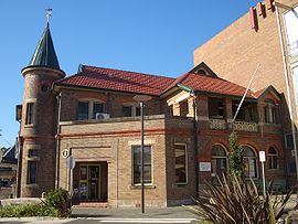
Kogarah Community CentrePopulation: 10,984 Established: 1885 Postcode: 2217 Area: 2.6 km² (1.0 sq mi) Location: 14 km (9 mi) south of Sydney CBD LGA: Municipality of Kogarah State District: Electoral district of Kogarah Federal Division: Division of Barton Suburbs around Kogarah: Bexley Rockdale Brighton-Le-Sands Carlton Kogarah Monterey Kogarah Bay Beverley Park Ramsgate Kogarah is a suburb of southern Sydney, in the state of New South Wales, Australia. Kogarah is located 14 kilometres south of the Sydney central business district and is considered to be the centre of the St George area. Kogarah is the administrative centre for the local government area of the Municipality of Kogarah, although a small part of the suburb is located in the City of Rockdale.
Contents
Location
Kogarah took its name from Kogarah Bay, a small bay on the northern shore of the Georges River. The suburb originally stretched to the bay but has since been divided up to form the separate suburbs of Kogarah Bay and Beverley Park.
Kogarah has a mixture of residential, commercial and light industrial areas. It is also known for its large number of schools (including primary school, high school and tertiary education) and health care services (including two hospitals and many medical centres). The NRL side, St George Illawarra Dragons have their Sydney office based at nearby WIN Jubilee Oval, often referred to as Kogarah Oval. Kogarah features all types of residential developments from low density detached houses, to medium density flats and high density high-rise apartments.
History
Kogarah is derived from an Aboriginal word meaning rushes or place of reeds. It had also been written as 'Coggera', 'Cogerah' and 'Kuggerah' but the current spelling was settled when the railway line came through the area in the 1880s.
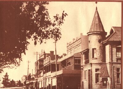
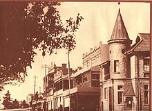 Railway Parade in 1915. The former Kogarah Post Office on the right was built in 1892 and is now a community centre
Early land grants in the area were made to John Townson (1760-1835) who received 2,250 acres (9.1 km2) from 1808 to 1810, centred around Hurstville and James Chandler, whose neighbouring estate was centred around Bexley. The district provided fruit, vegetables and oysters for Sydney. In 1869, St Pauls Church of England opened on Rocky Point Road (now Princes Highway). It was built on 2 acres (8,100 m2) of land given to the church by William Wolfen the Swedish Consul to Sydney, who owned 800 acres (3.2 km2) in Kogarah. The suburb grew around the church and the Gardeners Arms Hotel. Kogarah became a municipality in 1885.[1]
The former neighbourhood of Moorefield is now part of Kogarah. It was originally a 60-acre (240,000 m2) land grant from Governor Lachlan Macquarie in 1812 to Patrick Moore, who built a fine house there. The Moorefield racecourse built by a descendant opened in 1888. The Moorefield estate was subdivided in the 1950s and the Department of Education purchased 19 acres (77,000 m2), where it built two high schools and college of further education. Moorefields Girls High School was erected there in 1955 on the former site of Moore’s farm.[2]
The Kogarah Mecca cinema was a landmark building, located opposite the railway station in Station Street. The cinema was often used by local schools for important events such as Speech Day.
Commercial area
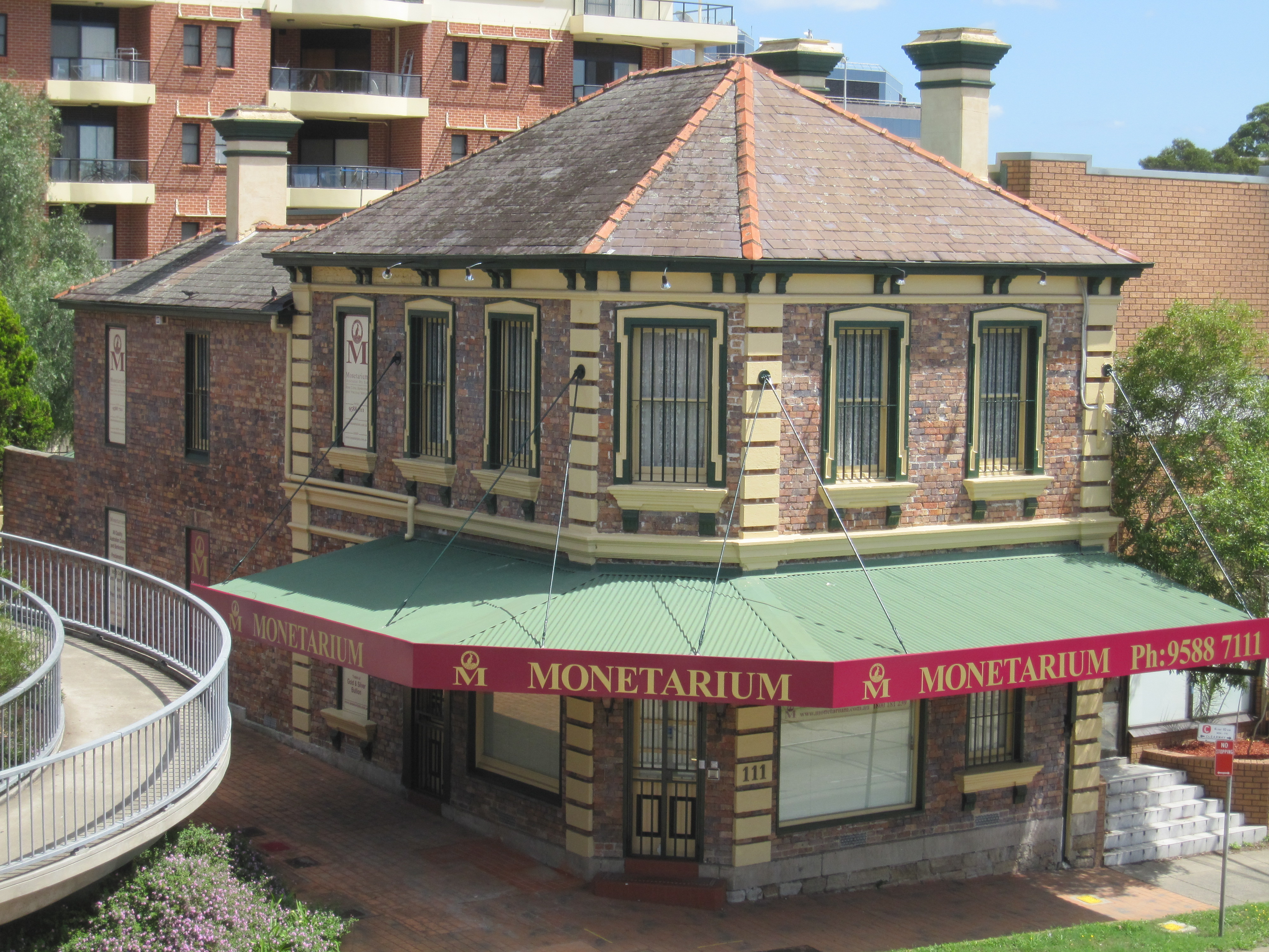
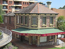 Kogarah Monetarium, Princes Highway
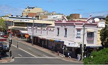 Montgomery Street
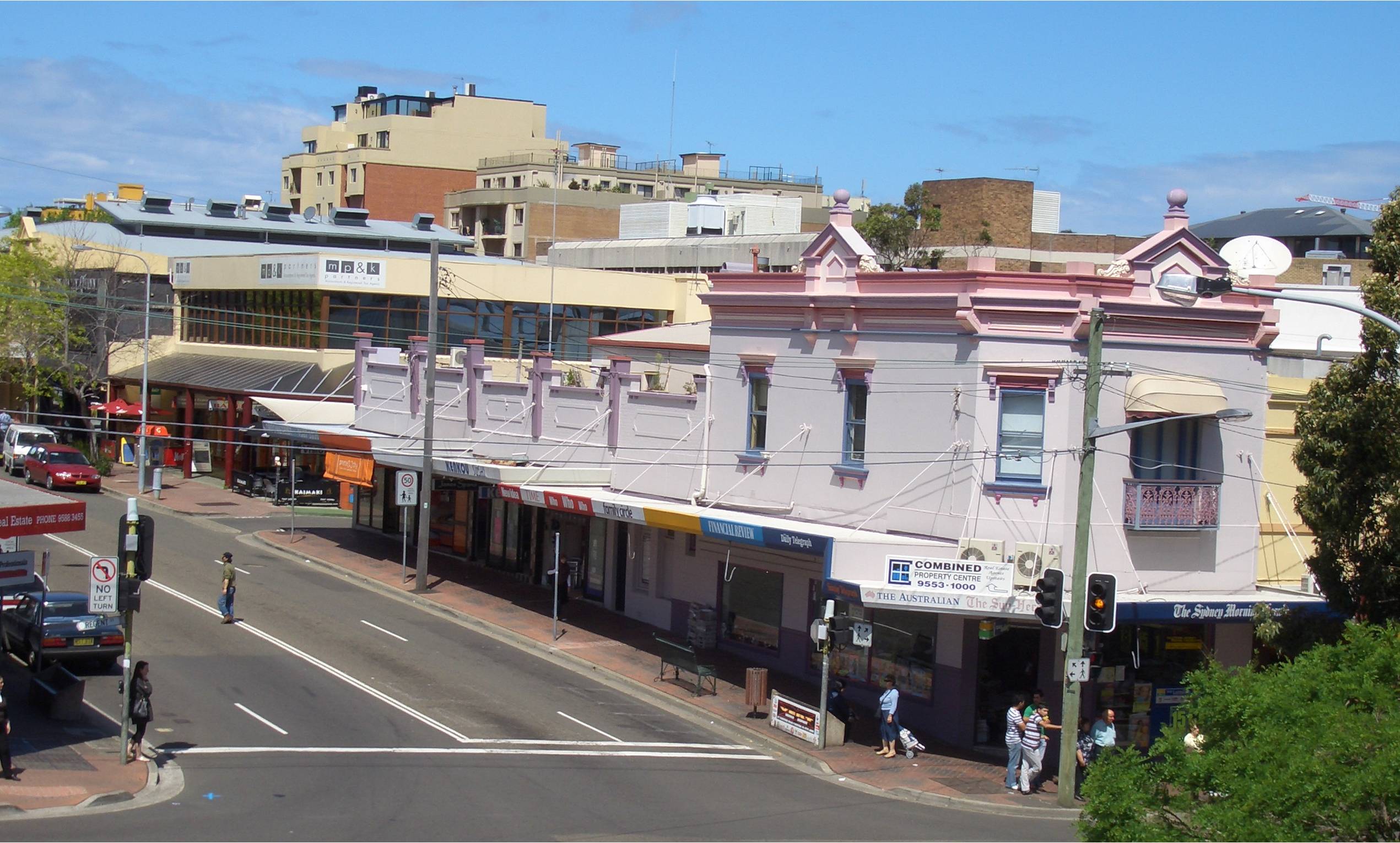
 Belgrave Street
Kogarah’s main shopping area is located around Kogarah railway station on Railway Parade, Regent Street and on the opposite side of the railway line on Station Street. The commercial area also extends to surrounding streets such as Montgomery and Belgrave Streets. Kogarah Town Centre is a shopping centre on Railway Parade. This commercial area includes the St. George Bank national headquarters in a large office building in Montgomery Street, which is a large employer in the area. Many high rise apartment buildings have also been built around the commercial area in recent years. The noted builder, James Goyen, had his works depot at 18 Montgomery Street, and later at 4 Montgomery Street. He built the original building of what was, for many years, the St George Technical College (now a campus of the Sydney Institute of TAFE).
Commercial and light industrial developments are also located along the Princes Highway and Rocky Point Road. The Darrell Lea Chocolate factory is located in Rocky Point Road. Surrounding streets feature more industrial developments. A small group of shops is located on President Avenue, sometimes referred to as Moorefield.
St George Hospital is a major regional hospital, that serves the whole St George area but also accepts patients from other regions in New South Wales. St George Private Hospital is located nearby. Many medical centres, doctor’s surgeries and specialists’ rooms and related services are located in the surrounding area.
Kogarah Police Station and Kogarah Local Court are located on Montgomery Street. The local court serves the whole of the St George area and as such many barristers and solicitors have their offices in Kogarah. A historic fire station is located in Gray Street and another heritage building, the Kogarah School of the Arts is in Bowns Road.
Railway Parade
fresh fruit stores
Kogarah Town Centre
The Kogarah Town Centre is Kogarah's largest shopping centre. It includes a post office, a supermarket (Woolworths) along with a multitude of specialty stores. It provides easy access to Kogarah railway station. While it is a shopping centre, it should be noted that the Kogarah Town Centre is quite small and the majority of its customers pass through from the railway station or Woolworths.
In early 2011 Kogarah Town Centre is due for a revamp with an application submitted into Kogarah Council to renovate the centre itself, the addition of a supermarket (Aldi), and expansion of Kogarah Tavern & Woolworths.
Kogarah Town Square
Kogarah Town Square is located in Belgrave Street. It is surrounded by residential developments and is anchored by the Kogarah Library and Cultural Centre. There is a small shopping arcade below one of the residential buildings. The square is surrounded by shops, offices, cafes, restaurants and a karaoke venue.
Transport
The entire Municipality of Kogarah and surrounding areas rely on bus, train and taxi services that operate from the centre of Kogarah's shopping district. Bus and train services accommodate the large population within Kogarah, as well as the large number of schools in the area.
Kogarah railway station is located on the Illawarra line of the CityRail network. The station sits below a concourse and a small shopping complex called the Kogarah Town Centre. In the late 1990s, the station underwent extensive renovations which added easy access facilities such as elevators from the concourse onto each of the four platforms.
Buses from Kogarah service surrounding suburbs, particularly those along the beach such as Brighton-Le-Sands, Monterey, Ramsgate Beach, Sans Souci etc. which rely heavily on bus services since they are far from railway stations. Until 1937, a steam tramway operated between Kogarah and Sans Souci via Rocky Point Road. This was replaced by an electric trolleybus service, one of only two such services to operate in Sydney. This was subsequently replaced in the 1950s with the current diesel government bus routes that currently operate. The majority of public transportation in Kogarah departs and arrives close to Kogarah Town Centre.
Parks
The Kogarah area also features many parks and reserves, with no shortage of sports playing fields. These include Hogben Park, Frys Reserve, Scarborough Park, Kogarah Park and Jubilee Oval.
Culture and events
 Kogarah Bed Race 2006, Railway Parade
have played rugby league at Jubilee Oval since 1935 and following a merger with the Illawarra Steelers also has WIN Stadium as a home ground.
Population
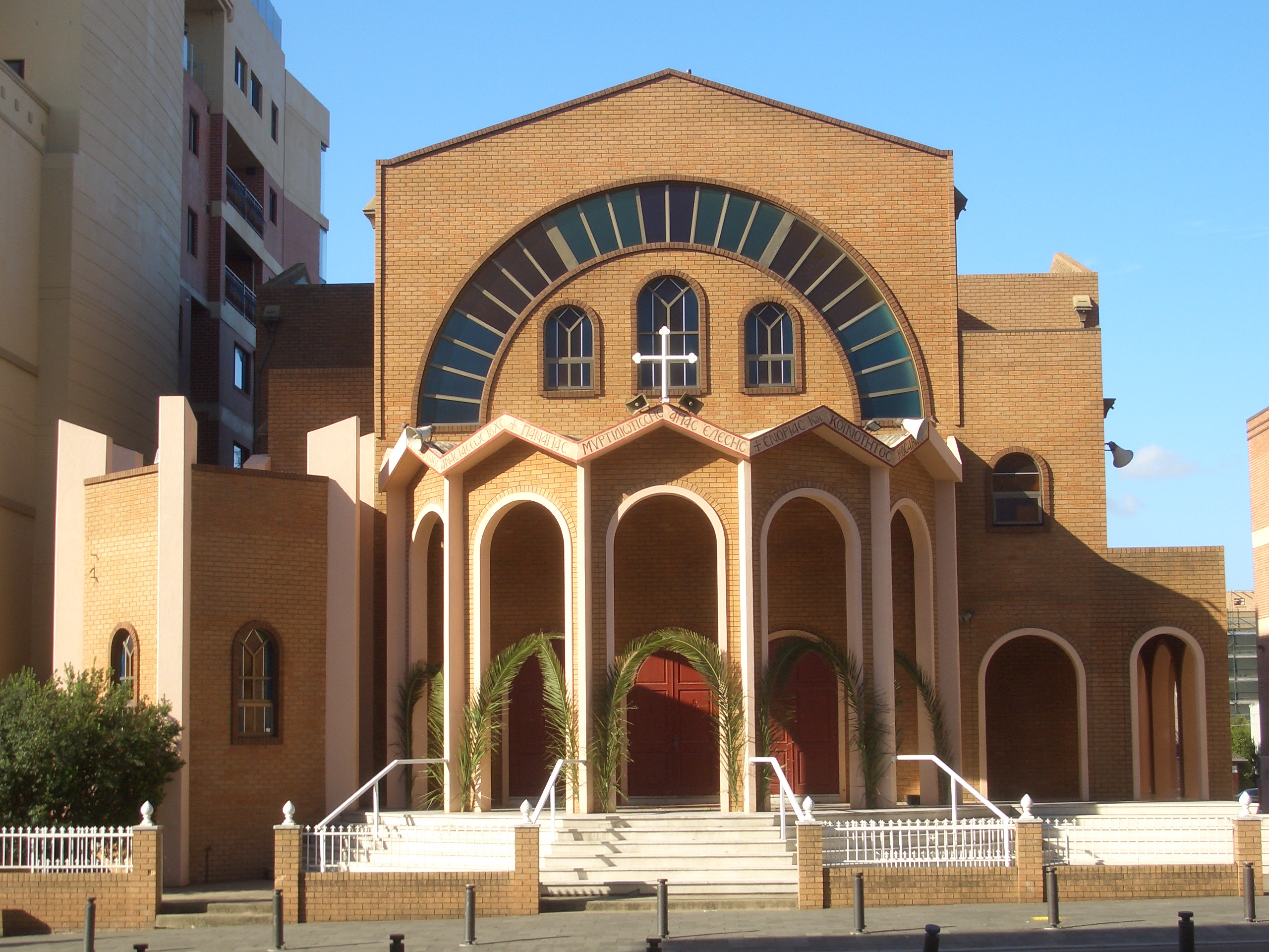
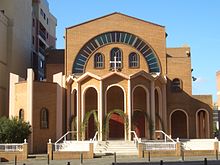 Resurrection of Christ Greek Orthodox Church
Demographics
According to the 2006 Australian Bureau of Statistics Census of Population, there were 12,336 people usually resident in Kogarah. 49.4% stated they were born overseas with the top countries of birth being China 10.9%, Bangladesh 3.8% and India 2.8%. English was stated as the only language spoken at home by 34.7% of residents and the most common other languages spoken were Mandarin 9.3%, Greek 6.6% and Cantonese 6.6%. The most common responses for religious affiliation were Catholic 21.3%, Orthodox 13.2% and Anglican 9.0%.[3]
Notable residents
- Clive James - writer, poet, essayist, critic and commentator on popular culture was raised in Kogarah.
- Kenneth Slessor, one of Australia's greatest poets, attended Kogarah Primary School, in the early 20th century. The family lived in Belgrave Street, according to his biographer, Geoffrey Dutton.
- Rev Dr Rowland Croucher, theologian and author, lived in Warialda Street in the early years of married life while he was a staffworker with the InterVarsity Fellowship. His wife Jan taught at Kogarah High School.
- Reg Gasnier - rugby league legend lives in Kogarah.
- Dave Brown rugby league star of the 1930s was born in Kogarah.
Schools and churches

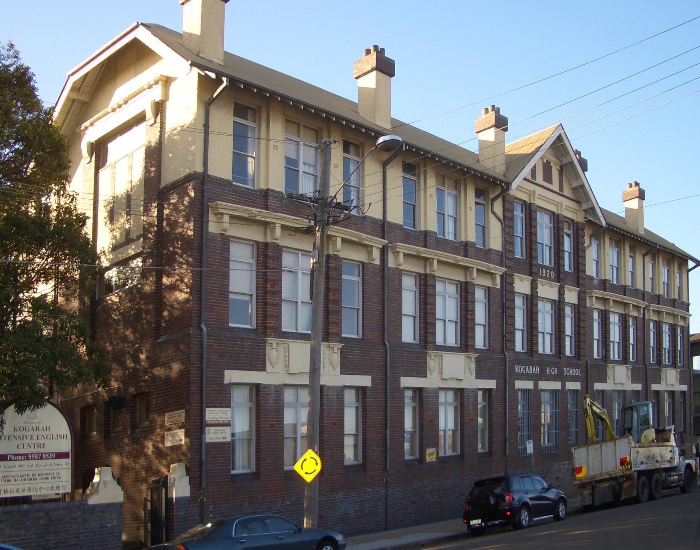
 Kogarah High School and St Pauls Anglican Church
- Resurrection of Christ Greek Orthodox Church
- Grace Chinese Christian Church,
- Kogarah Soldiers' Memorial Presbyterian Church (Kirkplace),
- St Patricks Catholic Church, St Pauls Anglican Church,
- Christ Church St George (Anglican), and Church In The Bank (Anglican).
- Kogarah Public School
- Kogarah High School, St George Girls High School, James Cook Boys Technology High School, Moorefield Girls High School
- St Patrick's Primary School, Bethany College (years 7 - 8), Marist College Kogarah
- Sydney Institute of TAFE: St. George Campus
References
- ^ The Book of Sydney Suburbs, Compiled by Frances Pollon, Angus & Robertson Publishers, 1990, Published in Australia ISBN 0-207-14495-8, page 142
- ^ Pictorial Memories. ST. GEORGE: Rockdale, Kogarah, Hurstville Joan Lawrence, Kingsclear Books, 1996, Published in Australia ISBN 0-908272-45-6
- ^ http://id.com.au/dosydney/Default.aspx?pg=1&gid=3320
External links
- Kogarah Municipality Council website
- Kogarah Marist High School
- St George Girls High School
- 2001 Census Information
Coordinates: 33°58′03″S 151°08′11″E / 33.96740°S 151.13648°E
Suburbs and localities within the Municipality of Kogarah · St George · Sydney Allawah · Beverley Park · Blakehurst · Carlton · Carss Park · Connells Point · Hurstville Grove · Kogarah · Kogarah Bay · Kyle Bay · South Hurstville
Suburbs and localities within the City of Rockdale · St George · Sydney Arncliffe · Banksia · Bardwell Park · Bardwell Valley · Bexley · Bexley North · Brighton-Le-Sands · Carlton · Dolls Point · Kingsgrove · Kogarah · Kyeemagh · Monterey · Ramsgate · Ramsgate Beach · Rockdale · Sandringham · Sans Souci · Sydney Airport · Turrella · Wolli Creek
Categories:- Suburbs of Sydney
- Australian Aboriginal placenames


Wikimedia Foundation. 2010.