Dobroyd Point, New South Wales

Dobroyd Point, New South Wales
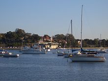
UTS Haberfield Rowing Club on Dobroyd Point

Dobroyd Point is a historical locality in the inner-west of Sydney, in the state of New South Wales, Australia. Dobroyd Point is part of the suburb of Haberfield, in the local government area of the Municipality of Ashfield. This locality faces the southern shoreline of Iron Cove bounded on the west by Iron Cove Creek, on the east by the Hawthorne Canal and on the south by Haberfield. It is the location of Robson Park, which has picnic, barbecue and toilet facilities. A bike track runs along the water edge.

The UTS Haberfield Rowing Club sits on Iron Cove and Dobroyd Parade. The Dobroyd Aquatic Club is located in the nearby suburb of Rodd Point.

External links


Wikimedia Foundation. 2010.

Игры ⚽ Поможем написать курсовую

Look at other dictionaries:

  • Rodd Point, New South Wales — Infobox Australian Place | type = suburb name = Rodd Point city = Sydney state = nsw caption = Rodd Point memorial lga = City of Canada Bay postcode = 2046 est = pop = area = propval = stategov = Drummoyne fedgov = Lowe near nw = Russell Lea near …   Wikipedia

  • Iron Cove (New South Wales) — Iron Cove is a bay on the Parramatta River, in the inner west of Sydney, in the state of New South Wales, Australia. It lies approximately 5 kilometres due west of Sydney s central business district. It is surrounded by the suburbs of Birchgrove …   Wikipedia

  • Croydon Park, New South Wales — Croydon Park Sydney, New South Wales Croydon Park Hotel Population …   Wikipedia

  • Clark Island (New South Wales) — Coordinates: 33°51′46″S 151°14′28″E / 33.86278°S 151.24111°E / 33.86278; 151.24111 Clark Islan …   Wikipedia

  • Balgowlah Heights, New South Wales — Infobox Australian Place | type = suburb name = Balgowlah Heights city = Sydney state = NSW caption = lga = Manly Council postcode = 2093 est = 1832 pop = area = propval = stategov = fedgov = Division of Warringah near nw = Balgowlah near n =… …   Wikipedia

  • List of Government schools in New South Wales: A–F — The New South Wales Department of Education and Training (DET) is a department of the Government of New South Wales. In addition to other responsibilities, it operates primary schools and secondary schools throughout the state. Contents 1 A 2 B 3 …   Wikipedia

  • Haberfield, New South Wales — Infobox Australian Place | type = suburb name = Haberfield city = Sydney state = nsw caption = Ramsay Street, Haberfield lga = Municipality of Ashfield postcode = 2045 pop = 6,797 (2001 census) stategov = Balmain fedgov = Grayndler near nw = Five …   Wikipedia

  • Croydon, New South Wales — Croydon Sydney, New South Wales The Strand, Croydon Population …   Wikipedia

  • Municipality of Ashfield — New South Wales Population: 42,541(2009) …   Wikipedia

  • Metroad 4 — M4 East redirects here. For information on the proposed extension see M4 Western Motorway Metroad 4 Highway system Highways in Australia National Highway • …   Wikipedia

Share the article and excerpts

Direct link
Do a right-click on the link above
and select “Copy Link”