- Rockdale, New South Wales
:"For the local government area, see the
City of Rockdale ."Infobox Australian Place | type = suburb
name = Rockdale
city = Sydney
state = nsw
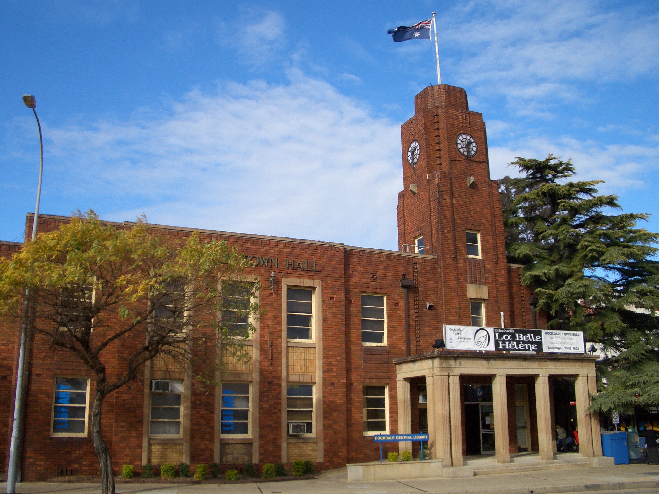
caption = Rockdale Town Hall
lga =City of Rockdale
postcode = 2216
pop = 11,588
area = 2.4
propval = $535,000
est = 1887
stategov = Rockdale
fedgov = Barton
near-nw = Arncliffe
near-n = Banksia
near-ne = Kyeemagh
near-w = Bexley
near-e = Brighton-Le-Sands
near-sw = Bexley
near-s = Kogarah
near-se = Monterey
dist1 = 13
dir1 = south
location1=Sydney CBD Rockdale is a
suburb in southernSydney , in the state ofNew South Wales ,Australia . Rockdale is located 13kilometres south of theSydney central business district and is part of the St George area. Rockdale is the administrative centre for the local government area of theCity of Rockdale .History
Rockdale was known by Europeans as Frog Hollow, then White Gum Flat and later West Botany. West Botany Municipality was declared 13th January 1871 and had two wards, West Botany and Arncliffe. A council chambers was built in 1872 on Rocky Point Road, Arncliffe and was used until 1888 when a new building was erected on the site of the present Rockdale Town Hall, which was then demolished and rebuilt after World War 2. [ "The Book of Sydney Suburbs", Page 223, Compiled by Frances Pollen, Angus & Robertson Publishers, 1990, Published in Australia ISBN 0-207-14495-8 ] There was a suggestion that the area become the Municipality of Scarborough but the name Rockdale was suggested by pioneer Mary Ann Geeves, postmistress and tollgate keeper and was officially adopted in 1887. Her husband, Yeoman Geeves, was a ganger on the construction of Rocky Point Road and the demolition of Cobbler's Hill (later called Arncliffe Hill). The Geeves family, including eldest son Frederick lived on the corner of today's Princes Highway and Tramway Arcade. Their general store adjoined the cottage and operated the first post office between Arncliffe and Kogarah in 1882. Residential development began with the opening of the railway in 1884. Perhaps the most significant property developer during the 1880s was Frederick Jamison Gibbes (1839-1888), a Member of Parliament, who is commemorated by Gibbes Street in
Banksia . Until 1949, an electric tramway operated between Rockdale Station down Bay Street to Brighton-Le-Sands. In 1948, Rockdale and Bexley councils amalgamated as Rockdale Municipal Council. TheCity of Rockdale was declared in 1995. [ "Pictorial Memories ST. GEORGE: Rockdale, Kogarah, Hurstville" Joan Lawrence, Kingsclear Books, 1996, Published in Australia ISBN 0-908272-45-6 ]Commercial Area
Rockdale has a mixture of residential, commercial and light industrial areas. The main shopping strip runs along the Princes Highway, on the eastern side of Rockdale railway station. The commercial centre spreads out into surrounding streets and on the western side of the railway line. King Street has developed into a cosy strip of cafes and grocery shops. Commercial developments run along the length of theparts of Bay Street and West Botany Street. The light industrial areas are located around West Botany Street.
Rockdale Plaza , which opened in 1997, is a medium sized shopping centre located on Princes Highway. It contains two supermarkets, two discount department stores, a motor registry, a medical centre, a food court, real estate agent, sports store, electrical appliance store, video rental shop and specialty shops. It was built on the former site of the Waltons department store.Rockdale Town Hall and the St George Tavern are examples of some of the
Art Deco architecture in the area.Transport
The
Princes Highway is the main road through Rockdale. West Botany Street, to the east, runs parallel to Princes Highway. Bay Street links Rockdale to General Holmes Drive at Brighton-le-Sands. Rockdale railway station is on theIllawarra line of theCity Rail network. Rockdale is a major bus interchange forSydney Buses government buses, which provides services to Miranda, Brighton-Le-Sands, Dulwich Hill, Burwood and Bondi Junction.Landmarks
*
Rockdale Plaza , Rockdale Town Hall, Rockdale Library
* Rockdale Ambulance Station, Rockdale Police Station, Rockdale Fire Station
* Guild TheatreParks
Bicentennial Park, McCarthy Reserve, Rockdale Park, Ador Reserve
Churches
* St John the Evangelist Anglican Church, Rockdale Presbyterian Church, Rockdale Uniting Church, Church of Christ
* St Joseph's Catholic Church, Society of St Pius X Catholic Church, St Petka Macedonian Orthodox Church
* Assemblies of God, Kingdom Hall of Jehovah's Witnesses, Sydney Chinese Alliance Churchchools
*Rockdale Public School: Kindergarten - Year 6
*St Joseph's Catholic School: Kindergarten - Year 6
*St Dominic Savio SchoolHouses
The Rockdale area possesses a wide variety of homes in various architectural styles. The following is a small sample.
Politics
* Federal Government: Rockdale is in the
Division of Barton in theAustralian House of Representatives .
* State government: Rockdale is in theElectoral district of Rockdale in theNew South Wales Legislative Assembly .
* Local Government: Rockdale is in the local government area of theCity of Rockdale .References
External links
* [http://www.rockdale.nsw.gov.au/ Rockdale City Council website]
* [http://www.abs.gov.au/ausstats/abs@census.nsf/Lookup2001Census/F3561E66022865CDCA256BBE008382A6 2001 Census Information]
* [http://www.sesahs.nsw.gov.au/index.htm South East Health]
* [http://www.rockdaletowncentre.org Rockdale Chamber of Commerce]
Wikimedia Foundation. 2010.