- South Western Highway
Infobox Australian Road
road_name = South Western Highway
route_
route_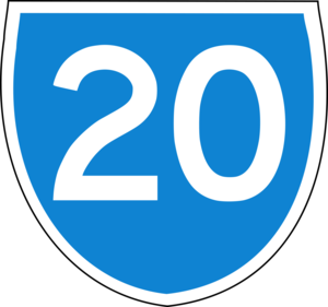
route_
photo =
caption =
length = 406
direction = Northwest-Southeast
start =
finish =
est =
through = Serpentine, North Dandalup, Pinjarra, Waroona, Yarloop, Harvey, Brunswick Junction, Bunbury, Donnybrook, Bridgetown, Manjimup
route = "Bunbury - South Coast Highway"
exits = Thomas Road,Uduc Road ,Coalfields Road , Robertson Drive,Brockman Highway ,Muirs Highway ,Vasse Highway "for full list see
Major intersections"South Western Highway is a highway in the South West region of
Western Australia connecting Perth's southeast with Walpole. It is a part of the National Highway 1 network for most of its length. It is about convert|406|km|mi|0|lk=on long.Description
Perth to Bunbury
From Perth, the highway, signed as State Route 20, starts from the
Albany Highway junction in Armadale, 28 km from Perth, and follows a north-south route 20-30 km inland from the coast, passing through several agricultural and timber towns that sprang up in the 1890s when the nearby railway came through, such as Pinjarra, Waroona, Yarloop and Harvey.Just past Brunswick Junction, the highway heads southwest towards Western Australia's second-largest city, Bunbury. The typical scenery on this part of the highway includes small dairy farms and orchards,
jarrah and marri remnant forests and pine plantations.Until the 1980s, the Armadale-Bunbury section was part of National Highway 1, but following the upgrading of
Old Coast Road and construction of the Mandurah bypass, Highway 1 now follows the coastal route viaKwinana Freeway and Old Coast Road to Bunbury passing through the resort town of Mandurah.In Bunbury
The highway does not actually enter Bunbury - it stops at the industrial suburb of Picton, following Robertson Drive (Bunbury's ring road) for 1km south before turning southeast past Bunbury Airport towards Boyanup. The highway actually used to follow what is now Boyanup-Picton Road from Picton via Dardanup, but changed to the present shorter route in the 1980s.
Bunbury to Walpole
From Bunbury, the highway goes through Boyanup and on to Donnybrook, the heart of WA's
apple country. From then on the highway passes through thick forests featuring many native trees likejarrah , marri andkarri . The region was settled much later than other parts of south western WA, under a soldier resettlement scheme in the 1920s. Typical scenery is farmland interspersed with forests and small timber towns.The highway then goes through Bridgetown (where it meets the
Brockman Highway from Augusta and Nannup), Manjimup and finally to Walpole. This part of the highway, especially from Manjimup, is sparsely populated and very thickly forested, with abundant wildlife andwildflower s as well as many old growth trees, especially the giantkarri .From Walpole, the Highway 1 continues as
South Coast Highway to Albany.Major towns
*Armadale
*Byford
*Pinjarra
*Waroona
*Yarloop
*Harvey
*Brunswick Junction
*Bunbury
*Boyanup
*Donnybrook
*Bridgetown
*Manjimup
*WalpoleMajor intersections
Armadale to Picton
* Interchange, Armadale and Bedfordale
**
**
***
*
* ("at Mundijong") Del Park Road to Dwellingup* ("at Pinjarra"):
** Pinjarra-Williams Road to Dwellingup and Boddington
** Pinjarra Road to Mandurah
** Old Bunbury Road to Old Coast Road Lake Clifton* ("at Harvey") Uduc Road to Myalup
* ("at Brunswick Jn") to Kemerton Industrial Park
*
* ("at Picton") Boyanup-Picton Road to Dardanup
*Picton to Walpole
* ("at Boyanup") to Stratham
* ("at Donnybrook") Goodwood Road to Capel
* ("at Bridgetown") to Boyup Brook
* ("at Bridgetown")Brockman Highway to Nannup and Augusta
*
* ("15km south of Manjimup")Vasse Highway to Pemberton
*ee also
*
Highways in Australia
*List of highways in Western Australia


Wikimedia Foundation. 2010.