- Manjimup, Western Australia
-
Manjimup
Western Australia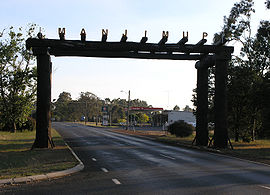
Entrance to Manjimup, late afternoon
 Manjimup
Population: 4,239[1] Established: 1856 Postcode: 6258 Coordinates: 34°14′28″S 116°08′46″E / 34.241°S 116.146°E[2]Coordinates: 34°14′28″S 116°08′46″E / 34.241°S 116.146°E[2] Elevation: 287 m (942 ft) [3] Location: - 307 km (191 mi) S of Perth
- 131 km (81 mi) SE of Bunbury
- 36 km (22 mi) S of Bridgetown
LGA: Shire of Manjimup State District: Blackwood-Stirling Federal Division: O'Connor Mean max temp Mean min temp Annual rainfall 20.3 °C
69 °F9.6 °C
49 °F1,010.9 mm
39.8 inManjimup is a town in Western Australia, 307 kilometres (191 mi) south of the state capital, Perth. The town of Manjimup is a regional centre for the largest shire in the South West of Western Australia. At the 2006 census, Manjimup had a population of 4,239.[1]
Contents
History
Manjimup was named for the Noongar Aboriginal words "Manjin" (a broad-leafed edible reed) and "up" (meeting place, or place of).[4] Manjimup was first settled in 1856 by timber cutter Thomas Muir.[5] It was declared a town in 1910, and a railway from Perth was completed in 1911.[5]
The population expanded when Manjimup became part of the post-World War I Group Settlement Scheme.[5] The Group Settlement Scheme was largely unsuccessful because the land was difficult to clear and many of the new settlers were not experienced farmers.[5] The settlers who stayed became dairy farmers, which ended during the 1930s Great Depression when the price of butterfat collapsed.[5]
Economy
Industry
Timber is the town's major industry, but it has been joined by fruit and vegetable farms, dairy farms, wool, grain and vineyards.[5] The Cripps Pink, otherwise better known as the Pink Lady apple was created in Manjimup by John Cripps from the West Australian Agriculture Service[6] and the trademark is now used on products across four continents.[7] Manjimup used to produce frozen French fries,[8] and had a lucrative tobacco industry that ended in the 1960s.[9] Manjimup exports include marri flooring;[10] apples, primarily to India;[11] and spring water to Saudi Arabia, Singapore and India.[12]
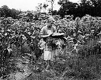 Picking tobacco leaves in 1954
Manjimup is the leading Australian-mainland producer of black truffles[13] and research on truffle-growing is conducted in collaboration with WA universities, with an annual government grant of $250,000 for three years.[14] Manjimup's climate is similar to that of Périgord and other truffle-growing areas of France.[14] Manjimup truffles are currently supplied to restaurants in Perth, Sydney and Melbourne, and requests for samples have been received from restaurants in France and Germany.[15]
Research is also being conducted on green tea production by the Department of Agriculture and Food and the Manjimup Horticultural Research Institute.[16] Japanese experts identified Manjimup as a suitable area for growing green tea based on "its climate, 'clean green' image, fertile soils and good rainfall".[16] The Manjimup/Pemberton area is a similar distance from the equator as the prime tea-growing area Shizuoka in Japan, and shares similar acidic soils and average annual temperature.[17] Trials of 10 varieties of green tea will determine which green tea varieties will be the most successful.[16]
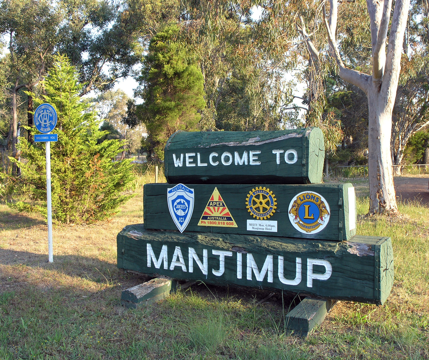
 Welcome to Manjimup
Tourism
Manjimup tourist attractions include the Diamond Tree fire lookout; the Four Aces, which are four 75 metre-tall karri trees over 400 years old; One Tree Bridge, a bridge made of a single karri tree; Fonty's Pool; a timber museum called Manjimup Timber Park; and timber sawmills including Deanmill. During wildflower season from October to December, the King Jarrah Heritage Trail is home to various native flowers.[5]
Since 2001, an annual cherry festival has been held in December. The three day festival features the crowning of the cherry king and queen and a cherry spitting competition, and is attended by some 5,000 visitors.[18][19] In 1980, Manjimup held its first motocross event, named the Manjimup 15000 International Motocross in honour of the $15,000 prize for first place.[20] The event was held annually in June until it was cancelled in 2006 due to public liability insurance issues and a lack of volunteers.[21] In 2005, the event drew 6,000 spectators and 340 competitors from Australia, New Zealand and the United States.[22] In 2009 the event will be run again on 30/31 May.
Education
Two public primary schools and one public high school are located in Manjimup with a Catholic K-12 school, Kearnan College also. Manjimup Primary School opened in 1911, and moved to a new location in 2005.[23] Manjimup Primary School had 431 students in semester 2, 2007, with 40 of those students in part-time kindergarten.[23] The student attendance rate is 94%, compared with 93.1% state-wide.[23] The school's students tend to remain in Manjimup for their secondary education.[24]
East Manjimup Primary School opened in 1971.[23] Seventy-five percent of students live in the town east of the railway line, with the remaining students from farms or smaller communities out of town or outside the school's catchment area.[23] The school had 331 students in semester 2, 2007, with 36 in part-time kindergarten.[23] Its student attendance rate is 93.2%.[23]
The town's high school, Manjimup Senior High School, was established in 1957.[23] School facilities were upgraded in 1997 and 1999, with the addition of a Technology and Enterprise Centre and refurbishment of several areas.[23] Over half of its students travel to school on the school's buses, with the most distant students travelling more than 80 km, each way, per day.[23] The school catchment area includes Manjimup, Bridgetown, Northcliffe, Pemberton and Boyup Brook.[23] Manjimup Senior High School had 668 students in semester 2, 2007.[23] Selected school programmes are delivered in partnership with South West College of TAFE, Challenger TAFE, and Edith Cowan University.[23] The school consistently performs well in Tertiary Entrance Exam results.[25] In 2007, Manjimup Senior High School was the best performing state school in WA, placed at number 8 in the list of top-performing schools.[26]
Transportation
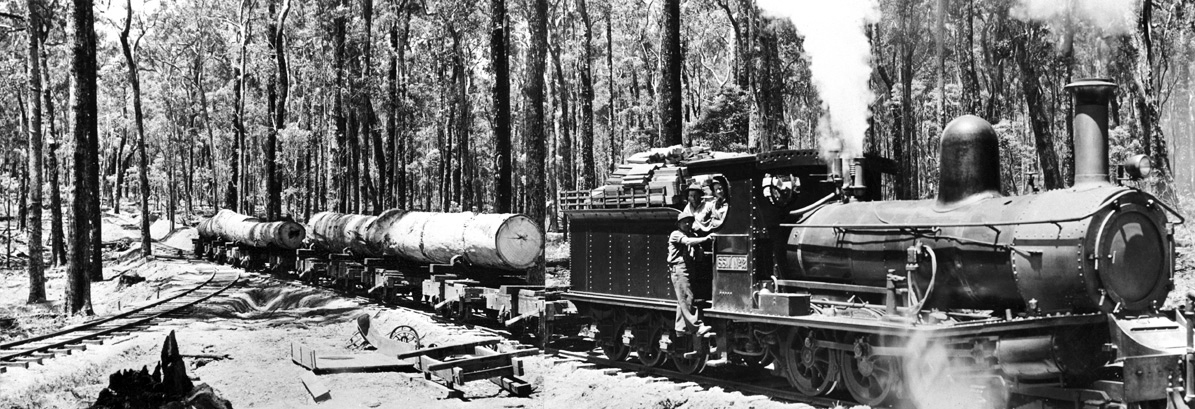
 A timber train in the 1940s
The railway from Bridgetown was extended to Wilgarup in 1909, and the railway line opened in 1911.[27] As the line's terminus was near the Manjimup homestead, the station was named Manjimup.[27] Aside from passengers, trains were used to transport timber to and from the sawmills in the area. The rail yards closed in 1997 and were redeveloped into Manji Park tourism precinct in 2003.[28]
Cars are the primary method of transport in Manjimup - according to the Australian Bureau of Statistics' 2006 census, 91% of people commuting to work were drivers or passengers in cars.[1] The next most popular method of transport was walking, at 4.5%.[1] The Manjimup Volunteer and Resource Centre runs a community bus service, primarily for youth, seniors, and people with disabilities [29] and the Public Transport Authority contracts school bus services to Warren Bus Service.[30]
Public transport between Perth and Manjimup consists of Transwa bus services 315 (Sunday) and 321 (Monday and Wednesday) from Perth to Pemberton via Bunbury, and 322 (Monday, Tuesday, Thursday) from Pemberton to Perth, also via Bunbury.[31] Travellers can also take the daily Australind train between the Perth and Bunbury portion of the journey.[32] South West Coach Lines travels between Perth and Manjimup on weekdays.[33]
Politics
Manjimup is located in the Western Australian electoral district of Blackwood-Stirling and Federal Division of O'Connor. The statistics below combine votes from the Manjimup and East Manjimup polling places.
2007 Federal Election
Source: AEC [1] [2]Liberal 50.0% Labor 23.7% Independent 18.0% Greens 3.35% CDP 2.39% 2004 Federal Election
Source: AEC [3] [4]Liberal 65.9% Labor 20.2% Greens 3.73% One Nation 3.37% CDP 2.01% 2001 Federal Election
Source: AEC [5] [6]Liberal 56.1% Labor 19.5% One Nation 15.5% Greens 2.79% Democrats 2.60% 2005 State Election
Source: WAECLiberal 71.5% Labor 16.1% Greens 4.02% One Nation 2.87% Family First 2.54% 2001 State Election
Source: WAECLiberal 57.4% Independent 16.4% One Nation 14.2% Labor 8.35% Greens 2.78% 1996 State Election
Source: WAECLiberal 64.2% Labor 24.8% CEC 7.62% Democrats 3.39% Forestry issues
The Manjimup region has been the focus of forest issues for over 80 years - initially the development of the Group Settlement Scheme saw forests cleared for settlements, then in the 1970s the Manjimup woodchipping scheme attracted widespread interest in the concern for the karri forests of the region. Two conservation groups prominently involved were Campaign to Save Native Forests and South West Forests Defence Foundation. Subsequent to the woodchipping controversies, the issue of old growth forests saw considerable interaction between conservationists - and local forestry organisations - the resultant conflicts were in part resolved by government intervention, reducing clearfell quotas and providing schemes to re-deploy forestry workers made redundant by the reduction in the industry.
Climate
Manjimup has a mild Mediterranean climate, with cool wet winters and warm dry summers.[34] Manjimup's longest consecutive run of cold days was 20 days between 13 July and 1 August 1958, and its longest consecutive wet spell was 44 days between 1 July to 13 August 1946.[35] During this period, 374 mm of rain fell.[35]
Manjimup Climate Data Temperature Month Jan Feb Mar Apr May Jun Jul Aug Sep Oct Nov Dec Year Record high 42.7 °C (109 °F) 41.6 °C (107 °F) 41.2 °C (106 °F) 33.6 °C (92.5 °F) 29.2 °C (84.6 °F) 22.9 °C (73.2 °F) 21.6 °C (70.9 °F) 24.4 °C (75.9 °F) 28.2 °C (82.8 °F) 33.3 °C (91.9 °F) 38.7 °C (102 °F) 40.0 °C (104 °F) 42.7 °C (109 °F) Average high 27.0 °C (80.6 °F) 26.9 °C (80.4 °F) 24.7 °C (76.5 °F) 21.0 °C (69.8 °F) 17.5 °C (63.5 °F) 15.2 °C (59.4 °F) 14.3 °C (57.7 °F) 14.9 °C (58.8 °F) 16.5 °C (61.7 °F) 18.7 °C (65.7 °F) 21.8 °C (71.2 °F) 24.8 °C (76.6 °F) 20.3 °C (68.5 °F) Average low 13.0 °C (55.4 °F) 13.3 °C (55.9 °F) 12.5 °C (54.5 °F) 10.7 °C (51.3 °F) 8.9 °C (48.0 °F) 7.4 °C (45.3 °F) 6.4 °C (43.5 °F) 6.5 °C (43.7 °F) 7.2 °C (45.0 °F) 8.2 °C (46.8 °F) 10.1 °C (50.2 °F) 11.6 °C (52.9 °F) 9.6 °C (49.3 °F) Record low 6.0 °C (42.8 °F) 5.6 °C (42.1 °F) 3.3 °C (37.9 °F) 1.6 °C (34.9 °F) −0.6 °C (30.9 °F) 0.2 °C (32.4 °F) −0.6 °C (30.9 °F) 0.0 °C (32.0 °F) 0.6 °C (33.1 °F) 0.1 °C (32.2 °F) 2.3 °C (36.1 °F) 4.4 °C (39.9 °F) −0.6 °C (30.9 °F) Rainfall Month Jan Feb Mar Apr May Jun Jul Aug Sep Oct Nov Dec Total Highest rainfall 92.2 mm (3.6 in) 117.4 mm (4.6 in) 137.7 mm (5.4 in) 193.8 mm (7.6 in) 269.0 mm (10.6 in) 331.9 mm (13.1 in) 319.7 mm (12.6 in) 323.3 mm (12.7 in) 256.5 mm (10.1 in) 165.4 mm (6.5 in) 121.6 mm (4.8 in) 98.0 mm (3.9 in) 1,761.2 mm (69.3 in) Average rainfall 19.3 mm (0.8 in) 19.1 mm (0.8 in) 30.8 mm (1.2 in) 60.3 mm (2.4 in) 132.6 mm (5.2 in) 166.5 mm (6.6 in) 175.7 mm (6.9 in) 148.7 mm (5.9 in) 109.2 mm (4.3 in) 77.9 mm (3.1 in) 46.2 mm (1.8 in) 25.2 mm (1.0 in) 1,010.9 mm (39.8 in) Lowest rainfall 0.0 mm (0.0 in) 0.0 mm (0.0 in) 0.5 mm (0.0 in) 4.0 mm (0.2 in) 26.3 mm (1.0 in) 13.8 mm (0.5 in) 42.7 mm (1.7 in) 49.0 mm (1.9 in) 23.9 mm (0.9 in) 8.9 mm (0.4 in) 2.5 mm (0.1 in) 0.0 mm (0.0 in) 650.3 mm (25.6 in) Average rainy days 5.8 5.8 7.4 11.3 17.4 19.8 22.0 20.8 17.4 14.9 10.3 7.2 160.1 Bureau of Meteorology[3] References
- ^ a b c d Australian Bureau of Statistics (25 October 2007). "Manjimup (Urban Centre/Locality)". 2006 Census QuickStats. http://www.censusdata.abs.gov.au/ABSNavigation/prenav/LocationSearch?collection=Census&period=2006&areacode=UCL517000&producttype=QuickStats&breadcrumb=PL&action=401. Retrieved 2007-10-25.
- ^ "Manjimup". Gazetteer of Australia online. Geoscience Australia, Australian Government. http://www.ga.gov.au/bin/gazd01?rec=310146. Retrieved 28 December 2009.
- ^ a b "Monthly climate statistics - Manjimup". Bureau of Meteorology. http://www.bom.gov.au/climate/averages/tables/cw_009573_All.shtml. Retrieved 2008-05-08.
- ^ "Shire of Manjimup: A Brief History". http://www.manjimup.wa.gov.au/about_us. Retrieved 2008-01-10.
- ^ a b c d e f g "Travel: Manjimup". The Sydney Morning Herald. 8 February 2004. http://www.smh.com.au/news/Western-Australia/Manjimup/2005/02/17/1108500208272.html. Retrieved 2008-01-10.
- ^ Bateman, Michael (20 May 2001). "Food: Pretty in pink". The Independent (London). http://findarticles.com/p/articles/mi_qn4158/is_20010520/ai_n14397569/pg_1. Retrieved 2008-01-10.
- ^ "Aussie IP: Pink Lady Apples". http://www.ipaustralia.gov.au/media/pages/innovations/pink.htm. Retrieved 2008-01-10.
- ^ "Department of Agriculture and Food: Manjimup Office". http://www.agric.wa.gov.au/agency/offices/manjimup/index.htm. Retrieved 2008-01-10.
- ^ "South West Life: Manjimup". Archived from the original on 2007-08-29. http://web.archive.org/web/20070829004444/http://southwestlife.com.au/manjimup.htm. Retrieved 2008-01-10.
- ^ "Manjimup property to make export flooring". ABC News. 2 September 2004. http://www.abc.net.au/news/stories/2004/09/02/1190569.htm. Retrieved 2008-01-29.
- ^ "India taken with Manjimup apples". ABC News. 21 June 2004. http://www.abc.net.au/news/stories/2004/06/21/1136424.htm. Retrieved 2008-01-29.
- ^ "Manjimup farmer set to export water". ABC News. 4 October 2007. http://www.abc.net.au/news/stories/2007/10/04/2050673.htm. Retrieved 2008-01-29.
- ^ "Getaway fact sheets: Manjimup truffles". http://getaway.ninemsn.com.au/article.aspx?id=60491. Retrieved 2008-01-22.
- ^ a b Elen, Judith (14 July 2007). "WA truffles in black gold rush". The Australian. http://www.news.com.au/travel/story/0,23483,22097649-5012674,00.html. Retrieved 2008-01-22.
- ^ Hartnet, Michelle. "Australian ingenuity spawns new industry". http://smallbusiness.ninemsn.com.au/article.aspx?id=82563. Retrieved 2008-01-22.
- ^ a b c "Green tea served up in Manjimup". 20 November 2006. http://www.agric.wa.gov.au/content/_abt/mr/mr201106.htm. Retrieved 2008-01-29.
- ^ "Growing green tea in Western Australia : development of a green tea industry in the Manjimup/Pemberton area". June 2001. http://www.agric.wa.gov.au/content/fcp/sc/bulletin4499.htm. Retrieved 2008-01-29.
- ^ "Cherry festival fever picks up". Manjimup-Bridgetown Times. 12 November 2006. http://www.thewest.com.au/default.aspx?MenuID=146&ContentID=12620. Retrieved 2008-01-10.[dead link]
- ^ "Manjimup celebrates cherry festival". ABC News. 15 December 2006. http://www.abc.net.au/news/stories/2006/12/15/1812218.htm. Retrieved 2008-04-16.
- ^ Olsen, Graeme (May 2005). "South West Life: Manjimup 15000". Archived from the original on 2007-10-30. http://web.archive.org/web/20071030234126/http://southwestlife.com.au/outdoors0503.htm. Retrieved 2008-01-10.
- ^ "Shire laments motocross race cancellation". ABC Sport Online. 2006-03-30. Archived from the original on 2007-08-08. http://web.archive.org/web/20070808064848/http://www.abc.net.au/sport/content/200603/s1604500.htm. Retrieved 2008-01-10.
- ^ "Thousands flock to see motocross stars shine in Manjimup". ABC News Online. 7 June 2005. http://www.abc.net.au/news/australia/wa/bunbury/200506/s1386506.htm. Retrieved 2008-01-10.
- ^ a b c d e f g h i j k l m "Department of Education and Training - Schools Online". http://www2.eddept.wa.edu.au/schoolprofile/home.do. Retrieved 2008-02-02.
- ^ "Manjimup Primary School Annual School Report for 2006" (PDF). http://www2.eddept.wa.edu.au/schoolprofile/file_download?schoolID=5284&fileType=SCH_RPT&yearID=2006. Retrieved 2008-02-02.
- ^ Varischetti, Belinda (1 November 2007). "Manjimup Senior High School one of WA's top performers". ABC Rural Bush Telegraph. http://www.abc.net.au/rural/telegraph/content/2006/s2078621.htm. Retrieved 2008-02-02.
- ^ "Private schools outperform public schools in TEE". ABC News. 8 January 2008. http://www.abc.net.au/news/stories/2008/01/08/2134118.htm. Retrieved 2008-02-02.
- ^ a b Western Australian Land Information Authority. "History of country town names". http://www.landgate.wa.gov.au/corporate.nsf/web/History+of+country+town+names. Retrieved 2008-03-02.
- ^ "Rail yards transformed into tourism site". ABC News. 15 December 2003. http://www.abc.net.au/news/stories/2003/12/15/1010137.htm. Retrieved 2008-03-02.
- ^ "Shire of Manjimup & Manjimup Volunteer & Resource Centre: Community bus". Archived from the original on 2008-07-23. http://web.archive.org/web/20080723233030/http://manjimup.org.au/bushire.htm. Retrieved 2008-10-10.
- ^ "Regional town bus services". Public Transport Authority. 2007-07-26. Archived from the original on 2008-07-19. http://web.archive.org/web/20080719025752/http://www.pta.wa.gov.au/scripts/viewoverview_contact.asp?NID=1072. Retrieved 2008-03-02.
- ^ "SW2 Perth to Pemberton via Bunbury timetable" (PDF). Transwa. 2006-11-01. Archived from the original on 2008-07-19. http://web.archive.org/web/20080719234910/http://www.transwa.wa.gov.au/portals/0/resources/timetables/SW2.pdf. Retrieved 2008-03-02.
- ^ "Australind timetable" (PDF). Transwa. 2006-05-29. Archived from the original on 2008-04-11. http://web.archive.org/web/20080411054051/http://www.transwa.wa.gov.au/portals/0/resources/timetables/Australind.pdf. Retrieved 2008-03-02.
- ^ "Manjimup" (PDF). South West Coach Lines. http://www.southwestcoachlines.com.au/SouthWestCoachLines-Manjimup.pdf. Retrieved 2008-03-02.
- ^ "Australia's South West: Climate". http://www.australiassouthwest.com/en/Menus/Travel+Information/Climate.htm. Retrieved 2008-03-02.
- ^ a b "Fascinating weather facts for the South West 18th June". ABC South West WA. 24 June 2004. http://www.abc.net.au/southwestwa/stories/s1139538.htm. Retrieved 2008-03-02.[dead link]
External links
- Shire of Manjimup
- Manjimup Visitor Centre
- Cemetery and Historical Records
- Manjimup Volunteer & Resource Centre
Towns in the South West region of Western Australia Major centres Bunbury · Busselton · Collie · Dunsborough · Harvey · Manjimup · Margaret River
Towns Acton Park · Alexandra Bridge · Allanson · Augusta · Balingup · Benger · Binningup · Boyanup · Boyup Brook · Bramley · Bridgetown · Brookhampton · Brunswick Jn. · Burekup · Capel · Carbunup River · Chowerup · Cookernup · Cowaramup · Cundinup · Dardanup · Deanmill · Dingup · Dinninup · Donnelly River · Donnybrook · Elgin · Ferguson · Forest Grove · Forrest Beach · Gnarabup · Gracetown · Greenbushes · Hester · Jardee · Jarrahwood · Karridale · Kirup · Kudardup · Kulikup · Ludlow · Mayanup · Metricup · Mullalyup · Myalup · Nannup · Nornalup · Northcliffe · Nyamup · Pemberton · Peppermint Grove Beach · Prevelly · Quindalup · Quinninup · Roelands · Rosa Brook · Shotts · Stratham · Uduc · Vasse · Walpole · Waterloo · Wilga · Windy Harbour · Witchcliffe · Wokalup · Wonnerup · Worsley · Yallingup · Yarloop · Yornup
Categories:- Towns in Western Australia
- Wine regions of Western Australia
- South West (Western Australia)
- Australian Aboriginal placenames


Wikimedia Foundation. 2010.