- Clifton, Western Australia
-
For other uses, see Clifton (disambiguation).
Clifton
Western AustraliaPostcode: 6211 Location: LGA: City of Mandurah State District: Dawesville Federal Division: Canning Coordinates: 32°44′42″S 115°37′52″E / 32.745°S 115.631°E
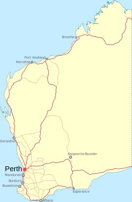
Clifton is a small, mostly uninhabited, locality located in the Peel region of Western Australia between Mandurah and Bunbury. Adjoining the nearby suburb of Herron. It lies on a narrow strip between Lake Clifton and Yalgorup National Park to the east, and the Indian Ocean to the west.
History
The area, originally known as "Koolijerrenup" by the local Noongar people, was named in honour of Marshall Walter Clifton (1787-1861), Chief Commissioner of the Western Australian Company's settlement at Australind and later a member of the Legislative Council [1] .
Transport
Clifton is not served by public transport.
References
- ^ "Clifton". City of Mandurah. http://www.mandurah.wa.gov.au/clifton.htm. Retrieved 9 October 2011.
Suburbs of the Mandurah region | Peel Region | Western Australia City of Mandurah Bouvard · Clifton · Coodanup · Dawesville · Dudley Park · Erskine · Falcon · Greenfields · Halls Head · Herron · Lakelands · Madora Bay · Mandurah · Meadow Springs · Parklands · San Remo · Silver Sands · Wannanup
Nearby suburbs Barragup · Furnissdale · Golden Bay · Keralup · North Yunderup · Singleton · Stake Hill
Towns and localities in the Peel region of Western Australia Major centres Mandurah · Boddington · Dwellingup · Pinjarra · South Yunderup · Waroona
Minor settlements /suburbs Banksiadale · Barragup · Birchmont · Blythewood · Bouvard · Carcoola · Chadoora · Clifton · Coodanup · Coolup · Crossman · Dawesville · Dudley Park · Erskine · Etmilyn · Fairbridge · Falcon · Furnissdale · Greenfields · Halls Head · Hamel · Herron · Holyoake · Inglehope · Keralup · Kooljerrenup · Lake Clifton · Lakelands · Lower Hotham · Madora Bay · Marradong · Marrinup · Meadow Springs · Meelon · Mount Cooke · Mount Wells · Myara · Nambeelup · Nanga Brook · Nirimba · North Dandalup · North Yunderup · Oakley · Parklands · Point Grey · Preston Beach · Quindanning · Ranford · Ravenswood · San Remo · Silver Sands · Solus · Stake Hill · Teesdale · Wagerup · Wannanup · West Coolup · West Pinjarra · Whittaker · Wuraming
Categories:- Towns in Western Australia
- Suburbs of Mandurah
Wikimedia Foundation. 2010.

