- Clifton, West Virginia
-
Clifton, West Virginia — Unincorporated community — 
 Clifton, West Virginia
Coordinates: 39°00′08″N 82°02′30″W / 39.00222°N 82.04167°WCoordinates: 39°00′08″N 82°02′30″W / 39.00222°N 82.04167°W Country United States State West Virginia County Mason Elevation 574 ft (175 m) Time zone Eastern (EST) (UTC-5) – Summer (DST) EDT (UTC-4) Area code(s) 304 & 681 GNIS feature ID 1554151[1] Clifton is an unincorporated community in Mason County, West Virginia, United States. Clifton is located on the east bank of the Ohio River along West Virginia Route 62, 1.5 miles (2.4 km) south of Mason; Middleport, Ohio lies across the river.[2] Clifton had a post office, which closed on May 24, 1997.[3]
References
- ^ U.S. Geological Survey Geographic Names Information System: Clifton, West Virginia
- ^ West Virginia Department of Transportation (2011). Mason County, West Virginia General Highway Map (Map). p. 1. http://gis.wvdot.com/gti/County_Maps/Mason_1_of_2.pdf. Retrieved October 12, 2011.
- ^ "Postmaster Finder - Post Offices by ZIP Code". United States Postal Service. http://webpmt.usps.gov/pmt008.cfm. Retrieved October 12, 2011.
Municipalities and communities of Mason County, West Virginia City 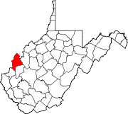
Towns Hartford City | Henderson | Leon | Mason | New Haven
CDPs Apple Grove | Gallipolis Ferry
Unincorporated
communitiesAmbrosia | Arbuckle | Arlee | Ashton | Beech Hill | Capehart | Clifton | Couch | Elmwood | Glenwood | Greer | Grimms Landing | Lakin | Letart | Mercers Bottom | Mount Olive | Sassafras | Southside | Upland | West Columbia | Wyoma
Categories:- Populated places in Mason County, West Virginia
- Unincorporated communities in West Virginia
- Metro Valley geography stubs


Wikimedia Foundation. 2010.