- Mason, West Virginia
-
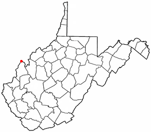
Mason, West Virginia — Town — Location of Mason, West Virginia
Coordinates: 39°1′11″N 82°1′51″W / 39.01972°N 82.03083°WCoordinates: 39°1′11″N 82°1′51″W / 39.01972°N 82.03083°W Country United States State West Virginia County Mason Area – Total 0.6 sq mi (1.4 km2) – Land 0.6 sq mi (1.4 km2) – Water 0.0 sq mi (0.0 km2) Elevation 584 ft (178 m) Population (2000) – Total 1,070 – Density 1,900.8/sq mi (733.9/km2) Time zone Eastern (EST) (UTC-5) – Summer (DST) EDT (UTC-4) ZIP code 25260 Area code(s) 304 FIPS code 54-52180[1] GNIS feature ID 1542846[2] Mason, also known as Mason City[3] is a town in Mason County, West Virginia, in the United States. The population was 1,064 at the 2000 census. It is part of the Point Pleasant, WV–OH Micropolitan Statistical Area.
Mason was initially known as Waggener's Bottom. It was chartered by the Virginia General Assembly in 1856, and named for Mason County, which was named for George Mason,[4] a delegate to the U.S. Constitutional Convention.
Mrs. Joanie S. Strode became the first female mayor in West Virginia when she was appointed in her husband's place in 1932. She served as the mayor of Mason until the end of her husband's term in 1933.[citation needed]
Contents
Phone Numbers
Town Hall: 304-773-5200
Police: 304-773-5201History
The Gold Houses and Shumaker-Lewis House are listed on the National Register of Historic Places.[5]
Geography
Mason is located at 39°1′11″N 82°1′51″W / 39.01972°N 82.03083°W (39.019760, -82.030952),[6] along the Ohio River.[7]
According to the United States Census Bureau, the town has a total area of 0.6 square miles (1.5 km²), all land.
Demographics
As of the census[1] of 2000, there were 1,064 people, 475 households, and 317 families residing in the town. The population density was 1,900.8 inhabitants per square mile (733.6/km²). There were 535 housing units at an average density of 955.8 per square mile (368.9/km²). The racial makeup of the town was 96.71% White, 0.09% African American, 1.60% Native American, 0.28% Asian, and 1.32% from two or more races. Hispanic or Latino of any race were 0.47% of the population.
There were 475 households out of which 26.5% had children under the age of 18 living with them, 49.3% were married couples living together, 13.9% had a female householder with no husband present, and 33.1% were non-families. 29.9% of all households were made up of individuals and 15.2% had someone living alone who was 65 years of age or older. The average household size was 2.24 and the average family size was 2.75.
In the town the population was spread out with 20.9% under the age of 18, 9.6% from 18 to 24, 24.1% from 25 to 44, 24.9% from 45 to 64, and 20.6% who were 65 years of age or older. The median age was 41 years. For every 100 females there were 89.7 males. For every 100 females age 18 and over, there were 88.4 males.
The median income for a household in the town was $24,621, and the median income for a family was $30,833. Males had a median income of $31,389 versus $17,500 for females. The per capita income for the town was $14,020. About 15.6% of families and 19.8% of the population were below the poverty line, including 37.2% of those under age 18 and 10.4% of those age 65 or over.
See also
References
- ^ a b "American FactFinder". United States Census Bureau. http://factfinder.census.gov. Retrieved 2008-01-31.
- ^ "US Board on Geographic Names". United States Geological Survey. 2007-10-25. http://geonames.usgs.gov. Retrieved 2008-01-31.
- ^ Geographic Names Information System. "Geographic Names Information System entry for Mason (Feature ID #1542846)". http://geonames.usgs.gov/pls/gnispublic/f?p=gnispq:3:::NO::P3_FID:1542846. Retrieved 2007-05-07.
- ^ West Virginia Blue Book. Published annually by the Clerk's Office of the West Virginia Senate.
- ^ "National Register Information System". National Register of Historic Places. National Park Service. 2010-07-09. http://nrhp.focus.nps.gov/natreg/docs/All_Data.html.
- ^ "US Gazetteer files: 2010, 2000, and 1990". United States Census Bureau. 2011-02-12. http://www.census.gov/geo/www/gazetteer/gazette.html. Retrieved 2011-04-23.
- ^ West Virginia Atlas & Gazetteer. Yarmouth, Me.: DeLorme. 1997. pp. 32. ISBN 0-89933-246-3.
External links
Municipalities and communities of Mason County, West Virginia City 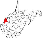
Towns Hartford City | Henderson | Leon | Mason | New Haven
CDPs Apple Grove | Gallipolis Ferry
Unincorporated
communitiesAmbrosia | Arbuckle | Arlee | Ashton | Beech Hill | Capehart | Clifton | Couch | Elmwood | Glenwood | Greer | Grimms Landing | Lakin | Letart | Mercers Bottom | Mount Olive | Sassafras | Southside | Upland | West Columbia | Wyoma
Categories:- Populated places in Mason County, West Virginia
- Towns in West Virginia
- Point Pleasant micropolitan area
- Populated places established in 1856

Wikimedia Foundation. 2010.