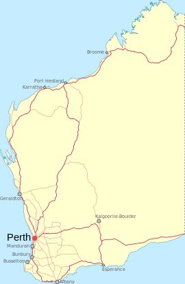
- Oakley, Western Australia
-
Oakley
Western AustraliaPopulation: 0 Postcode: 6208 Location: - 88 km (55 mi) from Perth
- 22 km (14 mi) from Mandurah
- 4.5 km (3 mi) from Pinjarra
- 22 km (14 mi) from Dwellingup
LGA: Shire of Murray State District: Murray-Wellington Federal Division: Canning Mean max temp Mean min temp Annual rainfall ? ? 941.4 mm
37.1 inCoordinates: 32°37′09″S 115°54′48″E / 32.619040°S 115.913210°E
Oakley is a locality in the Peel Region of Western Australia. Its local government area is the Shire of Murray.
Oakley is located at the foot of the Darling Scarp and is very lowly populated, it is one of the locations of Alcoa's three alumina refineries, which is named after the nearest large town in the region, Pinjarra.[1]
References
Towns and localities in the Peel region of Western Australia Major centres Mandurah · Boddington · Dwellingup · Pinjarra · South Yunderup · Waroona
Minor settlements /suburbs Banksiadale · Barragup · Birchmont · Blythewood · Bouvard · Carcoola · Chadoora · Clifton · Coodanup · Coolup · Crossman · Dawesville · Dudley Park · Erskine · Etmilyn · Fairbridge · Falcon · Furnissdale · Greenfields · Halls Head · Hamel · Herron · Holyoake · Inglehope · Keralup · Kooljerrenup · Lake Clifton · Lakelands · Lower Hotham · Madora Bay · Marradong · Marrinup · Meadow Springs · Meelon · Mount Cooke · Mount Wells · Myara · Nambeelup · Nanga Brook · Nirimba · North Dandalup · North Yunderup · Oakley · Parklands · Point Grey · Preston Beach · Quindanning · Ranford · Ravenswood · San Remo · Silver Sands · Solus · Stake Hill · Teesdale · Wagerup · Wannanup · West Coolup · West Pinjarra · Whittaker · Wuraming
Categories:- Towns in Western Australia
- Peel (Western Australia)
Wikimedia Foundation. 2010.

