- City of Gosnells
-
This article is about a local government authority. For the suburb, see Gosnells, Western Australia.
City of Gosnells
Western Australia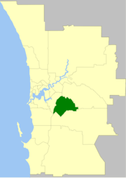
Population: 106,724(2010)[1] Established: 1907 Area: 128 km² (49.4 sq mi) Mayor: Olwen Searle JP Council Seat: Gosnells Region: SE Metropolitan Perth State District: Cannington, Darling Range, Gosnells, Jandakot, Southern River Federal Division: Hasluck, Canning 
LGAs around City of Gosnells: Canning Kalamunda Canning City of Gosnells Kalamunda Cockburn Armadale Armadale The City of Gosnells is a Local Government Area in the southeastern suburbs of the Western Australian capital city of Perth, located northwest of Armadale and about 20 kilometres (12 mi) southeast of Perth's central business district. The City covers an area of 128 square kilometres (49.42 sq mi), much of which is state forest rising into the Darling Scarp to the east, and has an estimated population of 106,724 as at June 2010.
Contents
History
The name Gosnells dates back to 1862 when Charles Gosnell who was the owner of London cosmetic company John Gosnell & Co., brought Canning location 16 from the Davis family who were the original grantees in 1829. While the purchase of the land was a personal investment by Charles Gosnell when the land was sold to developers in 1903 the developers used the association to the well known cosmetic company claiming it had brought the land because of its fertile soil to grow flowers of for the manufacture of its perfume range. The abundance of the Arum Lily in the area and the marketing contributed to the myth about the Gosnell company, being so successful that the Gosnells railway station was constructed on the Armadale line in 1903.[2][3]
Gosnells Road District was created out of the abolished Canning Road District on 1 July 1907. In 1923, it received land from Jandakot Road District when that entity was abolished.
On 1 July 1961, Gosnells Road District became a Shire following enactment of the Local Government Act 1960. On 1 July 1973 it became a Town and exactly four years later it attained City status.[4]
Mayors
Main article: List of mayors of GosnellsWards
The city has been divided into 3 wards, each of 4 councillors. The mayor is directly elected.
- Canning Vale Ward
- Bickley Ward
- Gosnells Ward
Suburbs
- Beckenham
- Canning Vale *
- Gosnells
- Huntingdale
- Kenwick
- Langford
- Maddington
- Martin
- Orange Grove
- Southern River
- Thornlie
( * indicates suburb partially located within City)
Population
Year Population 1911 737 1921 1,936 1933 3,016 1947 4,405 1954 7,366 1961 7,524 1966 11,374 1971 22,040 1976 40,422 1981 52,419 1986 60,610 1991 69,342 1996 73,421 2001 79,782 2006 91,579 References
- ^ Australian Bureau of Statistics (31 March 2011). "Regional Population Growth, Australia, 2009–10 - Western Australia". http://www.abs.gov.au/ausstats/abs@.nsf/Products/3218.0~2009-10~Main+Features~Western+Australia?OpenDocument. Retrieved 10 May 2011.
- ^ "A Condensed History". http://www.gosnells.wa.gov.au/scripts/viewarticle.asp?NID=12023. Retrieved 2008-04-23., City of Gosnells 2007
- ^ "North Otago Times, Volume IX, Issue 262, 26 November 1867, Page 1". Papers Past. http://paperspast.natlib.govt.nz/cgi-bin/paperspast?a=d&d=NOT18671126.2.2.4&cl=&srpos=0&st=1&e=-------en--1----0-all. Retrieved 2008-04-23., 1867 the arrival of perfumes Direct from John Gosnells & Co., Perfumers to Her Majesty(Queen Victoria), was noted in the business section of the New Zealand newspaper North Otago Times
- ^ WA Electoral Commission, Municipality Boundary Amendments Register (release 2.0), 31 May 2003.
External links
Cities of Western Australia Capital city Metropolitan cities Regional cities Large towns Categories:- Populated places established in 1907
- 1907 establishments in Australia
- Local Government Areas of Western Australia

Wikimedia Foundation. 2010.