- Shire of Kellerberrin
Infobox Australian Place | type = lga
name =Shire of Kellerberrin
state =wa
region =Wheatbelt
area =1916.8
est =1908
seat =Kellerberrin
pop =1,183 (2006 census)
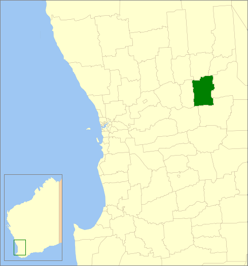
imagesize= 180
caption = Location inWestern Australia
logo =
logosize =
url =http://www.kellerberrin.wa.gov.au
mayor =Rodney Giles
fedgov =O'Connor
stategov =Central Wheatbelt
near-nw = Wyalkatchem
near-n = Trayning
near-ne = Nungarin
near-w = Tammin
near-e = Merredin
near-sw = Quairading
near-s = Bruce Rock
near-se = Bruce RockThe Shire of Kellerberrin is a Local Government Area in the Wheatbelt region of
Western Australia , about convert|60|km|mi|0 west of Merredin and about convert|200|km|mi|0 east of Perth, the state capital. The Shire covers an area of convert|1917|km2|sqmi|0 and its seat of government is the town of Kellerberrin.History
In 1908, the Kellerberrin Road Board was gazetted, and included large parts of what is now Tammin, Wyalkatchem and Trayning. On 1 July 1961, it became the Shire of Kellerberrin following changes to the Local Government Act. [WA Electoral Commission, "Municipality Boundary Amendments Register" (release 2.0), 31 May 2003.]
Wards
The shire has 7 councillors and no wards. Prior to the elections in May 2003, there were 8 councillors representing three wards - East Ward (2), Kellerberrin Ward (4) and West Ward (2).
Towns/Localities
* Kellerberrin
* Baandee
* Doodlakine
* Mount CarolineReferences
Wikimedia Foundation. 2010.