- Shire of Murchison
-
Shire of Murchison
Western Australia
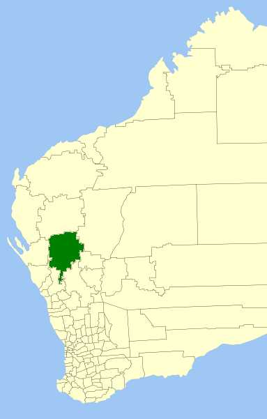
Location in Western AustraliaPopulation: 114(2009)[1] Area: 41173 km² (15,897.0 sq mi) Mayor: Simon Broad Region: Mid West State District: North West Federal Division: Durack 
LGAs around Shire of Murchison: Upper Gascoyne Upper Gascoyne Meekatharra Shark Bay Shire of Murchison Cue Northampton Greater Geraldton Yalgoo The Shire of Murchison is a large agricultural region in the central part of Western Australia, and is the only shire in Australia without a town.[2] At the 2006 Census, it was also the least populous Local Government Area in Western Australia.[3]
Contents
Description
The region is related to the catchment area of the Murchison River. It has extensive mining areas, some of which are active - with a large number of older abandoned workings. The region has large sheep stations and goat stations - also known as pastoral leases. The population of the shire is very scattered with only 200 inhabitants in the region.
This sparse population is one factor behind the Shire being one of the two shortlisted sites for the Square Kilometre Array - a proposed radio telescope with a total collecting area of one square kilometre. It is also home to the Murchison Widefield Array.
History
In 1875, the Murchison Road Board was gazetted. On 1 July 1961, it became the Shire Council following changes to the Local Government Act.[4]
A residence for the Shire Clerk was built in 1966 approximately 200 km north of the town of Mullewa. This building included a shire office. In 1985 a Roadhouse and new Shire offices which include a museum were built; this area was gazetted as the Murchison Settlement in 1988.[2]
Wards
The shire is represented by 7 councillors, and has been divided into two wards. The shire president is elected from among the councillors.
- Darlot Ward (4 councillors)
- Ballinyoo Ward (3 councillors)
Prior to 2005, there were 4 wards - Boolardy, Byro, Mileura and Yallalong.
References
- ^ Australian Bureau of Statistics (30 March 2010). "Regional Population Growth, Australia, 2008–09". http://www.abs.gov.au/ausstats/abs@.nsf/Latestproducts/3218.0Main%20Features82008-09?opendocument&tabname=Summary&prodno=3218.0&issue=2008-09&num=&view=. Retrieved 4 June 2010.
- ^ a b SMH Travel (8 February 2004). "Murchison - a vast shire without a town". The Sydney Morning Herald. http://www.smh.com.au/news/Western-Australia/Murchison/2005/02/17/1108500208581.html. Retrieved 2006-12-22.
- ^ 3218.0 - Regional Population Growth, Australia, 2006-07 — 3218.0 Population Estimates by Statistical Local Area, 2001 to 2007. Australian Bureau of Statistics.
- ^ WA Electoral Commission, Municipality Boundary Amendments Register (release 2.0), 31 May 2003.
External links
Further reading
- Grunsky, E.C. (et al.) (October 1998). Report on laterite geochemistry in the CSIRO-AGE database for the southern Murchison region (Yalgoo, Kirkalocka, Perenjori, Ninghan sheets). Wembley, W.A.: CRC LEME. ISBN 0-6422823-8-2. (CSIRO Division of Exploration Geoscience report ; 2R).
Wikimedia Foundation. 2010.