Shire of Roebourne

Shire of Roebourne

Infobox Australian Place | type = lga
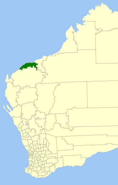
name = Shire of Roebourne
state = wa


imagesize= 180
caption = Location in Western Australia
pop = 16,423 (2006 census)
area = 15234
est = 1910
seat = Karratha
mayor = Brad Snell
region = Pilbara

url = http://www.roebourne.wa.gov.au/
stategov = North West
fedgov = Kalgoorlie
near-nw = "Indian Ocean"
near-n = "Indian Ocean"
near-ne = Port Hedland
near-e = Port Hedland
near-se = Port Hedland
near-s = Ashburton
near-sw = Ashburton
near-w = "Indian Ocean"

The Shire of Roebourne is one of the four Local Government Areas in the Pilbara region of Western Australia. The Shire covers an area of convert|15882|km2|sqmi|0 and has a population of about 15,900 (ABS 2001), most of which is located in its seat of government, the town of Karratha, and the major towns.

History

In 1887, Roebourne Municipal Council, Cossack Road Board and Roebourne Road Board were all gazetted. As the Roebourne region's population declined, the three merged into the Roebourne Road Board in 1910. On 1 July 1961, it became the Roebourne Shire Council following changes to the Local Government Act. [WA Electoral Commission, "Municipality Boundary Amendments Register" (release 2.0), 31 May 2003.]

Wards

The Shire is divided into wards:

* Karratha (6 councillors)
* Wickham, Point Samson and Cossack (2 councillors)
* Dampier (2 councillors)
* Roebourne/Pastoral (1 councillor)

Towns

* Cossack
* Dampier
* Karratha
* Point Samson
* Roebourne
* Wickham

References

External links

* [http://www.roebourne.wa.gov.au/ Shire of Roebourne]


Wikimedia Foundation. 2010.

Игры ⚽ Нужно сделать НИР?

Look at other dictionaries:

  • Roebourne Shire — Shire of Roebourne Lage des Roebourne Shire in Westaustralien Gliederung …   Deutsch Wikipedia

  • Roebourne — Staat: Australien Bundesstaat …   Deutsch Wikipedia

  • Roebourne, Western Australia — Infobox Australian Place | type = town name = Roebourne state = wa caption = Roebourne Tourist Centre lga = Shire of Roebourne postcode = 6718 pop = 950 est = 1880s stategov = North West fedgov = Kalgoorlie dist1 = 202 location1= Port Hedland… …   Wikipedia

  • Shire of Murchison — Western Australia Location in Western Australia Population …   Wikipedia

  • Shire of Derby-West Kimberley — Western Australia Population: 7,9 …   Wikipedia

  • Shire of Christmas Island — Population: 1,440(2009)[1] …   Wikipedia

  • Shire of Ngaanyatjarraku — Western Australia Location in Western Australia Population …   Wikipedia

  • Shire of Murray — This article is about the Western Australian Shire of Murray. For the New South Wales shire, see Murray Shire. Shire of Murray Western Australia Location in …   Wikipedia

  • Shire of Ashburton — Infobox Australian Place | type = lga name = Shire of Ashburton state = wa imagesize= 180 caption = Location in Western Australia pop = 6,078 (2006 census) area = 101240 est = 1972 seat = Tom Price mayor = Leanne Corker region = Pilbara url =… …   Wikipedia

  • Shire of Donnybrook-Balingup — This article is about a local government area. For the town, see Donnybrook, Western Australia. Shire of Donnybrook Balingup Western Australia …   Wikipedia

Share the article and excerpts

Direct link
Do a right-click on the link above
and select “Copy Link”