- Dampier, Western Australia
-
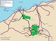
Dampier
Western Australia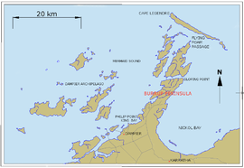
Map of Dampier, Western Australia and surrounding area.
 Dampier
Population: 1,370 (2006 Census)[1] Established: 1965 Postcode: 6713 Elevation: 48 m (157 ft) Location: LGA: Shire of Roebourne State District: North West Federal Division: Durack Mean max temp Mean min temp Annual rainfall 30.6 °C
87 °F22.7 °C
73 °F310.3 mm
12.2 inCoordinates: 20°39′47″S 116°42′29″E / 20.663°S 116.708°E
Dampier is a major industrial port in the north-west of Western Australia. The Dampier Port is part of the Dampier Archipelago. The port services petrochemical, salt, iron ore and natural gas export industries. Rio Tinto exports large volumes of iron ore through the port, and in September 2010 announced plans to expand capacity.[2] At the 2006 census, Dampier had a population of 1,370.[1]
Contents
History

Aboriginal people, including the Yaburara and Ngarluma tribes, have lived in the area for many thousands of years. The town derives its name from the nearby Dampier Archipelago, named after the English buccaneer William Dampier, who visited the area in 1699.[3]
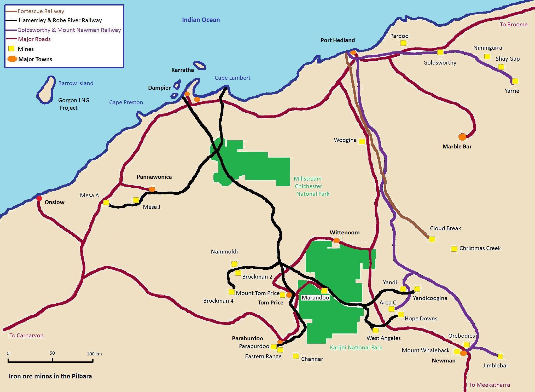
The town was built from 1965 onwards, to serve the railway transporting iron ore from Tom Price and Paraburdoo. By 1968, the further expansion of Dampier had been constrained by geographical factors and the new town of Karratha was established as a result.[4]
Environment
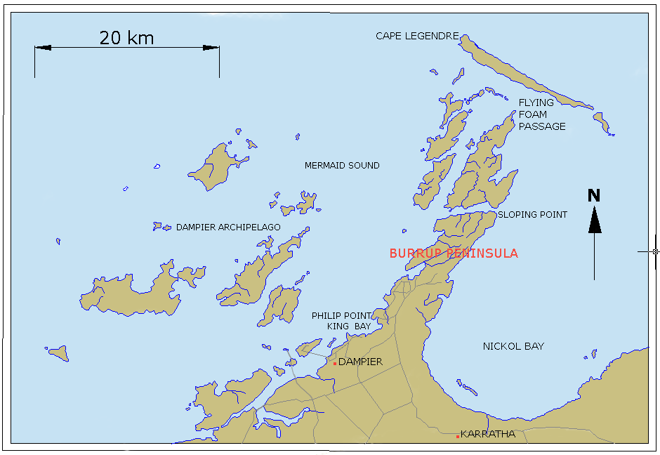
The nearby Murujuga (Burrup Peninsula) which means "Hip Bone Sticking Out" in the Ngarluma/Yaburara language, is home to what is believed to be the largest collection of petroglyphs (ancient rock art) in the world.[5]
There are 42 islands within the Dampier Archipelago.[6] There is a hugely diverse marine ecosystem around these islands where the fauna includes whales, dugongs, turtles, coral and sponges.[6] Green turtles, (Chelonia mydas) are also known to nest in the Dampier Archipelago.[7]
Attractions
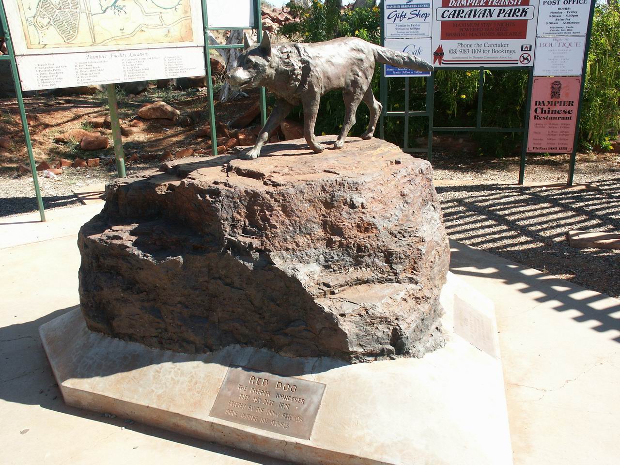
At the entrance to the town is a statue of "Red Dog", a red kelpie/cattledog well known for roaming the area in the 1970s and hitching rides to nearby towns. The statue reads "Erected by the many friends made during his travels".[8] Other attractions include the fishing not far off the coast, the most commonly targeted species being barramundi (Lates calcarifer).
Port
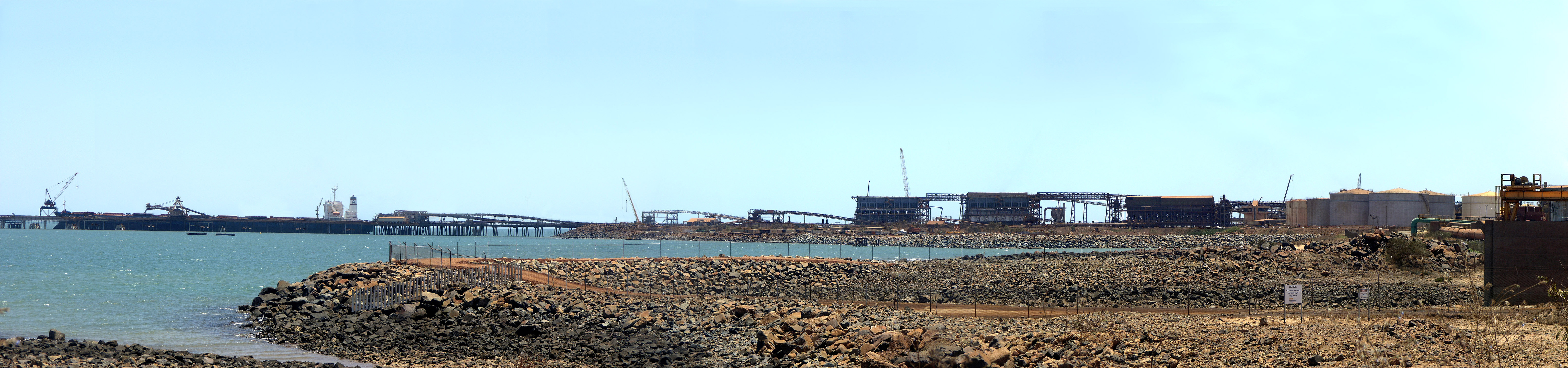
The port of Dampier, opened in 1966, when the first iron ore from the Mount Tom Price mine was transported via the Hamersley & Robe River railway to Parker Point and loaded on ships. The port at East Intercourse Island opened in 1972.[9]
The port has an annual capacity to handle 140 million tonnes of iron ore, in comparison to Rio Tinto's other iron ore port, Cape Lambert, which is able to handle 80 million tonnes. It takes between 24 to 36 hours to load a ship at port.[9]
Photos
-

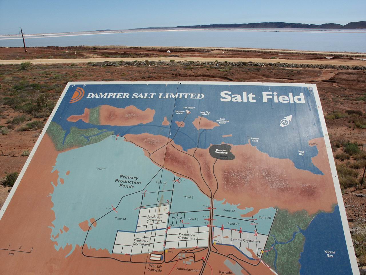
Salt Field
-
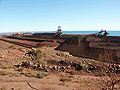
Iron Ore
-
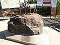
"Red Dog" statue
Panoramas
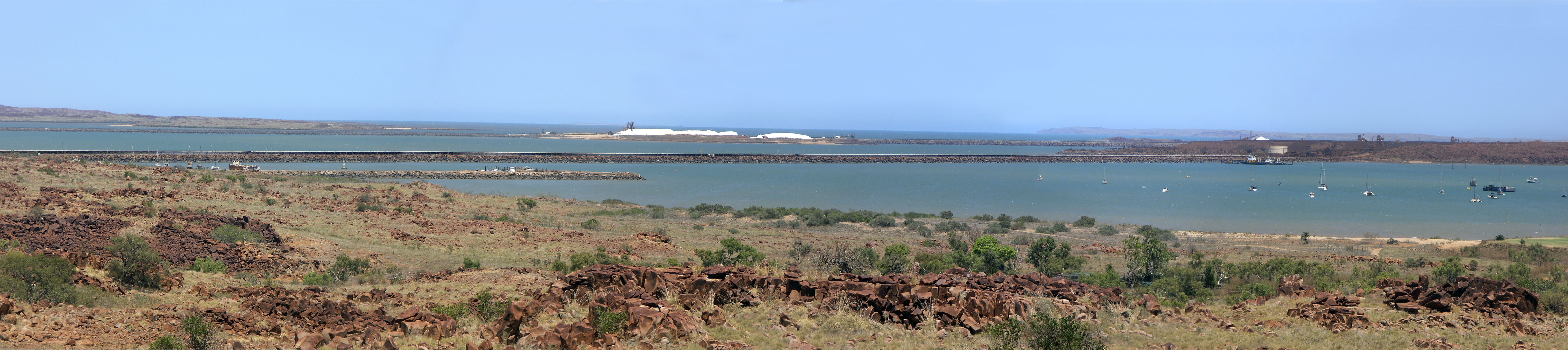
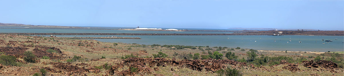 Dampier panorama, November 2006
 Dampier Port panorama, November 2006
References
- ^ a b Australian Bureau of Statistics (25 October 2007). "Dampier (Urban Centre/Locality)". 2006 Census QuickStats. http://www.censusdata.abs.gov.au/ABSNavigation/prenav/LocationSearch?collection=Census&period=2006&areacode=UCL506200&producttype=QuickStats&breadcrumb=PL&action=401. Retrieved 6 July 2011.
- ^ "Rio Tinto to boost Pilbara capacity - International Railway Journal". 2010-09-28. http://www.railjournal.com/newsflash/rio-tinto-to-boost-pilbara-capacity-2.html. Retrieved 2010-09-28.
- ^ "Dampier." Encyclopædia Britannica. 2006. Encyclopædia Britannica Online. 3 December 2006 http://www.britannica.com/eb/article-9028661
- ^ Dampier The Sydney Morning Herald. 8 February 2004. Retrieved 3 December 2006.
- ^ Save Dampier rock art Retrieved 3 December 2006.
- ^ a b D-day for Dampier 19 December 2005. The Wilderness Society. Retrieved 3 December 2006.
- ^ Marine turtles in Western Australia Department of Conservation and Land Management. Retrieved 4 March 2007.
- ^ Dog deserves a pat The West Australian. 12 October 2006. Retrieved 3 December 2006.
- ^ a b Ports Rio Tinto Iron Ore website, accessed: 8 November 2010
External links
- Dampier Port Authority
- The Burrup Peninsula The National Trust of Australia
- The World Monuments Fund's 2008 Watch List page for the Dampier Rock Art Complex
- Dampier Port Authority
See also
Iron ore mining in Western Australia BHP Billiton PortsRailwaysMinesFortescue Metals PortsRailwaysFortescue railwayMinesRio Tinto Atlas Iron MinesPardoo mine · Wodgina mineOther operations MinesCockatoo Island · Jack Hills · Koolan Island · Koolanooka · Koolyanobbing · Tallering Peak Ports · Railways · Mines
Towns in the Pilbara region of Western Australia Cossack · Dampier · Goldsworthy · Jigalong · Karratha · Marble Bar · Newman · Nullagine · Onslow · Pannawonica · Paraburdoo · Point Samson · Port Hedland · Roebourne · Shay Gap · South Hedland · Telfer · Tom Price · Whim Creek · Wickham · Wittenoom
Categories:- Towns in Western Australia
- Port cities in Australia
- Ports and harbours of the Indian Ocean
- Mining towns in Western Australia
- Pilbara
- Dampier Archipelago
- Coastal towns in Western Australia
-


Wikimedia Foundation. 2010.