Shire of Kojonup

Shire of Kojonup

Infobox Australian Place | type = lga
name =Shire of Kojonup
state =wa
region =Great Southern
area =2932.2
est =1871
seat =Kojonup
pop =2,152 (2006 census)
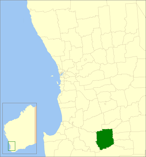

imagesize= 180
caption = Location in Western Australia
logo =
logosize =
url =http://www.kojonup.wa.gov.au
mayor =Jill Mathwin
fedgov =O'Connor
stategov =Wagin
near-nw = West Arthur
near-n = Woodanilling
near-ne = Katanning
near-w = Boyup Brook
near-e = Broomehill-Tambellup
near-sw = Manjimup
near-s = Cranbrook
near-se = Broomehill-Tambellup

The Shire of Kojonup is a Local Government Area in the Great Southern region of Western Australia, about convert|250|km|mi|0 southeast of the state capital, Perth, along Albany Highway. The Shire covers an area of convert|2932|km2|sqmi|0 and its seat of government is the town of Kojonup.

History

In 1871, the Kojonup Road Board was gazetted. On 1 July 1961, it became the Shire of Kojonup following changes to the Local Government Act. [WA Electoral Commission, "Municipality Boundary Amendments Register" (release 2.0), 31 May 2003.]

Wards

The shire has no wards, and all councillors serve 4-year terms. Previously, it was divided into 5 wards:

* Kojonup Ward (3 councillors)
* Balgarup Ward (2 councillors)
* Muradup Ward (2 councillors)
* Ongerup Ward (2 councillors)
* Namarillup Ward (2 councillors)

(Note: The town of Ongerup, unrelated to the ward, is located within the Shire of Gnowangerup.)

Towns/Localities

* Kojonup
* Boscabel
* Jingalup
* Muradup
* Mobrup
* Qualeup

References

External links

* [http://www.kojonup.wa.gov.au Shire of Kojonup website]


Wikimedia Foundation. 2010.

Игры ⚽ Поможем написать реферат

Look at other dictionaries:

  • Kojonup Shire — Shire of Kojonup Lage des Kojonup Shire in Westaustralien Gliederung …   Deutsch Wikipedia

  • Kojonup — 2001 angebauter Grosser Wollenwagen Kojonups Staat …   Deutsch Wikipedia

  • Kojonup, Western Australia — Infobox Australian Place | type = town name = Kojonup state = wa caption = lga = Shire of Kojonup postcode = 6395 est = 1845 pop = 1,122 (2006 Census) [Census 2006 AUS|id=UCL513400|name=Kojonup (Urban Centre/Locality)|quick=on|accessdate=2008 09… …   Wikipedia

  • Shire of Murchison — Western Australia Location in Western Australia Population …   Wikipedia

  • Shire of Derby-West Kimberley — Western Australia Population: 7,9 …   Wikipedia

  • Shire of Christmas Island — Population: 1,440(2009)[1] …   Wikipedia

  • Shire of Ngaanyatjarraku — Western Australia Location in Western Australia Population …   Wikipedia

  • Shire of Broomehill — Infobox Australian Place | type = lga name = Shire of Broomehill state = wa imagesize= 180 caption = Location in Western Australia pop = 451 density = area = 1172.8 est = 1892 seat = Broomehill region = Great Southern near nw = Katanning near n …   Wikipedia

  • Shire of Tambellup — Infobox Australian Place | type = lga name = Shire of Tambellup state = wa imagesize= 180 caption = Location in Western Australia pop = 670 density = area = 1436.3 est = 1905 seat = Tambellup region = Great Southern near nw = Kojonup near n =… …   Wikipedia

  • Shire of Katanning — Infobox Australian Place | type = lga name = Shire of Katanning state = wa imagesize= 180 caption = Location in Western Australia pop = 4,210 (2006 census) density = area = 1518.5 est = 1892 seat = Katanning mayor = Phil Rae region = Great… …   Wikipedia

Share the article and excerpts

Direct link
Do a right-click on the link above
and select “Copy Link”